ارتفاع نشانگر را پیکربندی کنید، ارتفاع نشانگر را پیکربندی کنید
با مجموعهها، منظم بمانید
ذخیره و طبقهبندی محتوا براساس اولویتهای شما.
پلتفرم مورد نظر را انتخاب کنید: اندروید، iOS میتوانید ارتفاع نشانگرهایی را که به نقشه سهبعدی اضافه میکنید، سفارشی کنید.
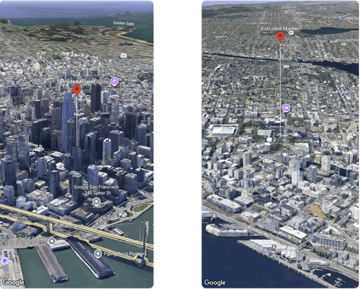
نمونه کد زیر نحوه تنظیم ارتفاع و حالت ارتفاع یک Marker را نشان میدهد.
@State var extrudedMarker: Marker3D = .init(
  position: .init(
      latitude: 37.78980534,
      longitude:  -122.3969349,
      altitude: 50.0),
  altitudeMode: .relativeToGround,
  collisionBehavior: .required,
  extruded: true,
  drawsWhenOccluded: true,
  sizePreserved: true,
  zIndex: 0,
  label: "Extruded marker"
)
جز در مواردی که غیر از این ذکر شده باشد،محتوای این صفحه تحت مجوز Creative Commons Attribution 4.0 License است. نمونه کدها نیز دارای مجوز Apache 2.0 License است. برای اطلاع از جزئیات، به خطمشیهای سایت Google Developers مراجعه کنید. جاوا علامت تجاری ثبتشده Oracle و/یا شرکتهای وابسته به آن است.
تاریخ آخرین بهروزرسانی 2026-07-11 بهوقت ساعت هماهنگ جهانی.
[null,null,["تاریخ آخرین بهروزرسانی 2026-07-11 بهوقت ساعت هماهنگ جهانی."],[],[]]
