אסימון סשן הוא נתון (UUID) שמשמש בקריאות REST כדי לזהות סשן – סדרה של חילופי הודעות קשורים. חובה לכלול אסימון סשן בכל הבקשות של משבצות דו-ממדיות ותמונות Street View.
הערך הזה מופיע כערך של הפרמטר session שנוסף לכל כתובות ה-URL של הבקשות.
ב-Map Tiles API, טוקן של סשן מייצג קבוצה מוגדרת של אפשרויות תצוגה. המשמעות היא שלא צריך להעביר קבוצה של אפשרויות תצוגה עם כל בקשה להצגת משבצת. אפשר להשתמש באותו אסימון סשן בכמה לקוחות.
כרגע, תוקף של טוקן סשן הוא שבועיים ממועד ההנפקה, אבל יכול להיות שזה ישתנה. תמיד אפשר לבדוק את זמן התפוגה של טוקן סשן בשדה expiry בהודעת התגובה.
בקשה לטוקן לסשן
כדי לבקש טוקן סשן, שולחים בקשת HTTPS POST לנקודת הקצה createSession, כמו בדוגמה הבאה. צריך לשלוח את הבקשה עם כותרת Content-Type: application/json.
curl -X POST -d '{
  "mapType": "streetview",
  "language": "en-US",
  "region": "US"
}' \
-H 'Content-Type: application/json' \
"https://tile.googleapis.com/v1/createSession?key=YOUR_API_KEY"
שדות חובה
mapTypeסוג מפת הבסיס. הערך הזה יכול להיות אחד מהערכים הבאים:
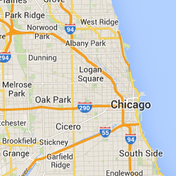
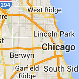
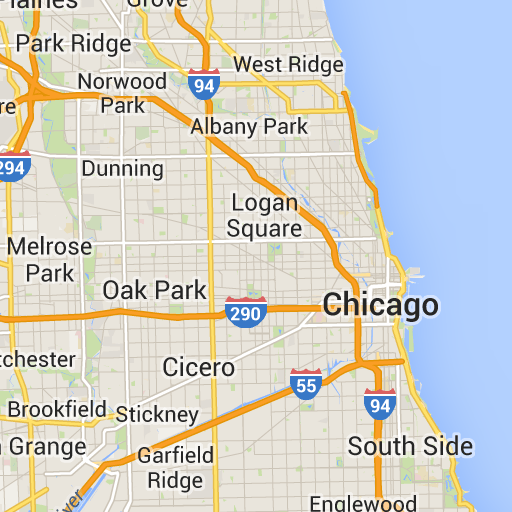
roadmap- קטעי המפה הרגילים של מפות Google.
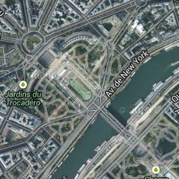
satellite- תמונות לוויין.
terrain- תמונות של פני השטח. כשבוחרים באפשרות
terrainכסוג המפה, צריך גם לכלול את סוג השכבהlayerRoadmap(כפי שמתואר בקטע שדות אופציונליים). streetview- תמונות פנורמיות ב-Street View. מידע נוסף זמין במאמר בנושא Street View Tiles.
languageתג שפה של IETF שמציין את השפה שבה מוצג המידע במשבצות. לדוגמה,
en-USמציין את השפה האנגלית כמו שמדברים אותה בארצות הברית.regionמזהה אזור (שתי אותיות רישיות) של מאגר נתונים של מיקומי שפה נפוצים שמייצג את המיקום הפיזי של המשתמש. לדוגמה,
US.
שדות אופציונליים
imageFormat- מציין את פורמט הקובץ שיוחזר. הערכים התקינים הם
jpegאוpng. קובצי JPEG לא תומכים בשקיפות, ולכן לא מומלץ להשתמש בהם במשבצות של שכבות-על. אם לא מצייניםimageFormat, המערכת בוחרת אוטומטית את הפורמט הכי טוב לאריח. scaleהגדלה של גודל רכיבי המפה (כמו תוויות של כבישים), תוך שמירה על גודל המשבצת ואזור הכיסוי של משבצת ברירת המחדל. הגדלת קנה המידה גם מקטינה את מספר התוויות במפה, וכך מצטמצם העומס. אלה הערכים החוקיים של
scale:-
scaleFactor1x: ברירת המחדל. -
scaleFactor2x: מגדיל את גודל התווית פי שניים ומסיר תוויות של תכונות משניות. -
scaleFactor4x: מכפיל פי ארבעה את גודל התווית ומסיר תוויות של תכונות משניות.
-
בדוגמאות הבאות אפשר לראות את ההשפעה של שינוי הגודל של רכיבי המפה.
| קנה מידה 1x | קנה מידה 2x |
|---|---|
 |
 |
highDpi- ההגדרה קובעת אם להחזיר משבצות ברזולוציה גבוהה. אם מגדילים את מתאם שינוי הגודל, נעשה שימוש ב-
highDpiכדי להגדיל את גודל המשבצת. בדרך כלל, הגדלת מקדם קנה המידה מגדילה את המשבצת שמתקבלת לתמונה באותו גודל, מה שמוריד את האיכות. במקרה שלhighDpi, הגודל שמתקבל גם גדל, כדי לשמור על האיכות. DPI מייצג נקודות לאינץ', ו-High DPI (יחס נקודות לאינץ' גבוה) אומר שהמשבצת מוצגת באמצעות יותר נקודות לאינץ' מהרגיל. אםtrue, אז מספר הפיקסלים בכל אחד מהמאפיינים x ו-y מוכפל בפקטור ההגדלה (כלומר , 2x או 4x). אזור הכיסוי של האריח לא משתנה. הפרמטר הזה פועל רק עם ערכים שלscale 2x או 4x. היא לא משפיעה על משבצות בקנה מידה של 1x.
| קנה מידה 1x | קנה מידה 2x DPI גבוה |
|---|---|
|
 |
layerTypesמערך של ערכים שמציין את סוגי השכבות שנוספו למפה. הערכים התקינים הם:
layerRoadmap- חובה אם מציינים את
terrainכסוג המפה. אפשר גם להוסיף אותו כשכבה על סוג המפהsatellite. אין השפעה על כרטיסי דרך. layerStreetview- האפשרות הזו מציגה במפה קווי מתאר כחולים של רחובות ומיקומים שבהם התכונה Street View זמינה.
layerTraffic- הצגת תנאי התנועה הנוכחיים.
stylesמערך של אובייקטים של סגנון JSON שמציינים את המראה ואת רמת הפירוט של רכיבים במפה, כמו כבישים, פארקים ואזורים בנויים. עיצוב משמש להתאמה אישית של מפת הבסיס הרגילה של Google. הפרמטר
stylesתקף רק אם סוג המפה הואroadmap. למידע על תחביר העיצוב המלא, אפשר לעיין במאמר העזר בנושא סגנונות.overlayערך בוליאני שמציין אם התמונה
layerTypesתוצג כשכבת-על נפרדת או תשולב עם תמונת הבסיס. כשמשתמשים ב-true, מפת הבסיס לא מוצגת. אם לא הגדרתם אףlayerTypes, המערכת תתעלם מהערך הזה.
לדוגמה, אם מבקשים סוג מפה satellite עם שכבה layerRoadmap, ומגדירים את overlay ל-false, מתקבלות משבצות שוות ערך לסוג המפה hybrid שמשמש בממשק API של JavaScript במפות Google (התמונה הימנית). אותם סוגי מפות ושכבות עם overlay שמוגדר כ-true יוצרים משבצת שקופה עם שכבת-על של מפה, שמעוצבת בצורה מתאימה להצגה כשכבת-על על תמונות לוויין (התמונה משמאל).
overlay: false |
overlay: true |
|---|---|
 |
 |
ה-JSON הבא הוא דוגמה לגוף בקשה טיפוסי שמכיל שדות חובה ושדות אופציונליים.
{
  "mapType": "satellite",
  "language": "en-US",
  "region": "us",
  "layerTypes": [ "layerRoadmap", "layerStreetview" ],
  "overlay":  true,
  "scale": "scaleFactor1x",
  "styles": [
    {
      "stylers": [
        { "hue": "#00ffe6" },
        { "saturation": -20 }
      ]
    },{
      "featureType": "road",
      "elementType": "geometry",
      "stylers": [
        { "lightness": 100 },
        { "visibility": "simplified" }
      ]
    }
  ]
}
בדוגמה הזו מוצגת שכבת-על שמתאימה לשילוב עם תמונות לוויין. בדוגמה יש גם מפת דרכים וגם שכבת-על של תצוגת רחוב. המפה שמתקבלת מוצגת עם שמות ונתונים באנגלית, כי זו השפה שמדוברת בארצות הברית.
תגובה של טוקן סשן
ה-JSON הבא הוא דוגמה לגוף התגובה.
{
  "session": "IgAAAHGU9jnAU4KOAfwY3Bcd6eH_WxQsyocSBAdUnAr9pnvTTNXtF9c_27RBo94ytEXTDg",
  "expiry": "1361828036",
  "tileWidth": 256,
  "tileHeight": 256,
  "imageFormat": "png"
}
ברשימה הבאה מפורטות ההגדרות של השדות בגוף התשובה.
session- ערך של טוקן סשן שחובה לכלול בכל הבקשות ל-Map Tiles API.
expiry- מחרוזת שמכילה את השעה (בשניות מאז תחילת התקופה של זמן מערכת) שבה האסימון יפוג. תוקף של טוקן סשן הוא שבועיים ממועד היצירה שלו, אבל יכול להיות שהמדיניות הזו תשתנה ללא הודעה מוקדמת.
tileWidth- רוחב האריחים בפיקסלים.
tileHeight- גובה האריחים בפיקסלים.
imageFormat- פורמט התמונה, שיכול להיות
pngאוjpeg.