- Disponibilidad del conjunto de datos
- 2020-01-01T00:00:00Z–2022-01-01T00:00:00Z
- Proveedor del conjunto de datos
- AHN
- Etiquetas
Descripción
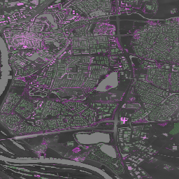
El Actueel Hoogtebestand Nederland (AHN) es un conjunto de datos con información de elevación detallada y precisa para todo el territorio de los Países Bajos. La información de elevación se recopiló de helicópteros y aeronaves con tecnología láser y una precisión vertical de 5 cm.
El conjunto de datos AHN4 contiene las variables DSM y DTM de AHN de 0.5 m de los Países Bajos. Los datos abarcan el período comprendido entre 2020 y 2022.
El producto del Modelo Digital del Terreno (DTM) representa la elevación del suelo, mientras que el producto del Modelo Digital de Superficie (DSM) representa la elevación de las superficies más altas en ese punto.
Bandas
Bandas
Tamaño de píxel: 0.5 metros (todas las bandas)
| Nombre | Unidades | Tamaño de los píxeles | Descripción |
|---|---|---|---|
dtm |
m | 0.5 metros | Elevación del suelo |
dsm |
m | 0.5 metros | Elevación de las superficies más altas en ese punto |
Condiciones de Uso
Condiciones de Uso
Los conjuntos de datos de la AHN están disponibles como datos abiertos. Esto significa que cualquier persona puede usar los datos de forma gratuita y sin restricciones. Para obtener más información, visita la página de Datos abiertos. Las descargas están disponibles según las condiciones de la licencia CC-0.
Explora con Earth Engine
Editor de código (JavaScript)
var dataset = ee.ImageCollection('AHN/AHN4');
var elevation = dataset.select('dsm');
var elevationVis = {
  min: -5.0,
  max: 30.0,
};
Map.setCenter(5.76583, 51.855276, 16);
Map.addLayer(elevation, elevationVis, 'AHN4 dsm');