- ডেটাসেটের উপলভ্যতা
- 2000-02-11T00:00:00Z–2000-02-22T00:00:00Z
- ডেটাসেট প্রযোজক
- নাসা/সিজিআইএআর
- ট্যাগ
- সিজিআইএআর
বর্ণনা
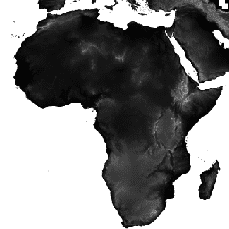
শাটল রাডার টপোগ্রাফি মিশন (এসআরটিএম) ডিজিটাল উচ্চতা ডেটাসেটটি মূলত প্রায় বৈশ্বিক পরিসরে সামঞ্জস্যপূর্ণ ও উচ্চ-মানের উচ্চতার ডেটা প্রদানের জন্য তৈরি করা হয়েছিল। এসআরটিএম ডিজিটাল উচ্চতা ডেটার এই সংস্করণটি ডেটার শূন্যস্থান পূরণ করতে এবং এর ব্যবহার সহজ করার জন্য প্রক্রিয়াজাত করা হয়েছে।
ব্যান্ড
ব্যান্ড
পিক্সেল সাইজ: ৯০ মিটার (সকল ব্যান্ড)
| নাম | ইউনিট | মিনিট | ম্যাক্স | পিক্সেল আকার | বর্ণনা |
|---|---|---|---|---|---|
elevation | এম | -৪৪৪* | ৮৮০৬* | ৯০ মিটার | উচ্চতা |
ব্যবহারের শর্তাবলী
ব্যবহারের শর্তাবলী
বিতরণ। CIAT-এর সুস্পষ্ট লিখিত অনুমতি ছাড়া ব্যবহারকারীদের কোনো প্রকার বাণিজ্যিক, অ-বিনামূল্যে পুনঃবিক্রয় বা পুনঃবিতরণ করা নিষিদ্ধ। এই ডেটাসেট ব্যবহারের ফলে উদ্ভূত যেকোনো প্রতিবেদন, প্রকাশনা, নতুন ডেটাসেট, উদ্ভূত পণ্য বা পরিষেবা তৈরির ক্ষেত্রে ব্যবহারকারীদের অবশ্যই CIAT-কে ব্যবহৃত উৎস হিসেবে স্বীকার করতে হবে। CIAT যেকোনো প্রকাশনার পুনর্মুদ্রণ এবং যেকোনো পুনঃবিতরণের প্রচেষ্টা সম্পর্কে অবহিত করার জন্যও অনুরোধ জানায়। ডেটার বাণিজ্যিক ব্যবহারের জন্য, অ্যান্ডি জার্ভিসের [a.jarvis@cgiar.org] কাছে অনুরোধ পাঠান।
কোনো ওয়ারেন্টি বা দায়বদ্ধতা নেই। CIAT কোনো প্রকার প্রকাশ্য বা উহ্য ওয়ারেন্টি ছাড়াই এই ডেটা সরবরাহ করে, যার মধ্যে বাণিজ্যিক উপযোগিতা এবং নির্দিষ্ট উদ্দেশ্যে উপযুক্ততার ওয়ারেন্টিও অন্তর্ভুক্ত। যেকোনো ডেটা ব্যবহারের ফলে উদ্ভূত আনুষঙ্গিক, ফলস্বরূপ বা বিশেষ ক্ষতির জন্য CIAT দায়ী থাকবে না।
স্বীকৃতি ও উদ্ধৃতি। সকল ব্যবহারকারীকে বিনীতভাবে অনুরোধ করা হচ্ছে যে, এই ডেটা ব্যবহার করে তৈরি যেকোনো প্রকাশিত সামগ্রীতে এই ডেটার উদ্ধৃতি দিন এবং সম্ভব হলে CIAT-CSI SRTM ওয়েবসাইটের ওয়েব পেজগুলোর লিঙ্ক যুক্ত করুন।
উদ্ধৃতি
জার্ভিস, এ., এইচআই রয়টার, এ., নেলসন, ই. গুয়েভারা। ২০০৮। গোলকের জন্য ছিদ্র-পূরিত এসআরটিএম সংস্করণ ৪, সিজিআইএআর-সিএসআই এসআরটিএম ৯০মি ডেটাবেস থেকে উপলব্ধ: https://srtm.csi.cgiar.org ।
আর্থ ইঞ্জিনের সাহায্যে ঘুরে দেখুন
কোড এডিটর (জাভাস্ক্রিপ্ট)
var dataset = ee.Image('CGIAR/SRTM90_V4');
var elevation = dataset.select('elevation');
var slope = ee.Terrain.slope(elevation);
Map.setCenter(-112.8598, 36.2841, 10);
Map.addLayer(slope, {min: 0, max: 60}, 'slope');
import ee
import geemap.core as geemap
কোলাব (পাইথন)
dataset = ee.Image('CGIAR/SRTM90_V4')
elevation = dataset.select('elevation')
slope = ee.Terrain.slope(elevation)

m = geemap.Map()
m.set_center(-112.8598, 36.2841, 10)
m.add_layer(slope, {'min': 0, 'max': 60}, 'slope')
m