- مدى توفّر مجموعة البيانات
- 2000-01-01T00:00:00Z–2020-01-01T00:00:00Z
- الجهة المنتجة لمجموعة البيانات
- NASA SEDAC في مركز شبكة معلومات علوم الأرض الدولية
- العلامات
الوصف
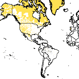
تحدّد مجموعة البيانات هذه وحدات البكسل المائية، ويتم إخفاء وحدات البكسل غير المائية. تم استخدام قناع المياه لاستبعاد مناطق المياه والجليد الدائم من عملية تخصيص السكان.
يقدّم الإصدار 4 من بيانات Gridded Population of World (GPWv4)، المراجعة 11، نموذجًا لتوزيع السكان في العالم خلال السنوات 2000 و2005 و2010 و2015 و2020، وذلك على مستوى خلايا شبكية تبلغ مساحة كل منها 30 ثانية قوسية (حوالي 1 كيلومتر). يتم توزيع السكان على الخلايا باستخدام التوزيع النسبي للسكان من التعداد السكاني والوحدات الإدارية. يتم جمع بيانات السكان المدخلة بأعلى دقة مكانية متاحة من نتائج جولة التعدادات لعام 2010 التي أُجريت بين عامَي 2005 و2014. يتم استقراء بيانات الإدخال لإنتاج تقديرات للسكان لكل سنة تم وضع نموذج لها.
النطاقات
النطاقات
حجم البكسل: 927.67 متر (جميع النطاقات)
| الاسم | الحد الأدنى | الحد الأقصى | حجم البكسل | الوصف | |||||||||||||||||||||||||||||||||||||||||||||||||||||||||||||||||||||||||||||||||||||||||||||||
|---|---|---|---|---|---|---|---|---|---|---|---|---|---|---|---|---|---|---|---|---|---|---|---|---|---|---|---|---|---|---|---|---|---|---|---|---|---|---|---|---|---|---|---|---|---|---|---|---|---|---|---|---|---|---|---|---|---|---|---|---|---|---|---|---|---|---|---|---|---|---|---|---|---|---|---|---|---|---|---|---|---|---|---|---|---|---|---|---|---|---|---|---|---|---|---|---|---|---|---|
water_mask |
927.67 متر | قناع مائي |
|||||||||||||||||||||||||||||||||||||||||||||||||||||||||||||||||||||||||||||||||||||||||||||||||
بنود الاستخدام
بنود الاستخدام
الاقتباسات
مركز شبكة معلومات علوم الأرض الدولية (CIESIN) في "جامعة كولومبيا" 2018. Gridded Population of the World, Version 4 (GPWv4): Water Mask, Revision 11. Palisades, NY: NASA Socioeconomic Data and Applications Center (SEDAC). https://doi.org/10.7927/H42Z13KG. تم الوصول إليه في DAY MONTH YEAR.
معرِّفات العناصر الرقمية (DOI)
الاستكشاف باستخدام Earth Engine
أداة تعديل الرموز (JavaScript)
var dataset = ee.ImageCollection('CIESIN/GPWv411/GPW_Water_Mask');
var raster = dataset.select('water_mask');
var raster_vis = {
  'min': 0.0,
  'palette': [
    '005ce6',
    '00ffc5',
    'bed2ff',
    'aed0f1'
  ],
  'max': 3.0
};
Map.setCenter(-88.6, 26.4, 1);
Map.addLayer(raster, raster_vis, 'water_mask');