- Dostępność zbioru danych
- 2006-01-24T00:00:00Z–2011-05-12T00:00:00Z
- Dostawca zbioru danych
- Centrum badań obserwacji Ziemi JAXA
- Tagi
Opis
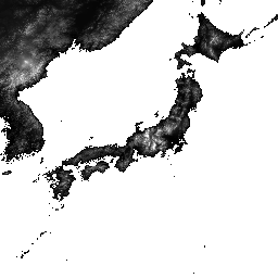
ALOS World 3D – 30 m (AW3D30) to globalny zbiór danych cyfrowego modelu powierzchni (DSM) o rozdzielczości poziomej około 30 m (siatka 1 sekundy łuku). Zbiór danych opiera się na zbiorze danych DSM (wersja siatki 5-metrowej) z topograficznych danych 3D o świecie. Więcej informacji znajdziesz w dokumentacji zbioru danych.
Ten zbiór danych zawiera dane z wersji 3.1, 4.0 i 4.1.
Wersja 4.1 (kwiecień 2024 r.): ta duża aktualizacja zawiera 19 051 kafelków obejmujących regiony na całym świecie (z wyjątkiem Antarktydy i Japonii). Zawiera nowe dane uzupełniające, które pozwalają wypełniać luki, oraz poprawia częściowe anomalie występujące w wersjach 3.1 i 3.2, a także ponownie wypełnia luki. W przypadku konkretnych aktualizacji kafelków w wersji 4.1 użyj filtra wersji 4.1 na kafelkach mapy lub zapoznaj się z najnowszym opisem formatu.
Wersja 4.0 (kwiecień 2023 r.): ta aktualizacja obejmuje 1886 kafelków, co poprawia jakość obrazów w regionach o niskiej i średniej szerokości geograficznej oraz na obszarach na południe od 60 stopni szerokości geograficznej.
Najważniejsze zmiany:1. Nowe dane uzupełniające do wypełniania pustych miejsc. 2. Korekta częściowych anomalii i ponowne wypełnianie pustych miejsc (2 kafelki). 3. Zaktualizowano linie brzegowe w regionach na południe od 60 stopni szerokości geograficznej (44 kafelki). 4. Wyłączono maskę wody Morza Kaspijskiego i uzupełniono ją danymi o wysokości (54 kafelki). 5. Wyodrębniliśmy i skorygowaliśmy nowe obszary częściowych anomalii w Ameryce Południowej (1786 kafelków). 6. Szczegółowe informacje o kafelkach w wersji 4.0 znajdziesz, używając filtra v4.0 na kafelkach mapy lub w opisie formatu.
Wersja 3.2, która została opublikowana w styczniu 2021 r., to ulepszona wersja, która powstała w wyniku ponownego rozważenia formatu w obszarze o wysokiej szerokości geograficznej, danych pomocniczych i metody przetwarzania. W obszarach o wysokiej szerokości geograficznej zastosowano różne odstępy między pikselami dla każdej strefy szerokości geograficznej. Zmieniono dane linii brzegowej, które są jednym z pomocniczych zbiorów danych, i użyto nowych danych dodatkowych. Dodatkowo jako dane źródłowe dla Japonii wykorzystano AW3D w wersji 3. Dodatkowo ulepszyliśmy metodę wykrywania wartości nietypowych w procesie.
Wysokość AW3D DSM jest obliczana w procesie dopasowywania obrazów, który wykorzystuje parę stereoskopową obrazów optycznych. Chmury, śnieg i lód są automatycznie identyfikowane podczas przetwarzania, a informacje o maskach są do nich stosowane. Czasami jednak punkty są niedopasowane, zwłaszcza w okolicach chmur, śniegu i lodu (lub na ich krawędziach), co powoduje pewne błędy wysokości w końcowym modelu DSM.
Pasma
Pasma
Rozmiar piksela: 30 m (wszystkie pasma)
| Nazwa | Minimum | Maks. | Rozmiar piksela | Opis | |||||||||||||||||||||||||||||||||||||||||||||||||||||||||||||||||||||||||||||||||||||||||||||||
|---|---|---|---|---|---|---|---|---|---|---|---|---|---|---|---|---|---|---|---|---|---|---|---|---|---|---|---|---|---|---|---|---|---|---|---|---|---|---|---|---|---|---|---|---|---|---|---|---|---|---|---|---|---|---|---|---|---|---|---|---|---|---|---|---|---|---|---|---|---|---|---|---|---|---|---|---|---|---|---|---|---|---|---|---|---|---|---|---|---|---|---|---|---|---|---|---|---|---|---|
DSM |
–433* | 8768* | 30 metrów | Wysokość nad poziomem morza. Liczba ze znakiem, 16 bitów. Wysokość (w metrach) przeliczona z wysokości elipsoidalnej na podstawie ITRF97 i GRS80 przy użyciu modelu geoidy EGM96†1. |
|||||||||||||||||||||||||||||||||||||||||||||||||||||||||||||||||||||||||||||||||||||||||||||||
STK |
1* | 54* | 30 metrów | Liczba nakładających się na siebie jednostek sceny DSM użytych do wygenerowania DSM. Pasmo jest uzyskiwane przez ponowne próbkowanie liczby stosów dla DSM o rozdzielczości 5 m do rozdzielczości 30 m. |
|||||||||||||||||||||||||||||||||||||||||||||||||||||||||||||||||||||||||||||||||||||||||||||||
MSK |
30 metrów | 8-bitowa maska pasma. |
|||||||||||||||||||||||||||||||||||||||||||||||||||||||||||||||||||||||||||||||||||||||||||||||||
Warunki korzystania z usługi
Warunki korzystania z usługi
Ten zbiór danych jest dostępny bezpłatnie na warunkach określonych w Warunkach korzystania z globalnego cyfrowego modelu powierzchni ALOS.
Cytaty
- T. Tadono, H. Ishida, F. Oda, S. Naito, K. Minakawa, H. Iwamoto
- Precise Global DEM Generation By ALOS PRISM, ISPRS Annals of the Photogrammetry, Remote Sensing and Spatial Information Sciences, Vol.II-4, pp.71-76, 2014. plik PDF
J. Takaku, T. Tadono, K. Tsutsui : Generation of High Resolution Global DSM from ALOS PRISM, The International Archives of the Photogrammetry, Remote Sensing and Spatial Information Sciences, Vol. XL-4, pp.243-248, ISPRS, 2014. plik PDF,
J. Takaku, T. Tadono, K. Tsutsui, M. Ichikawa : Validation of 'AW3D' Global DSM Generated from ALOS PRISM, ISPRS Annals of the Photogrammetry, Remote Sensing and Spatial Information Sciences, Vol.III-4, pp.25-31, 2016. plik PDF,
T. Tadono, H. Nagai, H. Ishida, F. Oda, S. Naito, K. Minakawa, H. Iwamoto : Initial Validation of the 30 m-mesh Global Digital Surface Model Generated by ALOS PRISM, The International Archives of the Photogrammetry, Remote Sensing and Spatial Information Sciences, ISPRS, Vol. XLI-B4, pp.157-162, 2016. plik PDF,
J. Takaku, T. Tadono, M. Doutsu, F. Ohgushi i H. Kai, : "Updates of 'AW3D30' ALOS Global Digital Surface Model in Antarctica with Other Open Access Datasets", Int. Arch. Photogramm. Remote Sens. Spatial Inf. Sci., XLIII-B4-2021, 401-408, 2021. plik PDF,
Odkrywaj za pomocą Earth Engine
Edytor kodu (JavaScript)
var dataset = ee.ImageCollection('JAXA/ALOS/AW3D30/V4_1');
var elevation = dataset.select('DSM');
var elevationVis = {
  min: 0,
  max: 5000,
  palette: ['0000ff', '00ffff', 'ffff00', 'ff0000', 'ffffff']
};
Map.setCenter(138.73, 35.36, 11);
Map.addLayer(elevation, elevationVis, 'Elevation');

// Reproject an image mosaic using a projection from one of the image tiles,
// rather than using the default projection returned by .mosaic().
var proj = elevation.first().select(0).projection();
var slopeReprojected = ee.Terrain.slope(elevation.mosaic()
                             .setDefaultProjection(proj));
Map.addLayer(slopeReprojected, {min: 0, max: 45}, 'Slope');