- Disponibilidad del conjunto de datos
- 1984-03-16T00:00:00Z–2022-01-01T00:00:00Z
- Proveedor del conjunto de datos
- EC JRC / Google
- Etiquetas
Descripción
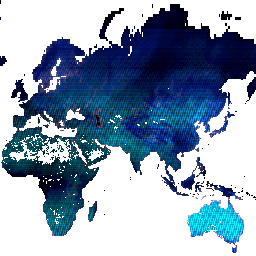
Este conjunto de datos contiene mapas de la ubicación y la distribución temporal de las aguas superficiales de 1984 a 2021, y proporciona estadísticas sobre la extensión y el cambio de esas superficies de agua. Para obtener más información, consulta el artículo de revista asociado: High-resolution mapping of global surface water and its long-term changes (Mapeo de alta resolución de las aguas superficiales globales y sus cambios a largo plazo) (Nature, 2016) y la Guía del usuario de datos en línea.
Estos datos se generaron con 4,716,475 escenas de Landsat 5, 7 y 8 adquiridas entre el 16 de marzo de 1984 y el 31 de diciembre de 2021. Cada píxel se clasificó individualmente como agua o no agua con un sistema experto, y los resultados se recopilaron en un historial mensual para todo el período y dos épocas (1984-1999 y 2000-2021) para la detección de cambios.
Este producto contiene metadatos sobre las observaciones que se utilizaron para calcular el conjunto de datos de Global Surface Water. Se enmascaran las áreas en las que nunca se detectó agua.
Bandas
Bandas
Tamaño de píxel: 30 metros (todas las bandas)
| Nombre | Mín. | Máx. | Tamaño de los píxeles | Descripción |
|---|---|---|---|---|
detections |
0* | 2007* | 30 metros | Es la cantidad de detecciones de agua en el período de estudio. |
valid_obs |
0* | 2076* | 30 metros | Es la cantidad de observaciones válidas en el período del estudio. |
total_obs |
0* | 2417* | 30 metros | Es la cantidad total de observaciones (es decir, escenas) disponibles en el período de estudio. |
Condiciones de Uso
Condiciones de Uso
Todos los datos que se muestran aquí se producen en el marco del Programa Copernicus y se proporcionan sin cargo y sin restricciones de uso. Para obtener la información completa de la licencia, consulta el Reglamento de Copernicus.
Las publicaciones, los modelos y los productos de datos que utilicen estos conjuntos de datos deben incluir el reconocimiento adecuado, lo que incluye citar los conjuntos de datos y el artículo de la revista como en la siguiente cita.
Si utilizas estos datos como una capa en un mapa publicado, incluye el siguiente texto de atribución: "Fuente: CE JRC/Google"
Citas
Jean-Francois Pekel, Andrew Cottam, Noel Gorelick, Alan S. Belward, M. (2015). High-resolution mapping of global surface water and its long-term changes. Nature 540, 418-422 (2016). (doi:10.1038/nature20584)
Explora con Earth Engine
Editor de código (JavaScript)
var dataset = ee.Image('JRC/GSW1_4/Metadata');

var visualization = {
  bands: ['detections', 'valid_obs', 'total_obs'],
  min: 100.0,
  max: 900.0,
};

Map.setCenter(71.72, 52.48, 0);

Map.addLayer(dataset, visualization, 'Detections/Observations');