- Disponibilidad del conjunto de datos
- 2000-02-18T00:00:00Z–2026-04-23T00:00:00Z
- Proveedor del conjunto de datos
- DAAC del NSIDC de la NASA en CIRES
- Cadencia
- 1 día
- Etiquetas
Descripción
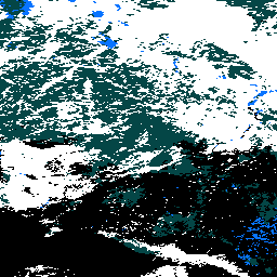
MOD10A2 es un conjunto de datos de cobertura de nieve del MODIS en el satélite Terra. El conjunto de datos informa la extensión máxima de la cobertura de nieve durante un período de ocho días con una resolución de 500 m.
Se eligió un período de composición de ocho días porque ese es el período exacto de repetición de la pista terrestre de las plataformas Terra y Aqua. La cobertura de nieve durante ocho días se asigna como la extensión máxima de nieve en un SDS y como una cronología de observaciones en el otro SDS. Los períodos de ocho días comienzan el primer día del año y se extienden hasta el año siguiente. El producto se puede producir con entre dos y ocho días de entrada. Es posible que no siempre haya ocho días de datos de entrada, por varios motivos, por lo que el usuario debe verificar los atributos para determinar en qué días se obtuvieron las observaciones.
Bandas
Bandas
Tamaño de píxel: 500 metros (todas las bandas)
| Nombre | Mín. | Máx. | Tamaño de los píxeles | Descripción | |||||||||||||||||||||||||||||||||||||||||||||||||||||||||||||||||||||||||||||||||||||||||||||||
|---|---|---|---|---|---|---|---|---|---|---|---|---|---|---|---|---|---|---|---|---|---|---|---|---|---|---|---|---|---|---|---|---|---|---|---|---|---|---|---|---|---|---|---|---|---|---|---|---|---|---|---|---|---|---|---|---|---|---|---|---|---|---|---|---|---|---|---|---|---|---|---|---|---|---|---|---|---|---|---|---|---|---|---|---|---|---|---|---|---|---|---|---|---|---|---|---|---|---|---|
Maximum_Snow_Extent |
0 | 255 | 500 metros | Extensión máxima de la nieve observada durante un período de ocho días. |
|||||||||||||||||||||||||||||||||||||||||||||||||||||||||||||||||||||||||||||||||||||||||||||||
Eight_Day_Snow_Cover |
500 metros | Son marcas de bits de cronología de nieve para cada día del período de observación de ocho días. |
|||||||||||||||||||||||||||||||||||||||||||||||||||||||||||||||||||||||||||||||||||||||||||||||||
Tabla de la clase Maximum_Snow_Extent
| Valor | Color | Descripción |
|---|---|---|
| 0 | Ninguno | Faltan datos |
| 1 | Ninguno | Sin decisión |
| 11 | Ninguno | Noche |
| 25 | Ninguno | Sin nieve |
| 37 | Ninguno | Lago |
| 39 | Ninguno | Océano |
| 50 | Ninguno | Cloud |
| 100 | Ninguno | Hielo del lago |
| 200 | Ninguno | Nieve |
| 254 | Ninguno | El detector está saturado |
Condiciones de Uso
Condiciones de Uso
Puedes descargar y usar fotografías, imágenes o texto del sitio web del NSIDC, a menos que se indiquen específicamente limitaciones para su uso. Para obtener más información sobre el uso y la cita de los conjuntos de datos del NSIDC, visita la página "Uso y derechos de autor" del NSIDC.
Citas
Hall, D. K., V. V. Salomonson y G. A. Riggs. 2016. MODIS/Terra: Cobertura de nieve diaria global en cuadrícula de nivel 3 de 500 m. Versión 6. Boulder, Colorado, EE.UU.: Centro de Archivo Activo Distribuido del Centro Nacional de Datos sobre Nieve y Hielo de la NASA.
DOI
Explora con Earth Engine
Editor de código (JavaScript)
var dataset = ee.ImageCollection('MODIS/061/MOD10A2')
  .filter(ee.Filter.date('2023-01-01', '2023-12-01'))
  .select('Maximum_Snow_Extent');

var visualization = {
  min: 50.0,
  max: 200.0,
  palette: [
    '000000',
    '0dffff',
    '0524ff',
    'ffffff'
  ]
};


Map.setCenter(-3.69, 65.99, 4);

Map.addLayer(dataset.mean(), visualization, 'Maximum_Snow_Extent');