- Dostępność zbioru danych
- 1999-10-01T00:00:00Z–2024-12-01T00:00:00Z
- Dostawca zbioru danych
- OpenET, Inc.
- Cykl
- 1 miesiąc
- Tagi
Opis
Operational Simplified Surface Energy Balance (SSEBop)
Model Operational Simplified Surface Energy Balance (SSEBop) opracowany przez Senaya i współautorów (2013, 2017) to uproszczony model energii powierzchni oparty na pomiarach termicznych, który służy do szacowania rzeczywistego parowania na podstawie zasad psychrometrii satelitarnej (Senay 2018). Implementacja OpenET SSEBop wykorzystuje temperaturę powierzchni gruntu (Ts) z Landsat (produkty naukowe poziomu 2 kolekcji 2) z kluczowymi parametrami modelu (odniesienie do temperatury mokrego termometru, Tc, i stała psychrometryczna powierzchni, 1/dT) pochodzącymi z kombinacji obserwowanej temperatury powierzchni, znormalizowanego różnicowego wskaźnika wegetacji (NDVI), średniej klimatycznej (1980–2017) dziennej maksymalnej temperatury powietrza (Ta, 1 km) z Daymet i danych dotyczących promieniowania netto z ERA-5. Ta implementacja modelu korzysta z platformy przetwarzania Google Earth Engine do łączenia kluczowych funkcji i algorytmów SSEBop ET podczas generowania wyników ET pośrednich i zagregowanych. Szczegółowe badanie i ocena modelu SSEBop w całych Stanach Zjednoczonych (Senay i in., 2022) dostarcza informacji zarówno na potrzeby implementacji w chmurze, jak i oceny aplikacji do bilansu wodnego na dużą skalę. Ulepszenia i wydajność modelu Notable (wersja 0.2.6) w porównaniu z poprzednimi wersjami obejmują dodatkową zgodność z satelitą Landsat 9 (wprowadzoną we wrześniu 2021 r.), globalną rozszerzalność modelu i ulepszone parametryzowanie SSEBop za pomocą FANO (Forcing and Normalizing Operation) w celu lepszego szacowania ET we wszystkich krajobrazach i we wszystkich porach roku niezależnie od gęstości pokrywy roślinnej, co zwiększa dokładność modelu poprzez unikanie ekstrapolacji Tc do regionów nieobjętych kalibracją.
Pasma
Rozmiar piksela
30 metrów
Pasma
| Nazwa | Jednostki | Rozmiar piksela | Opis |
|---|---|---|---|
et |
mm | metry | Wartość SSEBop ET |
count |
liczba | metry | Liczba wartości bezpłatnych w chmurze |
Właściwości obrazu
Właściwości obrazu
| Nazwa | Typ | Opis |
|---|---|---|
| build_date | CIĄG ZNAKÓW | Data budowy zasobów |
| cloud_cover_max | LICZBA ZMIENNOPRZECINKOWA O PODWÓJNEJ PRECYZJI | Maksymalna wartość procentowa CLOUD_COVER_LAND dla obrazów Landsat uwzględnionych w interpolacji |
| kolekcje | CIĄG ZNAKÓW | Lista kolekcji Landsat dla obrazów Landsat uwzględnionych w interpolacji |
| core_version | CIĄG ZNAKÓW | Wersja podstawowej biblioteki OpenET |
| end_date | CIĄG ZNAKÓW | Data zakończenia miesiąca |
| et_reference_band | CIĄG ZNAKÓW | Pasmo w et_reference_source, które zawiera dzienne dane ET referencyjne. |
| et_reference_resample | CIĄG ZNAKÓW | Tryb interpolacji przestrzennej do ponownego próbkowania dziennych danych ET |
| et_reference_source | CIĄG ZNAKÓW | Identyfikator kolekcji dziennych danych ET |
| interp_days | LICZBA ZMIENNOPRZECINKOWA O PODWÓJNEJ PRECYZJI | Maksymalna liczba dni przed i po dacie każdego zdjęcia, które mają być uwzględnione w interpolacji |
| interp_method | CIĄG ZNAKÓW | Metoda interpolacji między szacunkami modelu Landsat |
| interp_source_count | LICZBA ZMIENNOPRZECINKOWA O PODWÓJNEJ PRECYZJI | Liczba dostępnych obrazów w zbiorze obrazów źródłowych interpolacji w przypadku miesiąca docelowego |
| mgrs_tile | CIĄG ZNAKÓW | Identyfikator strefy siatki MGRS |
| model_name | CIĄG ZNAKÓW | Nazwa modelu OpenET |
| model_version | CIĄG ZNAKÓW | Wersja modelu OpenET |
| scale_factor_count | LICZBA ZMIENNOPRZECINKOWA O PODWÓJNEJ PRECYZJI | Współczynnik skalowania, który należy zastosować do zakresu liczby |
| scale_factor_et | LICZBA ZMIENNOPRZECINKOWA O PODWÓJNEJ PRECYZJI | Współczynnik skalowania, który należy zastosować do pasma ET |
| start_date | CIĄG ZNAKÓW | Data rozpoczęcia miesiąca |
Warunki korzystania z usługi
Warunki korzystania z usługi
Cytaty
Senay, G.B., Parrish, G.E., Schauer, M., Friedrichs, M., Khand, K., Boiko, O., Kagone, S., Dittmeier, R., Arab, S. i Ji, L., 2023 r. Ulepszanie modelu ewapotranspiracji opartego na uproszczonym bilansie energii powierzchni za pomocą operacji wymuszania i normalizacji. Remote Sensing, 15(1), s.260. doi:10.3390/rs15010260
Senay, G.B., Bohms, S., Singh, R.K., Gowda, P.H., Velpuri, N.M., Alemu, H. i Verdin, J.P., 2013 r. Operational evapotranspiration mapping using remote sensing and weather datasets: A new parameterization for the SSEB approach. JAWRA Journal of the American Water Resources Association, 49(3), s.577–591. doi:10.1111/jawr.12057
Senay, G.B., Schauer, M., Friedrichs, M., Velpuri, N.M. i Singh, R.K., 2017. Dynamika zużycia wody na podstawie danych satelitarnych z wykorzystaniem historycznych danych z satelity Landsat (1984–2014) w południowo-zachodniej części Stanów Zjednoczonych. Remote Sensing of Environment, 202, pp.98-112. doi:10.1016/j.rse.2017.05.005c
Senay, G.B., 2018 r. Satelitarna formuła psychrometryczna modelu Operacyjnego Uproszczonego Bilansu Energii Powierzchni (SSEBop) do określania ilościowego i mapowania ewapotranspiracji. Applied Engineering in Agriculture, 34(3), s.555–566. doi:10.13031/aea.12614
Senay, G.B., Friedrichs, M., Morton, C., Parrish, G.E., Schauer, M., Khand, K., Kagone, S., Boiko, O. i Huntington, J., 2022 r. Mapowanie rzeczywistego parowania przy użyciu danych z satelity Landsat na obszarze kontynentalnych Stanów Zjednoczonych: wdrożenie w Google Earth Engine i ocena modelu SSEBop. Remote Sensing of Environment, 275, s.113011. doi:10.1016/j.rse.2022.113011
DOI
Odkrywanie za pomocą Earth Engine
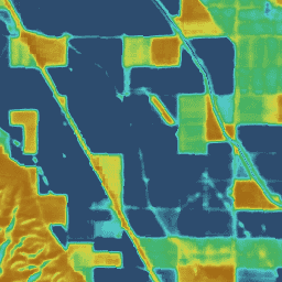
Edytor kodu (JavaScript)
var dataset = ee.ImageCollection('OpenET/SSEBOP/CONUS/GRIDMET/MONTHLY/v2_0')
  .filterDate('2020-01-01', '2021-01-01');

// Compute the annual evapotranspiration (ET) as the sum of the monthly ET
// images for the year.
var et = dataset.select('et').sum();

var visualization = {
  min: 0,
  max: 1400,
  palette: [
    '9e6212', 'ac7d1d', 'ba9829', 'c8b434', 'd6cf40', 'bed44b', '9fcb51',
    '80c256', '61b95c', '42b062', '45b677', '49bc8d', '4dc2a2', '51c8b8',
    '55cece', '4db4ba', '459aa7', '3d8094', '356681', '2d4c6e',
  ]
};

Map.setCenter(-100, 38, 5);

Map.addLayer(et, visualization, 'OpenET SSEBop Annual ET');