-
OpenET DisALEXI Monthly Evapotranspiration v2.0
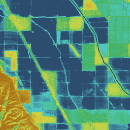
Atmosphere-Land Exchange Inverse / Disaggregation of the Atmosphere-Land Exchange Inverse (ALEXI/DisALEXI) DisALEXI został niedawno przeniesiony do Google Earth Engine w ramach platformy OpenET, a struktura bazowego modelu ALEXI/DisALEXI została opisana przez Andersona i współpracowników (2012, 2018). Model ewapotranspiracji (ET) ALEXI, w szczególności … evapotranspiration gridmet-derived landsat-derived monthly openet water -
OpenET Ensemble Monthly Evapotranspiration v2.0
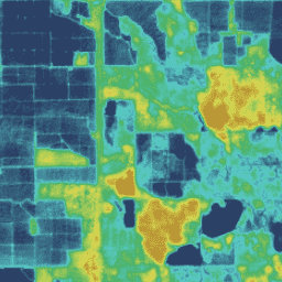
Zbiór danych OpenET zawiera dane satelitarne dotyczące łącznej ilości wody przenoszonej z powierzchni lądu do atmosfery w procesie parowania i transpiracji (ET). OpenET dostarcza dane ET z wielu modeli satelitarnych, a także oblicza jedną „wartość zbiorczą” na podstawie … evapotranspiration gridmet-derived landsat-derived monthly openet water -
OpenET PT-JPL Monthly Evapotranspiration v2.0
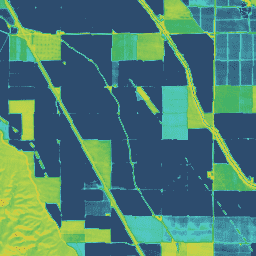
Priestley-Taylor Jet Propulsion Laboratory (PT-JPL) – główna formuła modelu PT-JPL w ramach OpenET nie zmieniła się od pierwotnej formuły opisanej w artykule Fisher et al. (2008). Wprowadziliśmy jednak ulepszenia i aktualizacje danych wejściowych modelu oraz integracji czasowej w przypadku PT-JPL, aby uwzględnić … evapotranspiration gridmet-derived landsat-derived monthly openet water -
OpenET SIMS Monthly Evapotranspiration v2.0
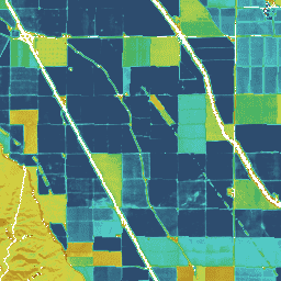
Wspomaganie zarządzania nawadnianiem z wykorzystaniem danych satelitarnych Model wspomagania zarządzania nawadnianiem z wykorzystaniem danych satelitarnych (SIMS) został pierwotnie opracowany, aby wspierać mapowanie współczynników plonów i parowania (ET) z nawadnianych terenów oraz zwiększyć dostęp do tych danych na potrzeby planowania nawadniania i regionalnej oceny … evapotranspiration gridmet-derived landsat-derived monthly openet water -
OpenET SSEBop Monthly Evapotranspiration v2.0
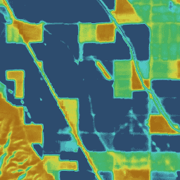
Uproszczona równowaga energetyczna powierzchni (SSEBop) Model uproszczonej równowagi energetycznej powierzchni (SSEBop) autorstwa Senay i współpracowników (2013, 2017) to uproszczony model energii powierzchni na podstawie danych termicznych, służący do szacowania rzeczywistej ET na podstawie zasad pomiaru psychrometrycznego satelitarnego (Senay 2018). Implementacja OpenET SSEBop używa… evapotranspiration gridmet-derived landsat-derived monthly openet water -
OpenET eeMETRIC Monthly Evapotranspiration v2.0
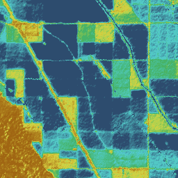
Implementacja w Google Earth Engine mapowania transpiracji w wysokiej rozdzielczości z wykorzystaniem modelu wewnętrznej kalibracji (eeMETRIC) eeMETRIC wykorzystuje zaawansowane algorytmy i proces METRIC Allena i współautorów (2007; 2015) oraz Allena i współautorów (2013b), w których pojedyncza relacja między temperaturą powietrza w pobliżu powierzchni … evapotranspiration gridmet-derived landsat-derived monthly openet water -
OpenET geeSEBAL Monthly Evapotranspiration v2.0
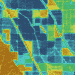
Wdrożenie geeSEBAL zostało niedawno zakończone w ramach platformy OpenET. Informacje o obecnej wersji geeSEBAL można znaleźć w artykule Laipelt i in. (2021), który opiera się na oryginalnych algorytmach opracowanych przez Bastiaanssen i in. (1998). Implementacja OpenET geeSEBAL wykorzystuje dane … evapotranspiration gridmet-derived landsat-derived monthly openet water
Datasets tagged openet in Earth Engine
[null,null,[],[[["\u003cp\u003eThe OpenET dataset provides satellite-based monthly evapotranspiration (ET) data for the contiguous United States using multiple models.\u003c/p\u003e\n"],["\u003cp\u003eEach OpenET model, including DisALEXI, eeMETRIC, geeSEBAL, PT-JPL, SIMS, and SSEBop, employs a unique methodology to estimate ET.\u003c/p\u003e\n"],["\u003cp\u003eOpenET data is derived from Landsat and GridMET, offering high spatial and temporal resolution for water resource management applications.\u003c/p\u003e\n"],["\u003cp\u003eAn ensemble ET dataset is available, combining results from individual models to provide a comprehensive estimate.\u003c/p\u003e\n"],["\u003cp\u003eOpenET data is openly accessible through Google Earth Engine, facilitating analysis and integration with other geospatial datasets.\u003c/p\u003e\n"]]],[],null,["# Datasets tagged openet in Earth Engine\n\n-\n\n |-------------------------------------------------------------------------------------------------------------------------------------------------------------------------------------------------------------------------------------------------------------------------------------------------------------------------------------------------------|\n | [### OpenET DisALEXI Monthly Evapotranspiration v2.0](/earth-engine/datasets/catalog/OpenET_DISALEXI_CONUS_GRIDMET_MONTHLY_v2_0) |\n | Atmosphere-Land Exchange Inverse / Disaggregation of the Atmosphere-Land Exchange Inverse (ALEXI/DisALEXI) DisALEXI was recently ported to Google Earth Engine as part of the OpenET framework and the baseline ALEXI/DisALEXI model structure is described by Anderson et al. (2012, 2018). The ALEXI evapotranspiration (ET) model specifically ... |\n | [evapotranspiration](/earth-engine/datasets/tags/evapotranspiration) [gridmet-derived](/earth-engine/datasets/tags/gridmet-derived) [landsat-derived](/earth-engine/datasets/tags/landsat-derived) [monthly](/earth-engine/datasets/tags/monthly) [openet](/earth-engine/datasets/tags/openet) [water](/earth-engine/datasets/tags/water) |\n\n-\n\n |-------------------------------------------------------------------------------------------------------------------------------------------------------------------------------------------------------------------------------------------------------------------------------------------------------------------------------------------|\n | [### OpenET Ensemble Monthly Evapotranspiration v2.0](/earth-engine/datasets/catalog/OpenET_ENSEMBLE_CONUS_GRIDMET_MONTHLY_v2_0) |\n | The OpenET dataset includes satellite-based data on the total amount of water that is transferred from the land surface to the atmosphere through the process of evapotranspiration (ET). OpenET provides ET data from multiple satellite-driven models, and also calculates a single \"ensemble value\" from the ... |\n | [evapotranspiration](/earth-engine/datasets/tags/evapotranspiration) [gridmet-derived](/earth-engine/datasets/tags/gridmet-derived) [landsat-derived](/earth-engine/datasets/tags/landsat-derived) [monthly](/earth-engine/datasets/tags/monthly) [openet](/earth-engine/datasets/tags/openet) [water](/earth-engine/datasets/tags/water) |\n\n-\n\n |-------------------------------------------------------------------------------------------------------------------------------------------------------------------------------------------------------------------------------------------------------------------------------------------------------------------------------------------|\n | [### OpenET PT-JPL Monthly Evapotranspiration v2.0](/earth-engine/datasets/catalog/OpenET_PTJPL_CONUS_GRIDMET_MONTHLY_v2_0) |\n | Priestley-Taylor Jet Propulsion Laboratory (PT-JPL) The core formulation of the PT-JPL model within the OpenET framework has not changed from the original formulation detailed in Fisher et al. (2008). However, enhancements and updates to model inputs and time integration for PT-JPL were made to take ... |\n | [evapotranspiration](/earth-engine/datasets/tags/evapotranspiration) [gridmet-derived](/earth-engine/datasets/tags/gridmet-derived) [landsat-derived](/earth-engine/datasets/tags/landsat-derived) [monthly](/earth-engine/datasets/tags/monthly) [openet](/earth-engine/datasets/tags/openet) [water](/earth-engine/datasets/tags/water) |\n\n-\n\n |----------------------------------------------------------------------------------------------------------------------------------------------------------------------------------------------------------------------------------------------------------------------------------------------------------------------------------------------|\n | [### OpenET SIMS Monthly Evapotranspiration v2.0](/earth-engine/datasets/catalog/OpenET_SIMS_CONUS_GRIDMET_MONTHLY_v2_0) |\n | Satellite Irrigation Management Support The NASA Satellite Irrigation Management Support (SIMS) model was originally developed to support satellite mapping of crop coefficients and evapotranspiration (ET) from irrigated lands and to increase access to this data to support use in irrigation scheduling and regional assessment of ... |\n | [evapotranspiration](/earth-engine/datasets/tags/evapotranspiration) [gridmet-derived](/earth-engine/datasets/tags/gridmet-derived) [landsat-derived](/earth-engine/datasets/tags/landsat-derived) [monthly](/earth-engine/datasets/tags/monthly) [openet](/earth-engine/datasets/tags/openet) [water](/earth-engine/datasets/tags/water) |\n\n-\n\n |--------------------------------------------------------------------------------------------------------------------------------------------------------------------------------------------------------------------------------------------------------------------------------------------------------------------------------------------|\n | [### OpenET SSEBop Monthly Evapotranspiration v2.0](/earth-engine/datasets/catalog/OpenET_SSEBOP_CONUS_GRIDMET_MONTHLY_v2_0) |\n | Operational Simplified Surface Energy Balance (SSEBop) The Operational Simplified Surface Energy Balance (SSEBop) model by Senay et al. (2013, 2017) is a thermal-based simplified surface energy model for estimating actual ET based on the principles of satellite psychrometry (Senay 2018). The OpenET SSEBop implementation uses ... |\n | [evapotranspiration](/earth-engine/datasets/tags/evapotranspiration) [gridmet-derived](/earth-engine/datasets/tags/gridmet-derived) [landsat-derived](/earth-engine/datasets/tags/landsat-derived) [monthly](/earth-engine/datasets/tags/monthly) [openet](/earth-engine/datasets/tags/openet) [water](/earth-engine/datasets/tags/water) |\n\n-\n\n |-------------------------------------------------------------------------------------------------------------------------------------------------------------------------------------------------------------------------------------------------------------------------------------------------------------------------------------------|\n | [### OpenET eeMETRIC Monthly Evapotranspiration v2.0](/earth-engine/datasets/catalog/OpenET_EEMETRIC_CONUS_GRIDMET_MONTHLY_v2_0) |\n | Google Earth Engine implementation of the Mapping Evapotranspiration at high Resolution with Internalized Calibration model (eeMETRIC) eeMETRIC applies the advanced METRIC algorithms and process of Allen et al. (2007; 2015) and Allen et al. (2013b), where a singular relationship between the near surface air temperature ... |\n | [evapotranspiration](/earth-engine/datasets/tags/evapotranspiration) [gridmet-derived](/earth-engine/datasets/tags/gridmet-derived) [landsat-derived](/earth-engine/datasets/tags/landsat-derived) [monthly](/earth-engine/datasets/tags/monthly) [openet](/earth-engine/datasets/tags/openet) [water](/earth-engine/datasets/tags/water) |\n\n-\n\n |-------------------------------------------------------------------------------------------------------------------------------------------------------------------------------------------------------------------------------------------------------------------------------------------------------------------------------------------|\n | [### OpenET geeSEBAL Monthly Evapotranspiration v2.0](/earth-engine/datasets/catalog/OpenET_GEESEBAL_CONUS_GRIDMET_MONTHLY_v2_0) |\n | Implementation of geeSEBAL was recently completed within the OpenET framework and an overview of the current geeSEBAL version can be found in Laipelt et al. (2021), which is based on the original algorithms developed by Bastiaanssen et al. (1998). The OpenET geeSEBAL implementation uses land ... |\n | [evapotranspiration](/earth-engine/datasets/tags/evapotranspiration) [gridmet-derived](/earth-engine/datasets/tags/gridmet-derived) [landsat-derived](/earth-engine/datasets/tags/landsat-derived) [monthly](/earth-engine/datasets/tags/monthly) [openet](/earth-engine/datasets/tags/openet) [water](/earth-engine/datasets/tags/water) |"]]