Tập dữ liệu Độ sáng của nắp có tua (TCB) được điền khoảng trống này được tạo bằng cách áp dụng các phương trình nắp có tua được xác định trong Lobser và Cohen (2007) cho hình ảnh được điều chỉnh BRDF của MODIS (MCD43B4). Dữ liệu thu được đã được lấp đầy khoảng trống bằng phương pháp được nêu trong Weiss và cộng sự (2014) để loại bỏ dữ liệu bị thiếu do các yếu tố như độ che phủ của mây, sau đó dữ liệu được tổng hợp theo thời gian và không gian để tạo ra sản phẩm hằng tháng có kích thước ≈5 km.
Giá trị trung bình của Độ sáng của mũ có tua cho từng pixel được tổng hợp.
FilledProportion
%
0*
100*
mét
Một dải kiểm soát chất lượng cho biết tỷ lệ phần trăm của từng pixel kết quả được tạo thành từ dữ liệu thô (thay vì các ước tính được lấp đầy khoảng trống).
Weiss, D.J., P.M. Atkinson, S. Bhatt, B. Mappin, S.I. Hay & P.W. Gething (2014) An effective approach for gap-filling continental scale remotely sensed time-series (Một phương pháp hiệu quả để lấp đầy khoảng trống trong chuỗi thời gian được cảm biến từ xa ở quy mô lục địa). ISPRS Journal of Photogrammetry and Remote Sensing,
98, 106-118.
Lobser, S.E. & Cohen, W.B. (2007) MODIS tasselled cap: land cover
characteristics expressed through transformed MODIS data. International
Journal of Remote Sensing, 28, 5079-5101.
Tập dữ liệu Độ sáng của nắp có tua (TCB) được điền khoảng trống này được tạo bằng cách áp dụng các phương trình nắp có tua được xác định trong Lobser và Cohen (2007) cho hình ảnh được điều chỉnh BRDF của MODIS (MCD43B4). Dữ liệu thu được được điền vào khoảng trống bằng phương pháp được nêu trong Weiss và cộng sự (2014) để loại bỏ dữ liệu bị thiếu do các yếu tố như độ che phủ của mây, …
[null,null,[],[[["\u003cp\u003eThis dataset provides monthly Tasseled Cap Brightness (TCB) data from 2001 to 2015, derived from MODIS imagery and gap-filled to address cloud cover issues.\u003c/p\u003e\n"],["\u003cp\u003eIt was produced by the Oxford Malaria Atlas Project and is available at a 5km resolution.\u003c/p\u003e\n"],["\u003cp\u003eThe dataset includes a "Mean" band representing TCB values and a "FilledProportion" band indicating the percentage of raw data used in each pixel.\u003c/p\u003e\n"],["\u003cp\u003eThe dataset is licensed under CC-BY-NC-SA-4.0 and is accessible through Google Earth Engine.\u003c/p\u003e\n"],["\u003cp\u003eThis dataset is valuable for various applications such as land cover analysis and monitoring environmental changes.\u003c/p\u003e\n"]]],[],null,["# Oxford MAP TCB: Malaria Atlas Project Gap-Filled Tasseled Cap Brightness\n\nDataset Availability\n: 2001-02-01T00:00:00Z--2015-01-01T00:00:00Z\n\nDataset Provider\n:\n\n\n [Oxford Malaria Atlas Project](https://www.bdi.ox.ac.uk/research/malaria-atlas-project)\n\nCadence\n: 1 Month\n\nTags\n:\n[brightness](/earth-engine/datasets/tags/brightness) [map](/earth-engine/datasets/tags/map) [oxford](/earth-engine/datasets/tags/oxford) [tasseled-cap](/earth-engine/datasets/tags/tasseled-cap) [tcb](/earth-engine/datasets/tags/tcb) [vegetation-indices](/earth-engine/datasets/tags/vegetation-indices) \n\n#### Description\n\nThis gap-filled Tasseled Cap Brightness (TCB) dataset was created by\napplying the tasseled-cap equations defined in Lobser and Cohen (2007) to\nMODIS BRDF-corrected imagery (MCD43B4). The resulting data were gap-filled\nusing the approach outlined in Weiss et al. (2014) to eliminate missing\ndata caused by factors such as cloud cover, and then the data were\naggregated temporally and spatially to produce the monthly ≈5km product.\n\nThis dataset was produced by Harry Gibson and Daniel Weiss of the\n[Malaria Atlas Project](https://malariaatlas.org/).\n\n### Bands\n\n\n**Pixel Size**\n\n5000 meters\n\n**Bands**\n\n| Name | Units | Min | Max | Pixel Size | Description |\n|--------------------|-------|-----|--------|------------|---------------------------------------------------------------------------------------------------------------------------------------------------|\n| `Mean` | | 0\\* | 1.99\\* | meters | The mean value of Tasseled Cap Brightness for each aggregated pixel. |\n| `FilledProportion` | % | 0\\* | 100\\* | meters | A quality control band that indicates the percentage of each resulting pixel that was comprised of raw data (as opposed to gap-filled estimates). |\n\n\\* estimated min or max value\n\n### Terms of Use\n\n**Terms of Use**\n\n[CC-BY-NC-SA-4.0](https://spdx.org/licenses/CC-BY-NC-SA-4.0.html)\n\n### Citations\n\nCitations:\n\n- Weiss, D.J., P.M. Atkinson, S. Bhatt, B. Mappin, S.I. Hay \\& P.W. Gething\n (2014) An effective approach for gap-filling continental scale remotely\n sensed time-series. ISPRS Journal of Photogrammetry and Remote Sensing,\n 98, 106-118.\n- Lobser, S.E. \\& Cohen, W.B. (2007) MODIS tasselled cap: land cover\n characteristics expressed through transformed MODIS data. International\n Journal of Remote Sensing, 28, 5079-5101.\n\n### Explore with Earth Engine\n\n| **Important:** Earth Engine is a platform for petabyte-scale scientific analysis and visualization of geospatial datasets, both for public benefit and for business and government users. Earth Engine is free to use for research, education, and nonprofit use. To get started, please [register for Earth Engine access.](https://console.cloud.google.com/earth-engine)\n\n### Code Editor (JavaScript)\n\n```javascript\n
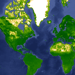
var dataset = ee.ImageCollection('Oxford/MAP/TCB_5km_Monthly')\n .filter(ee.Filter.date('2013-01-01', '2013-12-31'));\nvar tcb = dataset.select('Mean');\nvar tcbVis = {\n min: 0.0,\n max: 1.3,\n palette: [\n '011301', '004c00', '056201', '207401', '3e8601', '66a000', '99b718',\n 'fcd163', 'ffffff'\n ],\n};\nMap.setCenter(-44.65, 22.59, 2);\nMap.addLayer(tcb, tcbVis, 'TCB');\n```\n[Open in Code Editor](https://code.earthengine.google.com/?scriptPath=Examples:Datasets/Oxford/Oxford_MAP_TCB_5km_Monthly) \n[Oxford MAP TCB: Malaria Atlas Project Gap-Filled Tasseled Cap Brightness](/earth-engine/datasets/catalog/Oxford_MAP_TCB_5km_Monthly) \nThis gap-filled Tasseled Cap Brightness (TCB) dataset was created by applying the tasseled-cap equations defined in Lobser and Cohen (2007) to MODIS BRDF-corrected imagery (MCD43B4). The resulting data were gap-filled using the approach outlined in Weiss et al. (2014) to eliminate missing data caused by factors such as cloud cover, ... \nOxford/MAP/TCB_5km_Monthly, brightness,map,oxford,tasseled-cap,tcb,vegetation-indices \n2001-02-01T00:00:00Z/2015-01-01T00:00:00Z \n-90 -180 90 180 \nGoogle Earth Engine \nhttps://developers.google.com/earth-engine/datasets\n\n- [](https://doi.org/https://www.bdi.ox.ac.uk/research/malaria-atlas-project)\n- [](https://doi.org/https://developers.google.com/earth-engine/datasets/catalog/Oxford_MAP_TCB_5km_Monthly)"]]