- Ketersediaan Set Data
- 2019-01-01T00:00:00Z–2020-01-01T00:00:00Z
- Penyedia Set Data
- Malaria Atlas Project
- Tag
Deskripsi
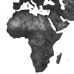
Peta aksesibilitas global ini mencantumkan waktu perjalanan berbasis darat (dalam menit) ke rumah sakit atau klinik terdekat untuk semua area antara 85 derajat utara dan 60 derajat selatan untuk tahun nominal 2019. Waktu ini juga mencakup waktu perjalanan "khusus berjalan kaki", hanya menggunakan alat transportasi non-bermotor.
Upaya pengumpulan data besar yang dilakukan oleh OpenStreetMap, Google Maps, dan peneliti akademis telah dimanfaatkan untuk mengumpulkan koleksi lokasi fasilitas kesehatan terlengkap hingga saat ini. Peta ini dibuat melalui kolaborasi antara MAP (University of Oxford), Telethon Kids Institute (Perth, Australia), Google, dan University of Twente, Belanda.
Project ini dibangun berdasarkan pekerjaan sebelumnya yang dipublikasikan oleh Weiss et al 2018 (doi:10.1038/nature25181). Weiss et al (2018) menggunakan set data untuk jalan (yang terdiri dari penggunaan set data jalan Google dan Open Street Map skala global pertama), jalur kereta api, sungai, danau, lautan, kondisi topografi (kemiringan dan elevasi), jenis penutup lahan, dan batas negara. Setiap set data ini dialokasikan kecepatan perjalanan dalam hal waktu untuk melintasi setiap piksel jenis tersebut. Kemudian, set data digabungkan untuk menghasilkan "permukaan gesekan": peta yang setiap pikselnya dialokasikan kecepatan perjalanan keseluruhan nominal berdasarkan jenis yang terjadi dalam piksel tersebut. Untuk project saat ini, permukaan gesekan yang diperbarui dibuat untuk menggabungkan peningkatan terbaru dalam data jalan OSM.
Algoritma jalur biaya terendah (dijalankan di Google Earth Engine dan, untuk area lintang tinggi, di R) digunakan bersama dengan permukaan gesekan ini untuk menghitung waktu perjalanan dari semua lokasi ke fasilitas kesehatan terdekat (dalam waktu). Set data fasilitas kesehatan menggunakan data lokasi dari dua database global terbesar: (1) data OSM yang dikumpulkan dan tersedia untuk didownload di www.healthsites.io; dan (2) data yang diekstrak dari Google Maps. Kumpulan data global dilengkapi dengan lokasi fasilitas skala benua yang baru-baru ini dipublikasikan untuk Afrika dan Australia. Untuk memfasilitasi perbandingan antara sumber data, hanya fasilitas yang ditentukan sebagai rumah sakit dan klinik yang digunakan. Beberapa titik yang ditemukan dalam piksel yang sama digabungkan agar sesuai dengan resolusi analisis sebagaimana ditentukan oleh representasi berpetak yang dipilih dari permukaan Bumi. Oleh karena itu, setiap piksel dalam peta aksesibilitas yang dihasilkan merepresentasikan waktu tersingkat yang dimodelkan (dalam menit) dari lokasi tersebut ke rumah sakit atau klinik.
Kredit set data sumber adalah seperti yang dijelaskan dalam makalah yang menyertainya.
Band
Ukuran Piksel
927,67 meter
Band
| Nama | Unit | Min | Maks | Ukuran Piksel | Deskripsi |
|---|---|---|---|---|---|
accessibility |
mnt | 0 | 41504.1 | meter | Waktu tempuh ke rumah sakit atau klinik terdekat. |
accessibility_walking_only |
mnt | 0 | 138893 | meter | Waktu tempuh ke rumah sakit atau klinik terdekat menggunakan transportasi non-bermotor. |
Persyaratan Penggunaan
Persyaratan Penggunaan
Karya ini dilisensikan berdasarkan Lisensi Atribusi 4.0 Internasional Creative Commons.
Kutipan
D.J. Weiss, A. Nelson, C.A. Vargas-Ruiz, K. Gligorić, S. Bavadekar, E. Gabrilovich, A. Bertozzi-Villa, J. Rozier, H.S. Gibson, T. Shekel, C. Kamath, A. Lieber, K. Schulman, Y. Shao, V. Qarkaxhija, A.K. Nandi, S.H. Keddie, S. Rumisha, E. Cameron, K.E. Battle, S. Bhatt, P.W. Gething. Peta global waktu perjalanan menuju fasilitas layanan kesehatan. Nature Medicine (2020).
Menjelajahi dengan Earth Engine
Code Editor (JavaScript)
var dataset = ee.Image('Oxford/MAP/accessibility_to_healthcare_2019');
var accessibility = dataset.select('accessibility');
var accessibilityVis = {
  min: 0.0,
  max: 41556.0,
  gamma: 4.0,
};
Map.setCenter(18.98, 6.66, 2);
Map.addLayer(accessibility, accessibilityVis, 'Accessibility');