-
Aksesibilitas ke Kota 2015
Peta aksesibilitas global ini menghitung waktu perjalanan darat ke area padat penduduk terdekat untuk semua area antara 85 derajat lintang utara dan 60 derajat lintang selatan untuk tahun nominal 2015. Area padat penduduk didefinisikan sebagai area yang berdekatan dengan 1.500 penduduk atau lebih per kilometer persegi atau … aksesibilitas jrc peta oxford populasi twente -
Aksesibilitas ke Layanan Kesehatan 2019
Peta aksesibilitas global ini mencantumkan waktu perjalanan darat (dalam menit) ke rumah sakit atau klinik terdekat untuk semua area antara 85 derajat lintang utara dan 60 derajat lintang selatan untuk tahun nominal 2019. Ini juga mencakup waktu perjalanan "khusus berjalan kaki", hanya menggunakan alat transportasi non-bermotor. Besar … aksesibilitas jrc peta oxford populasi twente -
Permukaan Gesekan Global 2019
Permukaan gesekan global ini menghitung kecepatan perjalanan berbasis darat untuk semua piksel daratan antara 85 derajat utara dan 60 derajat selatan untuk tahun nominal 2019. Fitur ini juga mencakup kecepatan perjalanan "khusus berjalan kaki", yang hanya menggunakan alat transportasi non-bermotor. Peta ini dibuat melalui kolaborasi antara … aksesibilitas jrc peta oxford populasi twente
Datasets tagged twente in Earth Engine
[null,null,[],[[["\u003cp\u003eThe datasets provide global accessibility maps for cities, healthcare, and travel speed.\u003c/p\u003e\n"],["\u003cp\u003eThese maps cover land areas between 85 degrees north and 60 degrees south.\u003c/p\u003e\n"],["\u003cp\u003eTravel time is calculated for a nominal year of either 2015 or 2019, depending on the dataset.\u003c/p\u003e\n"],["\u003cp\u003eAccessibility is evaluated based on land-based travel, including options for motorized and non-motorized transportation.\u003c/p\u003e\n"],["\u003cp\u003eThe maps were produced through a collaboration between several organizations, including Oxford, JRC, and Twente.\u003c/p\u003e\n"]]],[],null,["# Datasets tagged twente in Earth Engine\n\n-\n\n |---------------------------------------------------------------------------------------------------------------------------------------------------------------------------------------------------------------------------------------------------------------------------------------------------------------|\n | [### Accessibility to Cities 2015](/earth-engine/datasets/catalog/Oxford_MAP_accessibility_to_cities_2015_v1_0) |\n | This global accessibility map enumerates land-based travel time to the nearest densely-populated area for all areas between 85 degrees north and 60 degrees south for a nominal year 2015. Densely-populated areas are defined as contiguous areas with 1,500 or more inhabitants per square kilometer or ... |\n | [accessibility](/earth-engine/datasets/tags/accessibility) [jrc](/earth-engine/datasets/tags/jrc) [map](/earth-engine/datasets/tags/map) [oxford](/earth-engine/datasets/tags/oxford) [population](/earth-engine/datasets/tags/population) [twente](/earth-engine/datasets/tags/twente) |\n\n-\n\n |--------------------------------------------------------------------------------------------------------------------------------------------------------------------------------------------------------------------------------------------------------------------------------------------------------------|\n | [### Accessibility to Healthcare 2019](/earth-engine/datasets/catalog/Oxford_MAP_accessibility_to_healthcare_2019) |\n | This global accessibility map enumerates land-based travel time (in minutes) to the nearest hospital or clinic for all areas between 85 degrees north and 60 degrees south for a nominal year 2019. It also includes \"walking-only\" travel time, using non-motorized means of transportation only. Major ... |\n | [accessibility](/earth-engine/datasets/tags/accessibility) [jrc](/earth-engine/datasets/tags/jrc) [map](/earth-engine/datasets/tags/map) [oxford](/earth-engine/datasets/tags/oxford) [population](/earth-engine/datasets/tags/population) [twente](/earth-engine/datasets/tags/twente) |\n\n-\n\n |----------------------------------------------------------------------------------------------------------------------------------------------------------------------------------------------------------------------------------------------------------------------------------------------------------------------|\n | [### 
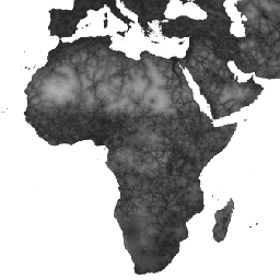
Global Friction Surface 2019](/earth-engine/datasets/catalog/Oxford_MAP_friction_surface_2019) |\n | This global friction surface enumerates land-based travel speed for all land pixels between 85 degrees north and 60 degrees south for a nominal year 2019. It also includes \"walking-only\" travel speed, using non-motorized means of transportation only. This map was produced through a collaboration between ... |\n | [accessibility](/earth-engine/datasets/tags/accessibility) [jrc](/earth-engine/datasets/tags/jrc) [map](/earth-engine/datasets/tags/map) [oxford](/earth-engine/datasets/tags/oxford) [population](/earth-engine/datasets/tags/population) [twente](/earth-engine/datasets/tags/twente) |"]]