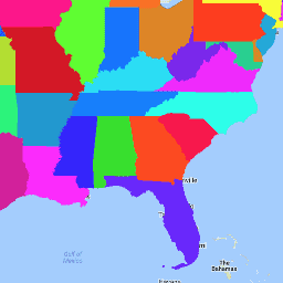
Набор данных TIGER Бюро переписи населения США содержит границы основных административно-территориальных единиц США по состоянию на 2016 год. Помимо пятидесяти штатов, Бюро переписи населения рассматривает округ Колумбия, Пуэрто-Рико и каждую из островных территорий (Американское Самоа, Содружество Северных Марианских Островов, Гуам и Американские Виргинские острова) в качестве статистических эквивалентов штатов для целей представления данных. Каждый объект представляет штат или эквивалент штата.
Описание юридической/статистической области для штата
МТФКК
НИТЬ
Код класса объектов MAF/TIGER (=G4000)
ИМЯ
НИТЬ
Название штата
ОБЛАСТЬ
НИТЬ
Код региона
STATEFP
НИТЬ
Государственный код FIPS
Стейтенс
НИТЬ
Государственный код GNIS
ШТУПС
НИТЬ
Аббревиатура штата Почтовая служба США
Условия эксплуатации
Бюро переписи населения США предоставляет часть своих общедоступных данных в машиночитаемом формате через интерфейс прикладного программирования (API). Весь контент, документация, код и сопутствующие материалы, доступные через API, регулируются настоящими условиями .
Цитаты
Цитаты:
Для создания любых отчетов, публикаций, новых наборов данных, производных продуктов или услуг на основе набора данных пользователи должны ссылаться на Бюро переписи населения США .
Набор данных TIGER Бюро переписи населения США содержит границы основных административно-территориальных единиц США по состоянию на 2016 год. Помимо пятидесяти штатов, Бюро переписи населения учитывает округ Колумбия, Пуэрто-Рико и каждую из островных территорий (Американское Самоа, Содружество Северных Марианских островов…).
TIGER/2016/Штаты, перепись, инфраструктура-границы, штат, штаты, таблица, тигр, США
[null,null,[],[[["\u003cp\u003eThe TIGER/2016/States dataset provides 2016 boundaries for the primary governmental divisions of the United States, including states and state equivalents.\u003c/p\u003e\n"],["\u003cp\u003eThe dataset includes attributes such as land and water area, geographic identifiers, and census region codes.\u003c/p\u003e\n"],["\u003cp\u003eUsers should cite the US Census Bureau when using this data for reports, publications, or derived products.\u003c/p\u003e\n"],["\u003cp\u003eThis dataset can be visualized and analyzed using Earth Engine, a platform for geospatial data analysis.\u003c/p\u003e\n"],["\u003cp\u003eThe dataset is available as a FeatureCollection and a FeatureView for optimized visualization in Earth Engine.\u003c/p\u003e\n"]]],[],null,["# TIGER: US Census States 2016\n\nDataset Availability\n: 2016-01-01T00:00:00Z--2017-01-02T00:00:00Z\n\nDataset Provider\n:\n\n\n [United States Census Bureau](https://www.census.gov/programs-surveys/geography/guidance/tiger-data-products-guide.html)\n\nTags\n:\n[census](/earth-engine/datasets/tags/census) [infrastructure-boundaries](/earth-engine/datasets/tags/infrastructure-boundaries) [state](/earth-engine/datasets/tags/state) [states](/earth-engine/datasets/tags/states) [table](/earth-engine/datasets/tags/table) [tiger](/earth-engine/datasets/tags/tiger) [us](/earth-engine/datasets/tags/us) \n\n#### Description\n\nThe United States Census Bureau TIGER dataset contains the 2016 boundaries\nfor the primary governmental divisions of the United States. In addition\nto the fifty states, the Census Bureau treats the District of Columbia,\nPuerto Rico, and each of the island areas (American Samoa, the Commonwealth\nof the Northern Mariana Islands, Guam, and the U.S. Virgin Islands) as the\nstatistical equivalents of States for the purpose of data presentation.\nEach feature represents a state or state equivalent.\n\nFor full technical details on all TIGER 2016 products, see the [TIGER\ntechnical documentation](https://www2.census.gov/geo/pdfs/maps-data/data/tiger/tgrshp2016/TGRSHP2016_TechDoc.pdf).\n\n### Table Schema\n\n**Table Schema**\n\n| Name | Type | Description |\n|----------|--------|----------------------------------------------|\n| ALAND | DOUBLE | Land area |\n| AWATER | DOUBLE | Water area |\n| DIVISION | STRING | Division code |\n| FUNCSTAT | STRING | Functional Status |\n| GEOID | STRING | State identifier; state FIPS code |\n| INTPTLAT | STRING | Internal point latitude |\n| INTPTLON | STRING | Internal point longitude |\n| LSAD | STRING | Legal/statistical area description for state |\n| MTFCC | STRING | MAF/TIGER feature class code (=G4000) |\n| NAME | STRING | State name |\n| REGION | STRING | Region code |\n| STATEFP | STRING | State FIPS code |\n| STATENS | STRING | State GNIS code |\n| STUSPS | STRING | US Postal Service state abbreviation |\n\n### Terms of Use\n\n**Terms of Use**\n\nThe U.S. Census Bureau offers some of its public data\nin machine-readable format via an Application Programming Interface\n(API). All of the content, documentation, code and related materials\nmade available through the API are subject to [these terms and\nconditions](https://www.census.gov/data/developers/about/terms-of-service.html).\n\n### Citations\n\nCitations:\n\n- For the creation of any reports, publications, new data sets, derived\n products, or services resulting from the data set, users should\n [cite the US Census Bureau](https://www.census.gov/about/policies/citation.html).\n\n### Explore with Earth Engine\n\n| **Important:** Earth Engine is a platform for petabyte-scale scientific analysis and visualization of geospatial datasets, both for public benefit and for business and government users. Earth Engine is free to use for research, education, and nonprofit use. To get started, please [register for Earth Engine access.](https://console.cloud.google.com/earth-engine)\n\n### Code Editor (JavaScript)\n\n```javascript\nvar dataset = ee.FeatureCollection('TIGER/2016/States');\nvar visParams = {\n palette: ['purple', 'blue', 'green', 'yellow', 'orange', 'red'],\n min: 500000000,\n max: 5e+11,\n opacity: 0.8,\n};\nvar image = ee.Image().float().paint(dataset, 'ALAND');\nMap.setCenter(-99.844, 37.649, 5);\nMap.addLayer(image, visParams, 'TIGER/2016/States');\nMap.addLayer(dataset, null, 'for Inspector', false);\n```\n[Open in Code Editor](https://code.earthengine.google.com/?scriptPath=Examples:Datasets/TIGER/TIGER_2016_States)\n\n### Visualize as a FeatureView\n\n\nA `FeatureView` is a view-only, accelerated representation of a\n`FeatureCollection`. For more details, visit the\n[`FeatureView` documentation.](/earth-engine/guides/featureview_overview)\n| **Important:** Earth Engine is a platform for petabyte-scale scientific analysis and visualization of geospatial datasets, both for public benefit and for business and government users. Earth Engine is free to use for research, education, and nonprofit use. To get started, please [register for Earth Engine access.](https://console.cloud.google.com/earth-engine)\n\n### Code Editor (JavaScript)\n\n```javascript\nvar fvLayer = ui.Map.FeatureViewLayer('TIGER/2016/States_FeatureView');\n\nvar visParams = {\n opacity: 0.8,\n color: {\n property: 'ALAND',\n mode: 'linear',\n palette: ['purple', 'blue', 'green', 'yellow', 'orange', 'red'],\n min: 5e8,\n max: 5e11\n }\n};\n\nfvLayer.setVisParams(visParams);\nfvLayer.setName('US census states');\n\nMap.setCenter(-99.844, 37.649, 5);\nMap.add(fvLayer);\n```\n[Open in Code Editor](https://code.earthengine.google.com/?scriptPath=Examples:Datasets/TIGER/TIGER_2016_States_FeatureView) \n[TIGER: US Census States 2016](/earth-engine/datasets/catalog/TIGER_2016_States) \nThe United States Census Bureau TIGER dataset contains the 2016 boundaries for the primary governmental divisions of the United States. In addition to the fifty states, the Census Bureau treats the District of Columbia, Puerto Rico, and each of the island areas (American Samoa, the Commonwealth of the Northern Mariana ... \nTIGER/2016/States, census,infrastructure-boundaries,state,states,table,tiger,us \n2016-01-01T00:00:00Z/2017-01-02T00:00:00Z \n-14.69 -180 71.567 -64.435 \nGoogle Earth Engine \nhttps://developers.google.com/earth-engine/datasets\n\n- [](https://doi.org/https://www.census.gov/programs-surveys/geography/guidance/tiger-data-products-guide.html)\n- [](https://doi.org/https://developers.google.com/earth-engine/datasets/catalog/TIGER_2016_States)"]]