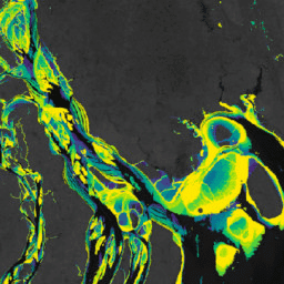
Zbiór danych Murray Global Intertidal Change Dataset zawiera globalne mapy ekosystemów pływowych,które powstały w wyniku nadzorowanej klasyfikacji 707 528 zdjęć z archiwum Landsat. Każdy piksel został zaklasyfikowany jako obszar pływowy, stały zbiornik wodny lub inny na podstawie globalnego zestawu danych treningowych.
Klasyfikacja została przeprowadzona na całej długości wybrzeża na świecie
między 60° N a 60° S w okresie od 1 stycznia 1984 r. do 31 grudnia 2016 r.
Kolekcja obrazów składa się z 11 globalnych map pływowych w rozdzielczości 30 m na piksel w określonych przedziałach czasowych (1984–1986, 1987–1989, 1990–1992, 1993–1995, 1996–1998, 1999–2001, 2002–2004, 2005–2007, 2008–2010, 2011–2013, 2014–2016).
Flaga wskazująca przestrzenne ograniczenia wdrożenia klasyfikatora płycizn pływowych określone przez ograniczenia wysokościowe (+100 m) i batymetryczne (-100 m).
Pasma
Rozmiar piksela 30 metrów
Pasma
Nazwa
Jednostki
Rozmiar piksela
Opis
datamask
wystąpienie
metry
Flaga wskazująca, czy dane mają być uwzględnione.
Bitmaska dla datamask
Bit 0: maska danych
0: brak danych
1. Obszar sklasyfikowany
Warunki korzystania z usługi
Ten utwór jest dostępny na licencji Creative Commons Uznanie autorstwa 4.0
Międzynarodowa.
Każde wykorzystanie danych dotyczących strefy pływów musi zawierać odpowiednie podziękowanie, w tym cytowanie powiązanego artykułu w czasopiśmie.
Cytaty
Cytowania:
Murray, N.J., Phinn, S.R., DeWitt, M., Ferrari, R., Johnston, R., Lyons, M.B.,
Clinton, N., Thau, D. & Fuller, R.A. (2019) The global distribution and
trajectory of tidal flats. Nature, 565, 222-225.
doi:10.1038/s41586-018-0805-8,
Murray, N. J. Phinn, S. P., Fuller, R. A., DeWitt, M., Ferrari, R.,
Johnston, R., Clinton, N., & Lyons, M. B. (2022). Mapy globalne o wysokiej rozdzielczości przedstawiające ekosystemy płycizn pływowych w latach 1984–2019. Scientific Data,
9(1).
doi:10.1038/s41597-022-01635-5,
Zbiór danych Murray Global Intertidal Change Dataset zawiera globalne mapy ekosystemów strefy pływów,które powstały w wyniku nadzorowanej klasyfikacji 707 528 zdjęć z archiwum Landsat. Każdy piksel został zaklasyfikowany jako płycizna pływowa, stały zbiornik wodny lub inny na podstawie globalnego zbioru danych treningowych. Klasyfikację wprowadzono w …
[null,null,[],[[["\u003cp\u003eThe Murray Global Intertidal Change Dataset provides global maps of tidal flat ecosystems based on a supervised classification of over 700,000 Landsat images from 1984 to 2016.\u003c/p\u003e\n"],["\u003cp\u003eThe dataset covers coastlines between 60° North and 60° South, classifying each 30m pixel as tidal flat, permanent water, or other.\u003c/p\u003e\n"],["\u003cp\u003eEleven global maps of tidal flats are included, representing different time periods between 1984 and 2016.\u003c/p\u003e\n"],["\u003cp\u003eThis dataset is licensed under a Creative Commons Attribution 4.0 International License, requiring proper acknowledgment and citation in any use.\u003c/p\u003e\n"],["\u003cp\u003eThe dataset was created by Murray et al.and is available for exploration and analysis within Google Earth Engine.\u003c/p\u003e\n"]]],["The Murray Global Intertidal Change Dataset provides global tidal flat ecosystem maps from 1984 to 2016, derived from 707,528 Landsat images. Pixels are classified as tidal flat, permanent water, or other, using training data. The dataset contains eleven 30m-resolution time-series maps, covering 1984-2016, along the global coastline between 60°N and 60°S. It includes a `datamask` band indicating data inclusion and can be accessed through Google Earth Engine. Citations are required for use.\n"],null,["# Murray Global Intertidal Change Data Mask\n\nDataset Availability\n: 1984-01-01T00:00:00Z--2017-01-01T00:00:00Z\n\nDataset Provider\n:\n\n\n [Murray/UQ/Google/USGS/NASA](https://intertidal.app)\n\nTags\n:\n[coastal](/earth-engine/datasets/tags/coastal) [google](/earth-engine/datasets/tags/google) [intertidal](/earth-engine/datasets/tags/intertidal) [landsat-derived](/earth-engine/datasets/tags/landsat-derived) [murray](/earth-engine/datasets/tags/murray) [surface-ground-water](/earth-engine/datasets/tags/surface-ground-water) [tidal-flats](/earth-engine/datasets/tags/tidal-flats) [uq](/earth-engine/datasets/tags/uq) \n\n#### Description\n\nThe Murray Global Intertidal Change Dataset contains global maps of tidal flat\necosystems produced via a supervised classification of 707,528 Landsat\nArchive images. Each pixel was classified into tidal flat, permanent water\nor other with reference to a globally distributed set of training data.\n\nThe classification was implemented along the entire global coastline\nbetween 60° North and 60° South from 1 January 1984 to 31 December 2016.\nThe image collection consists consists of a time-series of 11 global maps\nof tidal flats at 30m pixel resolution for set time-periods (1984-1986;\n1987-1989; 1990-1992; 1993-1995; 1996-1998; 1999-2001; 2002-2004;\n2005-2007; 2008-2010; 2011-2013; 2014-2016)\n\nFlag indicating the spatial limits of the implementation of the tidal flat\nclassifier as defined by altitudinal (+100m) and bathymetric (-100m) limits.\n\n### Bands\n\n\n**Pixel Size**\n\n30 meters\n\n**Bands**\n\n| Name | Units | Pixel Size | Description |\n|------------|------------|------------|------------------------------------|---|---|---|---|---|---|---|---|---|---|---|---|---|---|---|---|---|---|---|---|---|---|---|---|---|---|---|---|---|---|---|---|---|---|---|---|---|---|---|---|---|---|---|---|---|---|---|---|---|---|---|---|---|---|---|---|---|---|---|---|---|---|---|---|---|---|---|---|---|---|---|---|---|---|---|---|---|---|---|---|---|---|---|---|---|---|---|---|---|---|---|---|---|---|---|---|\n| `datamask` | occurrence | meters | A flag to indicate data inclusion. |\n| Bitmask for datamask - Bit 0: Data mask - 0: No data - 1: Classified area ||||||||||||||||||||||||||||||||||||||||||||||||||||||||||||||||||||||||||||||||||||||||||||||||||||\n\n### Terms of Use\n\n**Terms of Use**\n\nThis work is licensed under a Creative Commons Attribution 4.0\nInternational License.\n\nAny use of the intertidal data must include proper acknowledgement,\nincluding citing the associated journal article.\n\n### Citations\n\nCitations:\n\n- Murray, N.J., Phinn, S.R., DeWitt, M., Ferrari, R., Johnston, R., Lyons, M.B.,\n Clinton, N., Thau, D. \\& Fuller, R.A. (2019) The global distribution and\n trajectory of tidal flats. Nature, 565, 222-225.\n [doi:10.1038/s41586-018-0805-8](https://doi.org/10.1038/s41586-018-0805-8),\n- Murray, N. J., Phinn, S. P., Fuller, R. A., DeWitt, M., Ferrari, R.,\n Johnston, R., Clinton, N., \\& Lyons, M. B. (2022). High-resolution global\n maps of tidal flat ecosystems from 1984 to 2019. Scientific Data,\n 9(1).\n [doi:10.1038/s41597-022-01635-5](https://doi.org/10.1038/s41597-022-01635-5),\n\n### DOIs\n\n- \u003chttps://doi.org/10.1038/s41586-018-0805-8\u003e\n\n### Explore with Earth Engine\n\n| **Important:** Earth Engine is a platform for petabyte-scale scientific analysis and visualization of geospatial datasets, both for public benefit and for business and government users. Earth Engine is free to use for research, education, and nonprofit use. To get started, please [register for Earth Engine access.](https://console.cloud.google.com/earth-engine)\n\n### Code Editor (JavaScript)\n\n```javascript\nvar dataset = ee.Image('UQ/murray/Intertidal/v1_1/data_mask');\n\nvar visualization = {\n bands: ['datamask'],\n min: 0,\n max: 1,\n palette: ['000000', 'ffffff']\n};\n\nMap.setCenter(126.6339, 37.4394, 10);\n\nMap.addLayer(dataset, visualization, 'Data mask');\n```\n[Open in Code Editor](https://code.earthengine.google.com/?scriptPath=Examples:Datasets/UQ/UQ_murray_Intertidal_v1_1_data_mask) \n[Murray Global Intertidal Change Data Mask](/earth-engine/datasets/catalog/UQ_murray_Intertidal_v1_1_data_mask) \nThe Murray Global Intertidal Change Dataset contains global maps of tidal flat ecosystems produced via a supervised classification of 707,528 Landsat Archive images. Each pixel was classified into tidal flat, permanent water or other with reference to a globally distributed set of training data. The classification was implemented along the ... \nUQ/murray/Intertidal/v1_1/data_mask, coastal,google,intertidal,landsat-derived,murray,surface-ground-water,tidal-flats,uq \n1984-01-01T00:00:00Z/2017-01-01T00:00:00Z \n-60 -180 60 180 \nGoogle Earth Engine \nhttps://developers.google.com/earth-engine/datasets\n\n- [https://doi.org/10.1038/s41586-018-0805-8](https://doi.org/https://intertidal.app)\n- [https://doi.org/10.1038/s41586-018-0805-8](https://doi.org/https://developers.google.com/earth-engine/datasets/catalog/UQ_murray_Intertidal_v1_1_data_mask)"]]