- ডেটাসেটের উপলভ্যতা
- ২০১৭-১২-২৯T০০:০০:০০Z–২০১৭-১২-২৯T০০:০০:০০Z
- ডেটাসেট প্রযোজক
- মার্কিন যুক্তরাষ্ট্রের পররাষ্ট্র দপ্তর, ভূগোলবিদদের কার্যালয়
- ট্যাগ
বিবরণ
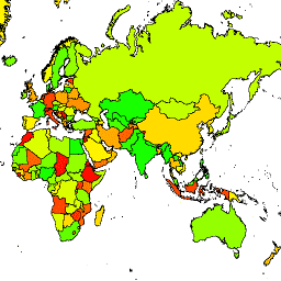
মার্কিন যুক্তরাষ্ট্রের ভূগোলবিদ অফিস লার্জ স্কেল ইন্টারন্যাশনাল বাউন্ডারি (LSIB) ডেটাসেট প্রদান করে। এটি আরও দুটি ডেটাসেট থেকে নেওয়া হয়েছে: একটি LSIB লাইন ভেক্টর ফাইল এবং ন্যাশনাল জিওস্পেশিয়াল-ইন্টেলিজেন্স এজেন্সি (NGA) থেকে ওয়ার্ল্ড ভেক্টর শোরলাইন (WVS)। অভ্যন্তরীণ সীমানা সীমানা, সীমানা বিরোধ এবং সার্বভৌমত্ব সম্পর্কিত মার্কিন সরকারের নীতি প্রতিফলিত করে। বহির্মুখী সীমানা WVS থেকে নেওয়া হয়েছে; তবে, WVS উপকূলরেখার তথ্য পুরানো এবং সাধারণত কয়েকশ মিটার থেকে এক কিলোমিটারেরও বেশি স্থানান্তরিত হয়। প্রতিটি বৈশিষ্ট্য হল অভ্যন্তরীণ সীমানা এবং বহির্মুখী উপকূলরেখা দ্বারা ঘেরা বহুভুজীয় এলাকা যেখানে প্রযোজ্য, এবং অনেক দেশে একাধিক বৈশিষ্ট্য রয়েছে, প্রতি বিচ্ছিন্ন অঞ্চলে একটি। 180,741 বৈশিষ্ট্যের প্রতিটি এই ডেটাসেটে বর্ণিত 284টি দেশের একটির জ্যামিতির অংশ।
টেবিল স্কিমা
টেবিল স্কিমা
| নাম | আদর্শ | বিবরণ |
|---|---|---|
| বস্তু | স্ট্রিং | অবজেক্ট আইডি |
| দেশ_নাগাদ | স্ট্রিং | মার্কিন যুক্তরাষ্ট্র স্বীকৃত দেশের নাম |
ব্যবহারের শর্তাবলী
ব্যবহারের শর্তাবলী
এই মার্কিন পাবলিক ডোমেন ডেটা ব্যবহারের উপর কোনও বিধিনিষেধ নেই।
আর্থ ইঞ্জিনের সাহায্যে ঘুরে দেখুন
কোড এডিটর (জাভাস্ক্রিপ্ট)
var dataset = ee.FeatureCollection('USDOS/LSIB/2017');
var styleParams = {
  fillColor: 'b5ffb4',
  color: '00909F',
  width: 3,
};
var countries = dataset.style(styleParams);
Map.setCenter(16.35, 48.83, 4);
Map.addLayer(countries, {}, 'USDOS/LSIB/2017', true, 0.8);
একটি FeatureView হিসেবে ভিজ্যুয়ালাইজ করুন
FeatureView হল FeatureCollection এর একটি ত্বরিত উপস্থাপনা যা কেবলমাত্র দেখার জন্য। আরও বিস্তারিত জানার জন্য, FeatureView ডকুমেন্টেশনটি দেখুন।
কোড এডিটর (জাভাস্ক্রিপ্ট)
var fvLayer = ui.Map.FeatureViewLayer('USDOS/LSIB/2017_FeatureView');

var visParams = {
  color: '00909F',
  fillColor: 'b5ffb4',
  width: 3,
  opacity: 1
};

fvLayer.setVisParams(visParams);
fvLayer.setName('USDOS/LSIB/2017');

Map.setCenter(16.35, 48.83, 4);
Map.add(fvLayer);