- Доступность набора данных
- 2017-03-30T00:00:00Z–2017-03-30T00:00:00Z
- Производитель наборов данных
- Государственный департамент США, Управление географа
- Теги
Описание
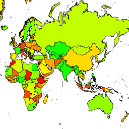
Управление географии США предоставляет набор данных «Крупномасштабные международные границы» (LSIB). Подробная версия (2013 г.) получена из двух других наборов данных: файла линейных векторов LSIB и набора данных «Мировые векторные береговые линии» (WVS) Национального агентства геопространственной разведки (NGA). Внутренние границы отражают политику правительства США в отношении границ, пограничных споров и суверенитета. Внешние границы получены из WVS; однако данные о береговой линии WVS устарели и, как правило, смещены от нескольких сотен метров до более чем километра. Каждый объект представляет собой полигональную область, ограниченную внутренними границами и внешними береговыми линиями, где это применимо, и многие страны состоят из нескольких объектов, по одному на каждый непересекающийся регион.
По сравнению с подробной базой данных LSIB, в этом упрощенном наборе данных некоторые разрозненные регионы каждой страны были сведены к одному объекту. Кроме того, он исключает средние и малые острова. Полученные упрощенные границы редко смещаются более чем на 100 метров относительно подробных линий LSIB. Каждый из 312 объектов является частью геометрии одной из 284 стран, описанных в этом наборе данных.
Схема таблицы
Схема таблицы
| Имя | Тип | Описание |
|---|---|---|
| аббревиати | НИТЬ | Сокращенное обозначение страны |
| страна_ко | НИТЬ | |
| страна_на | НИТЬ | Название страны, признанной США |
| wld_rgn | НИТЬ | Континентальный регион, например, Южная Америка |
Условия эксплуатации
Условия эксплуатации
На использование этих данных, находящихся в общественном достоянии США, никаких ограничений нет.
Исследуйте мир с помощью Earth Engine.
Редактор кода (JavaScript)
var dataset = ee.FeatureCollection('USDOS/LSIB_SIMPLE/2017');
var styleParams = {
  fillColor: 'b5ffb4',
  color: '00909F',
  width: 3,
};
var countries = dataset.style(styleParams);
Map.setCenter(16.35, 48.83, 4);
Map.addLayer(countries, {}, 'USDOS/LSIB_SIMPLE/2017', true, 0.8);
import ee
import geemap.core as geemap
Colab (Python)
dataset = ee.FeatureCollection('USDOS/LSIB_SIMPLE/2017')

countries = dataset.style(fillColor='b5ffb4', color='00909F', width=3)

m = geemap.Map()
m.set_center(16.35, 48.83, 4)
m.add_layer(countries, {}, 'USDOS/LSIB_SIMPLE/2017', True, 0.8)
m
Визуализируйте как FeatureView
FeatureView — это ускоренное представление FeatureCollection , доступное только для просмотра. Более подробную информацию можно найти в документации FeatureView .
Редактор кода (JavaScript)
var fvLayer = ui.Map.FeatureViewLayer('USDOS/LSIB_SIMPLE/2017_FeatureView');

var visParams = {
  color: '00909F',
  fillColor: 'b5ffb4',
  width: 3,
  opacity: 1
};

fvLayer.setVisParams(visParams);
fvLayer.setName('USDOS/LSIB_SIMPLE/2017');

Map.setCenter(16.35, 48.83, 4);
Map.add(fvLayer);
import ee
import geemap.core as geemap
Colab (Python)
dataset = ee.FeatureCollection('USDOS/LSIB_SIMPLE/2017')

countries = dataset.style(fillColor='b5ffb4', color='00909F', width=3)

m = geemap.Map()
m.set_center(16.35, 48.83, 4)
m.add_layer(countries, {}, 'USDOS/LSIB_SIMPLE/2017', True, 0.8)
m