- ডেটাসেটের প্রাপ্যতা
- 2000-02-11T00:00:00Z–2000-02-22T00:00:00Z
- ডেটাসেট প্রযোজক
- নাসা / ইউএসজিএস / জেপিএল-ক্যালটেক
- ট্যাগ
বর্ণনা
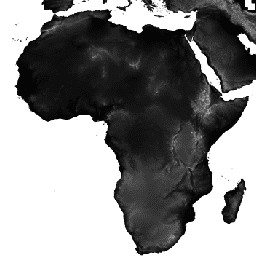
শাটল রাডার টপোগ্রাফি মিশন (এসআরটিএম, দেখুন ফার এট আল. ২০০৭ ) ডিজিটাল উচ্চতা ডেটা হলো একটি আন্তর্জাতিক গবেষণা প্রচেষ্টা, যার মাধ্যমে প্রায়-বৈশ্বিক স্কেলে ডিজিটাল উচ্চতা মডেল সংগ্রহ করা হয়েছে। এই এসআরটিএম ভি৩ প্রোডাক্টটি (এসআরটিএম প্লাস) নাসা জেপিএল কর্তৃক ১ আর্ক-সেকেন্ড (প্রায় ৩০ মিটার) রেজোলিউশনে সরবরাহ করা হয়।
এই ডেটাসেটটি ওপেন-সোর্স ডেটা (ASTER GDEM2, GMTED2010, এবং NED) ব্যবহার করে শূন্যস্থান পূরণের প্রক্রিয়ার মধ্য দিয়ে গেছে, যা অন্যান্য সংস্করণগুলো থেকে ভিন্ন, যেগুলোতে শূন্যস্থান রয়েছে বা বাণিজ্যিক উৎস থেকে শূন্যস্থান পূরণ করা হয়েছে। বিভিন্ন সংস্করণ সম্পর্কে আরও তথ্যের জন্য SRTM কুইক গাইড দেখুন।
নথিপত্র:
ব্যান্ড
ব্যান্ড
পিক্সেল সাইজ: ৩০ মিটার (সকল ব্যান্ড)
| নাম | ইউনিট | মিনিট | ম্যাক্স | পিক্সেল আকার | বর্ণনা |
|---|---|---|---|---|---|
elevation | এম | -১০* | ৬৫০০* | ৩০ মিটার | উচ্চতা |
ব্যবহারের শর্তাবলী
ব্যবহারের শর্তাবলী
অন্যথায় উল্লেখ না থাকলে, জেপিএল-এর পাবলিক ওয়েব সাইটগুলিতে (যেসব পাবলিক সাইটের ঠিকানা jpl.nasa.gov-এ শেষ হয়) থাকা ছবি এবং ভিডিও পূর্বানুমতি ছাড়াই যেকোনো উদ্দেশ্যে ব্যবহার করা যেতে পারে। আরও তথ্য এবং ব্যতিক্রম জানতে জেপিএল ইমেজ ইউজ পলিসি সাইটটি দেখুন।
উদ্ধৃতি
ফার, টিজি, রোজেন, পিএ, কারো, ই., ক্রিপেন, আর., ডুরেন, আর., হেন্সলি, এস., কোব্রিক, এম., প্যালার, এম., রড্রিগেজ, ই., রথ, এল., সিল, ডি., শ্যাফার, এস., শিমাদা, জে., উমলান্ড, জে., ওয়ার্নার, এম., ওস্কিন, এম., বারব্যাঙ্ক, ডি., এবং আলসডর্ফ, ডিই, ২০০৭, দ্য শাটল রাডার টপোগ্রাফি মিশন: রিভিউস অফ জিওফিজিক্স, খণ্ড ৪৫, সংখ্যা ২, আরজি২০০৪, https://doi.org/10.1029/2005RG000183 -এ।
আর্থ ইঞ্জিন দিয়ে অন্বেষণ করুন
কোড এডিটর (জাভাস্ক্রিপ্ট)
var dataset = ee.Image('USGS/SRTMGL1_003');
var elevation = dataset.select('elevation');
var slope = ee.Terrain.slope(elevation);
Map.setCenter(-112.8598, 36.2841, 10);
Map.addLayer(slope, {min: 0, max: 60}, 'slope');
import ee
import geemap.core as geemap
কোলাব (পাইথন)
dataset = ee.Image('USGS/SRTMGL1_003')
elevation = dataset.select('elevation')
slope = ee.Terrain.slope(elevation)

m = geemap.Map()
m.set_center(-112.8598, 36.2841, 10)
m.add_layer(slope, {'min': 0, 'max': 60}, 'slope')
m