- Disponibilidad del conjunto de datos
- 2000-02-11T00:00:00Z–2000-02-22T00:00:00Z
- Proveedor del conjunto de datos
- NASA / USGS / JPL-Caltech
- Etiquetas
Descripción
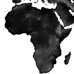
Los datos de elevación digital de Shuttle Radar Topography Mission (SRTM, consulta Farr et al., 2007) son un esfuerzo de investigación internacional que obtuvo modelos de elevación digital a una escala casi global. NASA JPL proporciona este producto SRTM V3 (SRTM Plus) con una resolución de 1 segundo de arco (aproximadamente 30 m).
Este conjunto de datos se sometió a un proceso de relleno de vacíos con datos de código abierto (ASTER GDEM2, GMTED2010 y NED), a diferencia de otras versiones que contienen vacíos o se rellenaron con fuentes comerciales. Para obtener más información sobre las diferentes versiones, consulta la Guía rápida de SRTM.
Documentación:
Bandas
Bandas
Tamaño de los píxeles: 30 metros (todas las bandas)
| Nombre | Unidades | Mín. | Máx. | Tamaño de los píxeles | Descripción |
|---|---|---|---|---|---|
elevation |
m | -10* | 6500* | 30 metros | Elevación |
Condiciones de Uso
Condiciones de Uso
A menos que se indique lo contrario, las imágenes y los videos de los sitios web públicos de JPL (sitios públicos que terminan con una dirección jpl.nasa.gov) se pueden usar para cualquier propósito sin permiso previo. Para obtener más información y excepciones, visita el sitio de la Política de uso de imágenes de JPL.
Citas
Farr, T.G., Rosen, P.A., Caro, E., Crippen, R., Duren, R., Hensley, S., Kobrick, M., Paller, M., Rodriguez, E., Roth, L., Seal, D., Shaffer, S., Shimada, J., Umland, J., Werner, M., Oskin, M., Burbank, D. y Alsdorf, D.E., 2007, The shuttle radar topography mission: Reviews of Geophysics (La misión topográfica Shuttle Radar: reseñas de geofísica), v. 45, n. º 2, RG2004, at https://doi.org/10.1029/2005RG000183.
Explora con Earth Engine
Editor de código (JavaScript)
var dataset = ee.Image('USGS/SRTMGL1_003');
var elevation = dataset.select('elevation');
var slope = ee.Terrain.slope(elevation);
Map.setCenter(-112.8598, 36.2841, 10);
Map.addLayer(slope, {min: 0, max: 60}, 'slope');
import ee
import geemap.core as geemap
Colab (Python)
dataset = ee.Image('USGS/SRTMGL1_003')
elevation = dataset.select('elevation')
slope = ee.Terrain.slope(elevation)

m = geemap.Map()
m.set_center(-112.8598, 36.2841, 10)
m.add_layer(slope, {'min': 0, 'max': 60}, 'slope')
m