NICFI Satellite Data Program Basemaps for Tropical Forest Monitoring - Africa
컬렉션을 사용해 정리하기
내 환경설정을 기준으로 콘텐츠를 저장하고 분류하세요.
설명
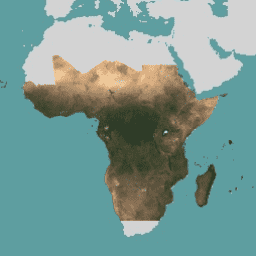
이 이미지 컬렉션은 열대 우림의 손실을 줄이고 되돌리며, 기후 변화에 대처하고, 생물 다양성을 보존하고, 산림 재성장, 복원 및 개선에 기여하고, 지속 가능한 개발을 촉진하는 것을 기본 목적으로 고해상도 위성 열대 지역 모니터링에 대한 액세스를 제공하며, 이 모든 것은 비상업적 용도로 사용해야 합니다.
배경 지도에 액세스하는 방법을 알아보려면 여기에서 가입 안내 를 따르세요.
NICFI 위성 데이터 프로그램 모자이크 (Planet-NICFI 모자이크라고도 함)에는 6개월마다 생성되는 월별 및 반년별 컬렉션이 모두 포함되어 있습니다. 모자이크 유형은 이미지 메타데이터 필드 'cadence'에 저장됩니다. 이 필드를 각 모자이크의 시작일 및 종료일과 함께 사용하여 원하는 이미지를 찾습니다.
기본 지도에 관한 자세한 내용은 NICFI 위성 데이터 프로그램 기본 지도 사양 을 참고하세요.
NICFI (노르웨이 국제 기후 및 산림 이니셔티브) 위성 데이터 프로그램 및 제공되는 데이터에 대한 자세한 내용은 프로그램 웹사이트 를 참고하세요.
NICFI의 미션을 지원하기 위해 이 데이터를 다음과 같은 다양한 프로젝트에 사용할 수 있습니다.
세계 열대 우림과 열대 우림이 제공하는 중요한 서비스에 관한 과학적 연구를 발전시킵니다.
개발 중인 열대림 국가 및 관할 구역에서 지속 가능한 산림 관리 및 토지 이용을 위한 정책을 구현하고 개선합니다.
열대 지역의 투명성과 책임성 강화
열대림 국가의 원주민 및 지역 사회의 권리를 보호하고 개선합니다.
글로벌 상품 및 금융 시장으로 인한 산림에 대한 압력을 줄이기 위한 솔루션을 혁신합니다.
대역
픽셀 크기
4.77미터
대역
이름
최소
최대
확장
픽셀 크기
설명
B
0
10000
0.0001
미터
파란색
G
0
10000
0.0001
미터
초록색
R
0
10000
0.0001
미터
빨간색
N
0
10000
0.0001
미터
근적외선
이미지 속성
이미지 속성
이름
유형
설명
케이던스
문자열
모자이크가 포함하는 간격: 월별 또는 반년별
이용약관
이용약관
이 데이터에는 NICFI 위성 데이터 프로그램의 목적을 지원하기 위한 사용, 복제, 배포 제한사항이 있습니다. 전체 라이선스 계약은 여기 에서 확인할 수 있습니다.
저작권 고지:
이미지 © 20xx Planet Labs PBC (여기서 xx는 사용된 콘텐츠의 연도를 나타냄)
인용
Planet Team (2017). Planet Application Program Interface: In Space for Life
on Earth. San Francisco, CA. https://api.planet.com
Earth Engine으로 탐색하기
중요:
Earth Engine은 공익을 위해 그리고 비즈니스 및 정부 사용자를 위해 페타바이트 규모의 과학적 분석 및 지리 공간 데이터 세트 시각화를 위한 플랫폼입니다.
Earth Engine은 연구, 교육, 비영리 목적으로 무료로 사용할 수 있습니다. 시작하려면 Earth Engine 액세스를 등록 하세요.
코드 편집기(JavaScript)
// This collection is not publicly accessible. To sign up for access,
// please see https://developers.planet.com/docs/integrations/gee/nicfi
var nicfi = ee . ImageCollection ( 'projects/planet-nicfi/assets/basemaps/africa' );
// Filter basemaps by date and get the first image from filtered results
var basemap = nicfi . filter ( ee . Filter . date ( '2021-03-01' , '2021-07-01' )). first ();
Map . centerObject ( basemap , 4 );
var vis = { 'bands' : [ 'R' , 'G' , 'B' ], 'min' : 64 , 'max' : 5454 , 'gamma' : 1.8 };
Map . addLayer ( basemap , vis , '2021-03 mosaic' );
Map . addLayer (
basemap . normalizedDifference ([ 'N' , 'R' ]). rename ( 'NDVI' ),
{ min :- 0.55 , max : 0.8 , palette : [
'8bc4f9' , 'c9995c' , 'c7d270' , '8add60' , '097210'
]}, 'NDVI' , false );
코드 편집기에서 열기
[null,null,[],[[["\u003cp\u003eThis dataset provides high-resolution satellite monitoring of the tropics to reduce and reverse tropical forest loss for non-commercial use.\u003c/p\u003e\n"],["\u003cp\u003eIt includes monthly and biannual mosaics with imagery available from December 2015 to November 2024.\u003c/p\u003e\n"],["\u003cp\u003eAccess requires following specific sign-up instructions, as it's part of the NICFI Satellite Data Program and has usage restrictions.\u003c/p\u003e\n"],["\u003cp\u003eThe data has a spatial resolution of 4.77 meters and includes bands for Blue, Green, Red, and Near-infrared.\u003c/p\u003e\n"],["\u003cp\u003eUse cases include scientific research, policy implementation, transparency initiatives, and indigenous rights protection related to tropical forests.\u003c/p\u003e\n"]]],[],null,["# NICFI Satellite Data Program Basemaps for Tropical Forest Monitoring - Africa\n\ninfo\n\n\nThis dataset is part of a Publisher Catalog, and not managed by Google Earth Engine.\n\nContact support@planet.com\n\nfor bugs or [view more datasets](https://developers.google.com/earth-engine/datasets/publisher/planet-nicfi)\nfrom the Planet Catalog. [Learn more about Publisher datasets](/earth-engine/datasets/publisher). \n[](https://planet.com/nicfi) \n\nCatalog Owner\n: Planet\n\nDataset Availability\n: 2015-12-01T00:00:00Z--2025-07-01T00:00:00Z\n\nDataset Provider\n:\n\n\n [Planet](https://planet.com/nicfi)\n\nTags\n:\n[basemaps](/earth-engine/datasets/tags/basemaps) [forest](/earth-engine/datasets/tags/forest) [nicfi](/earth-engine/datasets/tags/nicfi) [planet](/earth-engine/datasets/tags/planet) [planet-nicfi](/earth-engine/datasets/tags/planet-nicfi) [publisher-dataset](/earth-engine/datasets/tags/publisher-dataset) [satellite-imagery](/earth-engine/datasets/tags/satellite-imagery) [sr](/earth-engine/datasets/tags/sr) [surface-reflectance](/earth-engine/datasets/tags/surface-reflectance) [tropics](/earth-engine/datasets/tags/tropics) \n\n#### Description\n\nThis image collection provides access to high-resolution satellite\nmonitoring of the tropics for the primary purpose of reducing and reversing the\nloss of tropical forests, contributing to combating climate change, conserving\nbiodiversity, contributing to forest regrowth, restoration and enhancement, and\nfacilitating sustainable development, all of which must be Non-Commercial Use.\n\nTo learn how to access the Basemaps, follow the\n[sign up instructions here](https://developers.planet.com/docs/integrations/gee/nicfi/).\n\nThe NICFI Satellite Data Program mosaics (also referred to as Planet-NICFI\nmosaics) contain both monthly and biannual collections generated every\n6 months. The type of the mosaic is stored in the image metadata field\n'cadence'. Use that field along with the start and end date for each mosaic\nto find the desired imagery.\n\nFull details about the Basemaps are available in\n[NICFI Satellite Data Program Basemap spec](https://assets.planet.com/docs/NICFI_Basemap_Spec_Addendum.pdf).\n\nFor more information about the NICFI (Norway's International Climate\nand Forest Initiative) Satellite Data Program and the data offered,\nplease visit\n[the Program's website](https://assets.planet.com/docs/NICFI_General_FAQs.pdf).\n\nIn support of NICFI's mission, you can use this data for a number of projects\nincluding, but not limited to:\n\n- Advance scientific research about the world's tropical forests and the critical services they provide.\n- Implement and improve policies for sustainable forest management and land use in developing tropical forest countries and jurisdictions.\n- Increase transparency and accountability in the tropics.\n- Protect and improve the rights of indigenous peoples and local communities in tropical forest countries.\n- Innovate solutions towards reducing pressure on forests from global commodities and financial markets.\n\n### Bands\n\n\n**Pixel Size**\n\n4.77 meters\n\n**Bands**\n\n| Name | Min | Max | Scale | Pixel Size | Description |\n|------|-----|-------|--------|------------|---------------|\n| `B` | 0 | 10000 | 0.0001 | meters | Blue |\n| `G` | 0 | 10000 | 0.0001 | meters | Green |\n| `R` | 0 | 10000 | 0.0001 | meters | Red |\n| `N` | 0 | 10000 | 0.0001 | meters | Near-infrared |\n\n### Image Properties\n\n**Image Properties**\n\n| Name | Type | Description |\n|---------|--------|-----------------------------------------------------|\n| cadence | STRING | The interval the mosaic covers: monthly or biannual |\n\n### Terms of Use\n\n**Terms of Use**\n\nThis data has usage, reproduction, and distribution restrictions in support\nof the NICFI Satellite Data Program purpose. The full licensing agreement is available\n[here](https://assets.planet.com/docs/Planet_ParticipantLicenseAgreement_NICFI.pdf).\n\nCopyright notice:\n\nImage © 20xx Planet Labs PBC (where xx denotes the year of the content\nused)\n\n### Citations\n\nCitations:\n\n- Planet Team (2017). Planet Application Program Interface: In Space for Life\n on Earth. San Francisco, CA. \u003chttps://api.planet.com\u003e\n\n### Explore with Earth Engine\n\n| **Important:** Earth Engine is a platform for petabyte-scale scientific analysis and visualization of geospatial datasets, both for public benefit and for business and government users. Earth Engine is free to use for research, education, and nonprofit use. To get started, please [register for Earth Engine access.](https://console.cloud.google.com/earth-engine)\n\n### Code Editor (JavaScript)\n\n```javascript\n// This collection is not publicly accessible. To sign up for access,\n// please see https://developers.planet.com/docs/integrations/gee/nicfi\nvar nicfi = ee.ImageCollection('projects/planet-nicfi/assets/basemaps/africa');\n\n// Filter basemaps by date and get the first image from filtered results\nvar basemap= nicfi.filter(ee.Filter.date('2021-03-01','2021-07-01')).first();\n\nMap.centerObject(basemap, 4);\n\nvar vis = {'bands':['R','G','B'],'min':64,'max':5454,'gamma':1.8};\n\nMap.addLayer(basemap, vis, '2021-03 mosaic');\nMap.addLayer(\n basemap.normalizedDifference(['N','R']).rename('NDVI'),\n {min:-0.55,max:0.8,palette: [\n '8bc4f9', 'c9995c', 'c7d270','8add60','097210'\n ]}, 'NDVI', false);\n```\n[Open in Code Editor](https://code.earthengine.google.com/?scriptPath=Examples:Datasets/planet-nicfi/projects_planet-nicfi_assets_basemaps_africa) \n[NICFI Satellite Data Program Basemaps for Tropical Forest Monitoring - Africa](/earth-engine/datasets/catalog/projects_planet-nicfi_assets_basemaps_africa) \nThis image collection provides access to high-resolution satellite monitoring of the tropics for the primary purpose of reducing and reversing the loss of tropical forests, contributing to combating climate change, conserving biodiversity, contributing to forest regrowth, restoration and enhancement, and facilitating sustainable development, all of which must be Non-Commercial Use. ... \nprojects/planet-nicfi/assets/basemaps/africa, basemaps,forest,nicfi,planet,planet-nicfi,publisher-dataset,satellite-imagery,sr,surface-reflectance,tropics \n2015-12-01T00:00:00Z/2025-07-01T00:00:00Z \n-30.4 -25.5 25.6 58 \nGoogle Earth Engine \nhttps://developers.google.com/earth-engine/datasets\n\n- [](https://doi.org/https://planet.com/nicfi)\n- [](https://doi.org/https://developers.google.com/earth-engine/datasets/catalog/projects_planet-nicfi_assets_basemaps_africa)"]]