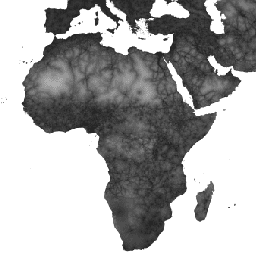
Доступность городов 2015 На этой глобальной карте доступности указано время наземного пути до ближайшего густонаселенного района для всех территорий между 85 градусами северной широты и 60 градусами южной широты в номинальном 2015 году. Густонаселенные районы определяются как прилегающие территории с населением 1500 или более жителей на квадратный километр или … доступность JRC карта Оксфорд население Твенте Доступность здравоохранения 2019 На этой глобальной карте доступности указано время наземного пути (в минутах) до ближайшей больницы или клиники для всех районов между 85 градусами северной широты и 60 градусами южной широты в номинальном 2019 году. Она также включает время в пути «только пешком» с использованием только немоторизованных средств транспорта. Главный … доступность JRC карта Оксфорд население Твенте Глобальная поверхность трения 2019 Эта глобальная поверхность трения определяет скорость движения по суше для всех пикселей суши между 85 градусами северной широты и 60 градусами южной широты для номинального 2019 года. Она также включает скорость движения «только пешком» с использованием только немоторизованных транспортных средств. Эта карта была создана в результате сотрудничества между… доступность JRC карта Оксфорд население Твенте
Datasets tagged accessibility in Earth Engine
[null,null,[],[[["\u003cp\u003eThe datasets provide global accessibility maps detailing travel time to cities, healthcare facilities, and overall land-based travel speed.\u003c/p\u003e\n"],["\u003cp\u003eThese maps cover land areas between 85 degrees north and 60 degrees south for the years 2015 (cities), 2019 (healthcare and travel speed).\u003c/p\u003e\n"],["\u003cp\u003eData includes travel time estimations for both motorized and non-motorized (walking-only) transportation.\u003c/p\u003e\n"],["\u003cp\u003eThe maps were developed through a collaboration between the University of Oxford, Google, the Joint Research Centre of the European Commission, and the University of Twente.\u003c/p\u003e\n"]]],["The data provides global land-based travel information between 85°N and 60°S. It details travel time to the nearest densely populated area (1,500+ inhabitants/km²) for 2015 and to healthcare facilities for 2019. It also includes a 2019 global friction surface map showing travel speed, including non-motorized options. The datasets are products of a collaboration and cover aspects of accessibility to cities, healthcare, and overall travel conditions.\n"],null,["# Datasets tagged accessibility in Earth Engine\n\n-\n\n |---------------------------------------------------------------------------------------------------------------------------------------------------------------------------------------------------------------------------------------------------------------------------------------------------------------|\n | [### Accessibility to Cities 2015](/earth-engine/datasets/catalog/Oxford_MAP_accessibility_to_cities_2015_v1_0) |\n | This global accessibility map enumerates land-based travel time to the nearest densely-populated area for all areas between 85 degrees north and 60 degrees south for a nominal year 2015. Densely-populated areas are defined as contiguous areas with 1,500 or more inhabitants per square kilometer or ... |\n | [accessibility](/earth-engine/datasets/tags/accessibility) [jrc](/earth-engine/datasets/tags/jrc) [map](/earth-engine/datasets/tags/map) [oxford](/earth-engine/datasets/tags/oxford) [population](/earth-engine/datasets/tags/population) [twente](/earth-engine/datasets/tags/twente) |\n\n-\n\n |--------------------------------------------------------------------------------------------------------------------------------------------------------------------------------------------------------------------------------------------------------------------------------------------------------------|\n | [### Accessibility to Healthcare 2019](/earth-engine/datasets/catalog/Oxford_MAP_accessibility_to_healthcare_2019) |\n | This global accessibility map enumerates land-based travel time (in minutes) to the nearest hospital or clinic for all areas between 85 degrees north and 60 degrees south for a nominal year 2019. It also includes \"walking-only\" travel time, using non-motorized means of transportation only. Major ... |\n | [accessibility](/earth-engine/datasets/tags/accessibility) [jrc](/earth-engine/datasets/tags/jrc) [map](/earth-engine/datasets/tags/map) [oxford](/earth-engine/datasets/tags/oxford) [population](/earth-engine/datasets/tags/population) [twente](/earth-engine/datasets/tags/twente) |\n\n-\n\n |----------------------------------------------------------------------------------------------------------------------------------------------------------------------------------------------------------------------------------------------------------------------------------------------------------------------|\n | [### Global Friction Surface 2019](/earth-engine/datasets/catalog/Oxford_MAP_friction_surface_2019) |\n | This global friction surface enumerates land-based travel speed for all land pixels between 85 degrees north and 60 degrees south for a nominal year 2019. It also includes \"walking-only\" travel speed, using non-motorized means of transportation only. This map was produced through a collaboration between ... |\n | [accessibility](/earth-engine/datasets/tags/accessibility) [jrc](/earth-engine/datasets/tags/jrc) [map](/earth-engine/datasets/tags/map) [oxford](/earth-engine/datasets/tags/oxford) [population](/earth-engine/datasets/tags/population) [twente](/earth-engine/datasets/tags/twente) |"]]