-
Luas Mangrove Tahunan Global (1984-2023)

Set data CGMD-Extent30 (Continuous Global Mangrove Dynamics-Annual Mangrove Extent at 30-m resolution) menyediakan luas mangrove tahunan global dari tahun 1984 hingga 2023. Set data ini didistribusikan sebagai satu Earth Engine FeatureCollection, dengan setiap fitur mewakili poligon mangrove yang dipetakan untuk tahun tertentu. Set data … annual coastal forest-biomass global landsat-derived landuse-landcover -
Tutupan Kanopi Fraksional Mangrove Tahunan Global (1984-2023)

Set data ini menyediakan tutupan kanopi fraksional (FCC) mangrove tahunan global dengan resolusi spasial 30 m dari tahun 1984 hingga 2023 untuk mendukung analisis skala besar dinamika mangrove jangka panjang, termasuk degradasi dan pemulihan kanopi, penilaian karbon biru, dan pemantauan ekosistem pesisir. FCC mengukur proporsi setiap Landsat … annual coastal forest-biomass global landsat-derived mangrove -
Distribusi Hutan Mangrove Global, v1 (2000)

Database ini disiapkan menggunakan data satelit Landsat dari tahun 2000. Lebih dari 1.000 scene Landsat yang diperoleh dari USGS Earth Resources Observation and Science Center (EROS) diklasifikasikan menggunakan teknik klasifikasi citra digital hibrida yang diawasi dan tidak diawasi. Database ini adalah yang pertama, paling … annual ciesin forest-biomass global landsat-derived mangrove -
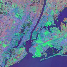
Histori Klasifikasi Air Tahunan JRC, v1.4

Set data ini berisi peta lokasi dan distribusi temporal air permukaan dari tahun 1984 hingga 2021 serta memberikan statistik tentang luas dan perubahan permukaan air tersebut. Untuk mengetahui informasi selengkapnya, lihat artikel jurnal terkait: High-resolution mapping of global surface water and its … annual geophysical google history jrc landsat-derived -
MOD44B.061 Terra Vegetation Continuous Fields Yearly Global 250m

Produk Terra MODIS Vegetation Continuous Fields (VCF) adalah representasi tingkat sub-piksel dari perkiraan tutupan vegetasi permukaan secara global. Dirancang untuk terus merepresentasikan permukaan terestrial Bumi sebagai proporsi sifat vegetasi dasar, produk ini memberikan gradasi tiga komponen tutupan permukaan: persentase tutupan pohon, persentase … annual geophysical global landuse-landcover modis nasa -
Open Buildings Temporal V1

Set Data Temporal Open Buildings 2.5D berisi data tentang keberadaan bangunan, jumlah bangunan fraksional, dan tinggi bangunan dengan resolusi spasial efektif1 sebesar 4 m (raster disediakan dengan resolusi 0,5 m) pada frekuensi tahunan dari tahun 2016-2023. Set data ini dihasilkan dari citra open source beresolusi rendah dari … africa annual asia built-up height open-buildings -
Satellite Embedding V1
Set data Google Satellite Embedding adalah koleksi embedding geospasial yang dipelajari dan siap dianalisis secara global. Setiap piksel 10 meter dalam set data ini adalah representasi 64 dimensi, atau "vektor embedding", yang meng-encode lintasan temporal kondisi permukaan di dan sekitar piksel tersebut seperti yang diukur oleh berbagai pengamatan Bumi … annual global google landsat-derived satellite-imagery sentinel1-derived -
VIIRS Nighttime Day/Night Annual Band Composites V2.1

Set data lampu malam VIIRS global tahunan adalah deret waktu yang dihasilkan dari kisi-kisi radiasi rata-rata bulanan tanpa awan yang mencakup tahun 2013 hingga 2021. Data untuk tahun 2022 tersedia dalam set data NOAA/VIIRS/DNB/ANNUAL_V22. Langkah pemfilteran awal menghapus piksel yang terkena sinar matahari, sinar bulan, dan berawan, sehingga menghasilkan komposit kasar yang … annual dnb eog lights nighttime noaa -
VIIRS Nighttime Day/Night Annual Band Composites V2.2

Set data lampu malam VIIRS global tahunan adalah deret waktu yang dihasilkan dari kisi-kisi radiasi rata-rata bulanan tanpa awan untuk tahun 2022. Data untuk tahun-tahun sebelumnya tersedia dalam set data NOAA/VIIRS/DNB/ANNUAL_V21. Langkah pemfilteran awal menghapus piksel yang terkena sinar matahari, sinar bulan, dan berawan, sehingga menghasilkan komposit kasar yang berisi … annual dnb eog lights nighttime noaa
Datasets tagged annual in Earth Engine
[null,null,[],[],["The datasets provide annual global information on various Earth features. The Open Buildings dataset offers building presence, counts, and heights from 2016-2023. JRC data maps surface water distribution and changes from 1984-2021. Another dataset, based on data from 2000, details mangrove forest distribution. MODIS data provides continuous vegetation cover estimates, including tree cover percentages. Lastly, VIIRS data sets map annual nighttime light composites from 2013-2022, based on cloud-free average radiance grids.\n"]]