-
Peta Tutupan Lahan BNETD 2020 Côte d'Ivoire
Peta Tutupan Lahan BNETD 2020 Côte d'Ivoire dibuat oleh Pemerintah Pantai Gading melalui lembaga nasional, Pusat Informasi Geografis dan Digital dari National Study Office Techniques and Development (BNETD-CIGN), dengan dukungan teknis dan keuangan dari Uni Eropa. Metodologi … classification deforestation forest landcover landuse-landcover -
Klasifikasi Hutan Global 2020 untuk Estimasi Biomassa Permukaan Tanah IPCC Tingkat 1, V1
Set data ini menyediakan kelas hutan global yang dibatasi berdasarkan status/kondisi pada tahun 2020 dengan resolusi sekitar 30 m. Data ini mendukung pembuatan estimasi Tingkat 1 untuk Kepadatan Biomassa Kayu Kering di Atas Permukaan Tanah (AGBD) di hutan alami dalam Penyempurnaan 2019 terhadap Panduan IPCC 2006 untuk Gas Rumah Kaca Nasional … biomassa di atas tanah karbon klasifikasi hutan biomassa hutan -
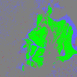
Peta Hutan/Non-Hutan PALSAR-2/PALSAR Global 3-class
Versi yang lebih baru dari set data ini dengan 4 kelas untuk tahun 2017-2020 dapat ditemukan di JAXA/ALOS/PALSAR/YEARLY/FNF4 Peta hutan/non-hutan global (FNF) dibuat dengan mengklasifikasikan gambar SAR (koefisien pemantulan balik) dalam mosaik SAR PALSAR-2/PALSAR resolusi global 25 m sehingga piksel pemantulan balik yang kuat dan rendah … alos alos2 classification eroc forest forest-biomass -
Peta Hutan/Non-Hutan PALSAR-2/PALSAR Global 4-class
Peta hutan/non-hutan global (FNF) dibuat dengan mengklasifikasikan citra SAR (koefisien pantulan balik) dalam mosaik SAR PALSAR-2/PALSAR beresolusi 25 m global sehingga piksel pantulan balik yang kuat dan rendah ditetapkan sebagai "hutan" dan "non-hutan". Di sini, "hutan" didefinisikan sebagai hutan alami dengan … alos alos2 classification eroc forest forest-biomass
Datasets tagged classification in Earth Engine
[null,null,[],[[["\u003cp\u003eThe webpage provides access to various global and regional forest classification datasets.\u003c/p\u003e\n"],["\u003cp\u003eDatasets include land cover maps, forest/non-forest classifications, and biomass estimations.\u003c/p\u003e\n"],["\u003cp\u003eData sources include satellite imagery from PALSAR-2/PALSAR and organizations like BNETD and NASA.\u003c/p\u003e\n"],["\u003cp\u003eThese datasets support research on deforestation, forest monitoring, and carbon stock assessments.\u003c/p\u003e\n"],["\u003cp\u003eUsers can leverage these resources to analyze forest cover change and contribute to environmental studies.\u003c/p\u003e\n"]]],[],null,["# Datasets tagged classification in Earth Engine\n\n-\n\n |--------------------------------------------------------------------------------------------------------------------------------------------------------------------------------------------------------------------------------------------------------------------------------------------------------------------------------|\n | [### Cote d'Ivoire BNETD 2020 Land Cover Map](/earth-engine/datasets/catalog/BNETD_land_cover_v1) |\n | The Cote d'Ivoire BNETD 2020 Land Cover Map was produced by the Ivorian Government through a national institution, the Center for Geographic Information and Digital from the National Study Office Techniques and Development (BNETD-CIGN), with technical and financial support from the European Union. The methodology ... |\n | [classification](/earth-engine/datasets/tags/classification) [deforestation](/earth-engine/datasets/tags/deforestation) [forest](/earth-engine/datasets/tags/forest) [landcover](/earth-engine/datasets/tags/landcover) [landuse-landcover](/earth-engine/datasets/tags/landuse-landcover) |\n\n-\n\n |---------------------------------------------------------------------------------------------------------------------------------------------------------------------------------------------------------------------------------------------------------------------------------------------------------------------------|\n | [### Global 2020 Forest Classification for IPCC Aboveground Biomass Tier 1 Estimates, V1](/earth-engine/datasets/catalog/NASA_ORNL_global_forest_classification_2020_V1) |\n | This dataset provides classes of global forests delineated by status/condition in 2020 at approximately 30m resolution. The data support generating Tier 1 estimates for Aboveground dry woody Biomass Density (AGBD) in natural forests in the 2019 Refinement to the 2006 IPCC Guidelines for National Greenhouse ... |\n | [aboveground](/earth-engine/datasets/tags/aboveground) [biomass](/earth-engine/datasets/tags/biomass) [carbon](/earth-engine/datasets/tags/carbon) [classification](/earth-engine/datasets/tags/classification) [forest](/earth-engine/datasets/tags/forest) [forest-biomass](/earth-engine/datasets/tags/forest-biomass) |\n\n-\n\n |-------------------------------------------------------------------------------------------------------------------------------------------------------------------------------------------------------------------------------------------------------------------------------------------------------------------------------|\n | [### Global 3-class PALSAR-2/PALSAR Forest/Non-Forest Map](/earth-engine/datasets/catalog/JAXA_ALOS_PALSAR_YEARLY_FNF) |\n | A newer version of this dataset with 4 classes for 2017-2020 can be found in JAXA/ALOS/PALSAR/YEARLY/FNF4 The global forest/non-forest map (FNF) is generated by classifying the SAR image (backscattering coefficient) in the global 25m resolution PALSAR-2/PALSAR SAR mosaic so that strong and low backscatter pixels ... |\n | [alos](/earth-engine/datasets/tags/alos) [alos2](/earth-engine/datasets/tags/alos2) [classification](/earth-engine/datasets/tags/classification) [eroc](/earth-engine/datasets/tags/eroc) [forest](/earth-engine/datasets/tags/forest) [forest-biomass](/earth-engine/datasets/tags/forest-biomass) |\n\n-\n\n |-----------------------------------------------------------------------------------------------------------------------------------------------------------------------------------------------------------------------------------------------------------------------------------------------------------------------------------|\n | [### Global 4-class PALSAR-2/PALSAR Forest/Non-Forest Map](/earth-engine/datasets/catalog/JAXA_ALOS_PALSAR_YEARLY_FNF4) |\n | The global forest/non-forest map (FNF) is generated by classifying the SAR image (backscattering coefficient) in the global 25m resolution PALSAR-2/PALSAR SAR mosaic so that strong and low backscatter pixels are assigned as \"forest\" and \"non-forest\", respectively. Here, \"forest\" is defined as the natural forest with ... |\n | [alos](/earth-engine/datasets/tags/alos) [alos2](/earth-engine/datasets/tags/alos2) [classification](/earth-engine/datasets/tags/classification) [eroc](/earth-engine/datasets/tags/eroc) [forest](/earth-engine/datasets/tags/forest) [forest-biomass](/earth-engine/datasets/tags/forest-biomass) |"]]