-
Klasifikasi Hutan Global 2020 untuk Estimasi Biomassa Permukaan Tanah IPCC Tingkat 1, V1
Set data ini menyediakan kelas hutan global yang dibatasi berdasarkan status/kondisi pada tahun 2020 dengan resolusi sekitar 30 m. Data ini mendukung pembuatan estimasi Tingkat 1 untuk Kepadatan Biomassa Kayu Kering di Atas Permukaan Tanah (AGBD) di hutan alami dalam Penyempurnaan 2019 terhadap Panduan IPCC 2006 untuk Gas Rumah Kaca Nasional … biomassa di atas tanah karbon klasifikasi hutan biomassa hutan -
Peta Kepadatan Karbon Biomassa Permukaan dan Bawah Tanah Global
Set data ini menyediakan peta global yang konsisten secara temporal dan harmonis tentang kepadatan karbon biomassa di atas tanah dan di bawah tanah untuk tahun 2010 pada resolusi spasial 300 m. Peta biomassa di atas tanah mengintegrasikan peta biomassa kayu, padang rumput, lahan pertanian, dan tundra yang diukur dari jarak jauh dan khusus untuk tutupan lahan. Peta input … biomassa di atas tanah karbon kepadatan hutan biomassa hutan -
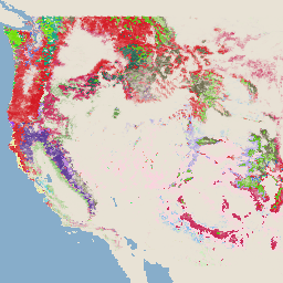
Set Data Stok Karbon Tingkat Nasional Pantropis WHRC
Peta tingkat nasional tentang kepadatan biomassa berkayu hidup di atas tanah untuk negara-negara tropis pada ketinggian 500 m. Set data ini disusun dari kombinasi pengukuran lapangan yang berlokasi sama, pengamatan LiDAR, dan gambar yang direkam dari Moderate Resolution Imaging Spectroradiometer (MODIS). biomassa di atas tanah karbon biomassa hutan geophysical umd
Datasets tagged aboveground in Earth Engine
[null,null,[],[[["\u003cp\u003eThese datasets offer global and pantropical maps of biomass carbon density, primarily focusing on aboveground biomass.\u003c/p\u003e\n"],["\u003cp\u003eThey utilize a variety of data sources, including remotely sensed imagery, field measurements, and LiDAR observations, to provide estimates at various spatial resolutions (30m, 300m, 500m).\u003c/p\u003e\n"],["\u003cp\u003eOne dataset specifically supports the IPCC's aboveground biomass estimation methodology for national greenhouse gas inventories.\u003c/p\u003e\n"],["\u003cp\u003eThe datasets cover different time periods, including a temporally consistent view for 2010 and forest classifications for 2020.\u003c/p\u003e\n"]]],[],null,["# Datasets tagged aboveground in Earth Engine\n\n-\n\n |---------------------------------------------------------------------------------------------------------------------------------------------------------------------------------------------------------------------------------------------------------------------------------------------------------------------------|\n | [### Global 2020 Forest Classification for IPCC Aboveground Biomass Tier 1 Estimates, V1](/earth-engine/datasets/catalog/NASA_ORNL_global_forest_classification_2020_V1) |\n | This dataset provides classes of global forests delineated by status/condition in 2020 at approximately 30m resolution. The data support generating Tier 1 estimates for Aboveground dry woody Biomass Density (AGBD) in natural forests in the 2019 Refinement to the 2006 IPCC Guidelines for National Greenhouse ... |\n | [aboveground](/earth-engine/datasets/tags/aboveground) [biomass](/earth-engine/datasets/tags/biomass) [carbon](/earth-engine/datasets/tags/carbon) [classification](/earth-engine/datasets/tags/classification) [forest](/earth-engine/datasets/tags/forest) [forest-biomass](/earth-engine/datasets/tags/forest-biomass) |\n\n-\n\n |---------------------------------------------------------------------------------------------------------------------------------------------------------------------------------------------------------------------------------------------------------------------------------------------------------------------------------------|\n | [### Global Aboveground and Belowground Biomass Carbon Density Maps](/earth-engine/datasets/catalog/NASA_ORNL_biomass_carbon_density_v1) |\n | This dataset provides temporally consistent and harmonized global maps of aboveground and belowground biomass carbon density for the year 2010 at a 300-m spatial resolution. The aboveground biomass map integrates land-cover specific, remotely sensed maps of woody, grassland, cropland, and tundra biomass. Input maps were ... |\n | [aboveground](/earth-engine/datasets/tags/aboveground) [biomass](/earth-engine/datasets/tags/biomass) [carbon](/earth-engine/datasets/tags/carbon) [density](/earth-engine/datasets/tags/density) [forest](/earth-engine/datasets/tags/forest) [forest-biomass](/earth-engine/datasets/tags/forest-biomass) |\n\n-\n\n |---------------------------------------------------------------------------------------------------------------------------------------------------------------------------------------------------------------------------------------------------------------------------------------------------------|\n | [### USFS TreeMap v2020](/earth-engine/datasets/catalog/USFS_GTAC_TreeMap_v2020) |\n | This product is part of the TreeMap data suite. It provides detailed spatial information on forest characteristics including number of live and dead trees, biomass, and carbon across the entire forested extent of the United States in 2020. TreeMap v2020 contains 22-band 30 x 30m ... |\n | [aboveground](/earth-engine/datasets/tags/aboveground) [biomass](/earth-engine/datasets/tags/biomass) [carbon](/earth-engine/datasets/tags/carbon) [climate-change](/earth-engine/datasets/tags/climate-change) [conus](/earth-engine/datasets/tags/conus) [forest](/earth-engine/datasets/tags/forest) |\n\n-\n\n |---------------------------------------------------------------------------------------------------------------------------------------------------------------------------------------------------------------------------------------------------------------------------------------------------------|\n | [### USFS TreeMap v2022](/earth-engine/datasets/catalog/USFS_GTAC_TreeMap_v2022) |\n | This product is part of the TreeMap data suite. It provides detailed spatial information on forest characteristics including number of live and dead trees, biomass, and carbon across the entire forested extent of the United States in 2022. TreeMap v2022 contains 22-band 30 x 30m ... |\n | [aboveground](/earth-engine/datasets/tags/aboveground) [biomass](/earth-engine/datasets/tags/biomass) [carbon](/earth-engine/datasets/tags/carbon) [climate-change](/earth-engine/datasets/tags/climate-change) [conus](/earth-engine/datasets/tags/conus) [forest](/earth-engine/datasets/tags/forest) |\n\n-\n\n |---------------------------------------------------------------------------------------------------------------------------------------------------------------------------------------------------------------------------------------------------------------------------------------------------------------|\n | [### WHRC Pantropical National Level Carbon Stock Dataset](/earth-engine/datasets/catalog/WHRC_biomass_tropical) |\n | A national-level map of above-ground live woody biomass density for tropical countries at 500m. This dataset was assembled from a combination of co-located field measurements, LiDAR observations, and imagery recorded from the Moderate Resolution Imaging Spectroradiometer (MODIS). |\n | [aboveground](/earth-engine/datasets/tags/aboveground) [biomass](/earth-engine/datasets/tags/biomass) [carbon](/earth-engine/datasets/tags/carbon) [forest-biomass](/earth-engine/datasets/tags/forest-biomass) [geophysical](/earth-engine/datasets/tags/geophysical) [umd](/earth-engine/datasets/tags/umd) |"]]