-
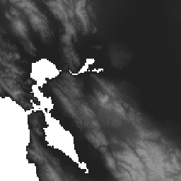
WWF HydroSHEDS 水文条件付き DEM、15 秒
HydroSHEDS は、地域規模および世界規模のアプリケーション向けに、水文情報を一貫した形式で提供するマッピング プロダクトです。河川網、分水界、排水方向、流量の累積など、さまざまなスケールの地理参照データセット(ベクトルとラスター)のスイートを提供します。HydroSHEDS は、 conditioned dem elevation geophysical hydrography hydrology -
WWF HydroSHEDS 水文条件付き DEM、3 アーク秒
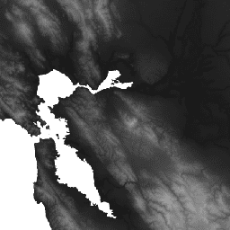
HydroSHEDS は、地域規模および世界規模のアプリケーション向けに、水文情報を一貫した形式で提供するマッピング プロダクトです。河川網、分水界、排水方向、流量の累積など、さまざまなスケールの地理参照データセット(ベクトルとラスター)のスイートを提供します。HydroSHEDS は、 conditioned dem elevation geophysical hydrography hydrology -
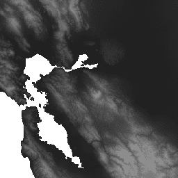
WWF HydroSHEDS 水文条件付き DEM、30 アーク秒
HydroSHEDS は、地域規模および世界規模のアプリケーション向けに、水文情報を一貫した形式で提供するマッピング プロダクトです。河川網、分水界、排水方向、流量の累積など、さまざまなスケールの地理参照データセット(ベクトルとラスター)のスイートを提供します。HydroSHEDS は、 conditioned dem elevation geophysical hydrography hydrology
Datasets tagged conditioned in Earth Engine
[null,null,[],[],[]]