-
전 세계 지상 및 지하 바이오매스 탄소 밀도 지도
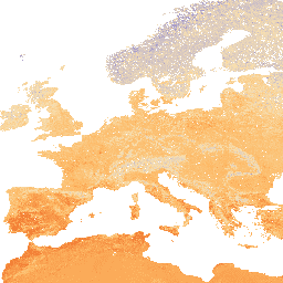
이 데이터 세트는 2010년의 지상 및 지하 바이오매스 탄소 밀도의 시간적 일관성과 조화를 이루는 전 세계 지도를 300m 공간 해상도로 제공합니다. 지상 바이오매스 지도에는 나무, 초원, 농경지, 툰드라 바이오매스의 지형지물별 원격 감지 지도와 통합된 바이오매스 정보가 표시됩니다. 입력 맵은 다음과 같습니다. 지상 바이오매스 탄소 밀도 숲 forest-biomass -
OpenLandMap 토양 부피 밀도
250m 해상도에서 6개의 표준 깊이 (0, 10, 30, 60, 100, 200cm)에서 토양 부피 밀도 (미세 토양) 10xkg / m3 처리 단계는 여기에서 자세히 설명합니다. 남극은 포함되지 않습니다. 지구 외부의 지도에 액세스하고 시각화하려면 다음 단계를 따르세요. density envirometrix opengeohub openlandmap soil
Datasets tagged density in Earth Engine
[null,null,[],[[["\u003cp\u003eThe NASA/ORNL dataset provides global maps of aboveground and belowground biomass carbon density for 2010 at a 300-meter resolution, integrating various land-cover specific biomass data.\u003c/p\u003e\n"],["\u003cp\u003eThe OpenLandMap dataset offers soil bulk density data for six standard depths (0-200 cm) at a 250-meter resolution, excluding Antarctica.\u003c/p\u003e\n"]]],[],null,["# Datasets tagged density in Earth Engine\n\n-\n\n |---------------------------------------------------------------------------------------------------------------------------------------------------------------------------------------------------------------------------------------------------------------------------------------------------------------------------------------|\n | [### Global Aboveground and Belowground Biomass Carbon Density Maps](/earth-engine/datasets/catalog/NASA_ORNL_biomass_carbon_density_v1) |\n | This dataset provides temporally consistent and harmonized global maps of aboveground and belowground biomass carbon density for the year 2010 at a 300-m spatial resolution. The aboveground biomass map integrates land-cover specific, remotely sensed maps of woody, grassland, cropland, and tundra biomass. Input maps were ... |\n | [aboveground](/earth-engine/datasets/tags/aboveground) [biomass](/earth-engine/datasets/tags/biomass) [carbon](/earth-engine/datasets/tags/carbon) [density](/earth-engine/datasets/tags/density) [forest](/earth-engine/datasets/tags/forest) [forest-biomass](/earth-engine/datasets/tags/forest-biomass) |\n\n-\n\n |--------------------------------------------------------------------------------------------------------------------------------------------------------------------------------------------------------------------------------------------------------------|\n | [### OpenLandMap Soil Bulk Density](/earth-engine/datasets/catalog/OpenLandMap_SOL_SOL_BULKDENS-FINEEARTH_USDA-4A1H_M_v02) |\n | Soil bulk density (fine earth) 10 x kg / m3 at 6 standard depths (0, 10, 30, 60, 100 and 200 cm) at 250 m resolution. Processing steps are described in detail here. Antarctica is not included. To access and visualize maps outside of Earth ... |\n | [density](/earth-engine/datasets/tags/density) [envirometrix](/earth-engine/datasets/tags/envirometrix) [opengeohub](/earth-engine/datasets/tags/opengeohub) [openlandmap](/earth-engine/datasets/tags/openlandmap) [soil](/earth-engine/datasets/tags/soil) |"]]