Page Summary
-
The Monitoring Trends in Burn Severity (MTBS) provides data on burned area boundaries and burn severity images for fires across the United States and Puerto Rico.
-
Burned area boundaries define the spatial extent of fires.
-
Burn severity images classify the impact of fires on the landscape and are compiled annually by state.
-
MTBS Burned Area Boundaries
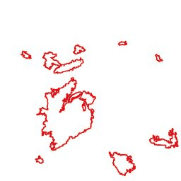
The Monitoring Trends in Burn Severity (MTBS) burned area boundaries dataset contains the extent polygons of the burned areas of all currently completed MTBS fires for the continental United States, Alaska, Hawaii, and Puerto Rico. Below NBR stands for "Normalized Burn Ratio", while dNBR stands … eros fire gtac mtbs table usda -
Monitoring Trends in Burn Severity (MTBS) Burn Severity Images
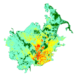
The burn severity mosaics consist of thematic raster images of MTBS burn severity classes for all currently completed MTBS fires for the continental United States, Alaska, Hawaii and Puerto Rico. Mosaicked burn severity images are compiled annually for each year by US State and the … eros fire forest gtac landcover landsat-derived