-
FIRMS:资源管理系统火灾信息

资源管理系统火灾信息 (FIRMS) 数据集的 Earth Engine 版本包含光栅化的 LANCE 火灾检测产品。LANCE 使用标准 MODIS MOD14/MYD14 火点和热异常产品处理近乎实时 (NRT) 的火点位置。每… eosdis 火灾 firms 地球物理 热点 lance -
FORMA 提醒阈值

WRI 的注意事项:WRI 决定停止更新 FORMA 提醒。目标是简化 Global Forest Watch 用户体验并减少冗余。我们发现,Terra-i 和 GLAD 的使用频率更高。此外,使用 GLAD 作为标准,发现 Terra-i 的性能优于 FORMA… 每日 森林砍伐 火灾 森林 FORMA gfw -
FORMA 提醒

WRI 的注意事项:WRI 决定停止更新 FORMA 提醒。目标是简化 Global Forest Watch 用户体验并减少冗余。我们发现,Terra-i 和 GLAD 的使用频率更高。此外,使用 GLAD 作为标准,发现 Terra-i 的性能优于 FORMA… 每日 森林砍伐 火灾 森林 FORMA gfw -
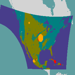
FORMA 原始输出 FIRMS

WRI 的注意事项:WRI 决定停止更新 FORMA 提醒。目标是简化 Global Forest Watch 用户体验并减少冗余。我们发现,Terra-i 和 GLAD 的使用频率更高。此外,使用 GLAD 作为标准,发现 Terra-i 的性能优于 FORMA… 每日 森林砍伐 火灾 森林 FORMA gfw -
FireCCI51:MODIS Fire_cci 烧毁面积像素产品,版本 5.1

MODIS Fire_cci 烧毁面积像素产品版本 5.1 (FireCCI51) 是一个每月更新的全球数据集,空间分辨率约为 250 米,其中包含烧毁面积信息以及辅助数据。该指数基于 MODIS 仪器在近红外 (NIR) 波段的地表反射率计算得出,… burn cci climate-change copernicus esa fire -
GOES-16 FDCC 系列 ABI 2 级火点/热点特征 CONUS

Fire (HSC) 产品包含四张影像:一张是火点掩膜,另外三张的像素值分别表示火点温度、火点面积和火点辐射功率。ABI L2+ FHS 元数据掩模会为每个经过地球导航定位的像素分配一个标志,用于… abi fdc fire goes goes-16 goes-east -
GOES-16 FDCF 系列 ABI 2 级火点/热点特征全圆盘

Fire (HSC) 产品包含四张影像:一张是火点掩膜,另外三张的像素值分别表示火点温度、火点面积和火点辐射功率。ABI L2+ FHS 元数据掩模会为每个经过地球导航定位的像素分配一个标志,用于… abi fdc fire goes goes-16 goes-east -
GOES-17 FDCC 系列 ABI 2 级火点/热点特征 CONUS

Fire (HSC) 产品包含四张影像:一张是火点掩膜,另外三张的像素值分别表示火点温度、火点面积和火点辐射功率。ABI L2+ FHS 元数据掩模会为每个经过地球导航定位的像素分配一个标志,用于… abi fdc fire goes goes-17 goes-s -
GOES-17 FDCF 系列 ABI 2 级火点/热点特征全圆盘

Fire (HSC) 产品包含四张影像:一张是火点掩膜,另外三张的像素值分别表示火点温度、火点面积和火点辐射功率。ABI L2+ FHS 元数据掩模会为每个经过地球导航定位的像素分配一个标志,用于… abi fdc fire goes goes-17 goes-s -
GOES-18 FDCC 系列 ABI 2 级火点/热点特征 CONUS

Fire (HSC) 产品包含四张影像:一张是火点掩膜,另外三张的像素值分别表示火点温度、火点面积和火点辐射功率。ABI L2+ FHS 元数据掩模会为每个经过地球导航定位的像素分配一个标志,用于… abi fdc fire goes goes-18 goes-t -
GOES-18 FDCF 系列 ABI 2 级火点/热点特征全圆盘

Fire (HSC) 产品包含四张影像:一张是火点掩膜,另外三张的像素值分别表示火点温度、火点面积和火点辐射功率。ABI L2+ FHS 元数据掩模会为每个经过地球导航定位的像素分配一个标志,用于… abi fdc fire goes goes-18 goes-t -
GOES-19 FDCC 系列 ABI 2 级火点/热点特征 CONUS
GOES 卫星是由 NOAA 运行的地球同步气象卫星。Fire (HSC) 产品包含四张影像:一张是火点掩膜,另外三张的像素值分别表示火点温度、火点面积和火点辐射功率。ABI L2+ FHS 元数据… abi fdc fire goes goes-19 goes-east -
GOES-19 FDCF 系列 ABI 2 级火点/热点特征全圆盘

Fire (HSC) 产品包含四张影像:一张是火点掩膜,另外三张的像素值分别表示火点温度、火点面积和火点辐射功率。ABI L2+ FHS 元数据掩模会为每个经过地球导航定位的像素分配一个标志,用于… abi fdc fire goes goes-19 goes-east -
基于 MCD64A1 的 GlobFire 每日火灾事件检测

基于 MODIS 数据集 MCD64A1 的火灾边界。这些数据是根据一种算法计算得出的,该算法依赖于在图结构中对烧毁区域的斑块之间的时空关系进行编码。每起火灾都有一个唯一编号来标识相应事件。 area burnt disaster fire globfire mcd64a1 -
基于 MCD64A1 的 GlobFire 最终火灾事件检测

基于 MODIS 数据集 MCD64A1 的火灾边界。这些数据是根据一种算法计算得出的,该算法依赖于在图结构中对烧毁区域的斑块之间的时空关系进行编码。每起火灾都有一个唯一编号来标识相应事件。 area burnt disaster fire globfire mcd64a1 -
KBDI:Keetch-Byram 干旱指数

Keetch-Byram 干旱指数 (KBDI) 是一种用于估计土壤和腐殖质层干燥程度的连续参考尺度。每逢无雨天,该指数都会增加(增加幅度取决于当天的最高气温);下雨时,该指数会下降。此系统… 干旱 火灾 降雨 -
LANDFIRE BPS(生物物理设置)v1.4.0

LANDFIRE (LF) 的全称为“景观火灾与资源管理规划工具”。该项目由美国农业部林务局、内政部地质调查局以及大自然保护协会共同主导,是各机构野火管理计划的合作共享项目。LANDFIRE (LF) 图层是使用预测性… doi 火灾 森林生物质 土地火灾 自然保护 usda -
LANDFIRE ESP AK(环境立地潜力)v1.2.0

LANDFIRE (LF) 的全称为“景观火灾与资源管理规划工具”。该项目由美国农业部林务局、内政部地质调查局以及大自然保护协会共同主导,是各机构野火管理计划的合作共享项目。LANDFIRE (LF) 图层是使用预测性… doi 火灾 森林生物质 土地火灾 自然保护 usda -
LANDFIRE ESP CONUS(环境立地潜力)v1.2.0

LANDFIRE (LF) 的全称为“景观火灾与资源管理规划工具”。该项目由美国农业部林务局、内政部地质调查局以及大自然保护协会共同主导,是各机构野火管理计划的合作共享项目。LANDFIRE (LF) 图层是使用预测性… doi 火灾 森林生物质 土地火灾 自然保护 usda -
LANDFIRE ESP HI(环境立地潜力)v1.2.0

LANDFIRE (LF) 的全称为“景观火灾与资源管理规划工具”。该项目由美国农业部林务局、内政部地质调查局以及大自然保护协会共同主导,是各机构野火管理计划的合作共享项目。LANDFIRE (LF) 图层是使用预测性… doi 火灾 森林生物质 土地火灾 自然保护 usda -
LANDFIRE EVC(现有植被覆盖)v1.4.0

LANDFIRE (LF) 的全称为“景观火灾与资源管理规划工具”。该项目由美国农业部林务局、内政部地质调查局以及大自然保护协会共同主导,是各机构野火管理计划的合作共享项目。LANDFIRE (LF) 图层是使用预测性… doi 火灾 森林生物质 土地火灾 自然保护 usda -
LANDFIRE EVH(现有植被高度)v1.4.0

LANDFIRE (LF) 的全称为“景观火灾与资源管理规划工具”。该项目由美国农业部林务局、内政部地质调查局以及大自然保护协会共同主导,是各机构野火管理计划的合作共享项目。LANDFIRE (LF) 图层是使用预测性… doi 火灾 森林生物质 土地火灾 自然保护 usda -
LANDFIRE EVT(现有植被类型)v1.4.0

LANDFIRE (LF) 的全称为“景观火灾与资源管理规划工具”。该项目由美国农业部林务局、内政部地质调查局以及大自然保护协会共同主导,是各机构野火管理计划的合作共享项目。LANDFIRE (LF) 图层是使用预测性… doi 火灾 森林生物质 土地火灾 自然保护 usda -
LANDFIRE FRG(火灾频度组)v1.2.0

LANDFIRE (LF) 的全称为“景观火灾与资源管理规划工具”。该项目由美国农业部林务局、内政部地质调查局以及大自然保护协会共同主导,是各机构野火管理计划的合作共享项目。Landfire (LF) 历史火灾模式、间隔期及… doi 火灾 土地火灾 自然保护 usda usgs -
LANDFIRE MFRI(平均火灾重现间隔)v1.2.0

LANDFIRE (LF) 的全称为“景观火灾与资源管理规划工具”。该项目由美国农业部林务局、内政部地质调查局以及大自然保护协会共同主导,是各机构野火管理计划的合作共享项目。Landfire (LF) 历史火灾模式、间隔期及… doi 火灾 土地火灾 自然保护 usda usgs -
LANDFIRE PLS(低强度火燃烧比例)v1.2.0

LANDFIRE (LF) 的全称为“景观火灾与资源管理规划工具”。该项目由美国农业部林务局、内政部地质调查局以及大自然保护协会共同主导,是各机构野火管理计划的合作共享项目。Landfire (LF) 历史火灾模式、间隔期及… doi 火灾 土地火灾 自然保护 usda usgs -
LANDFIRE PMS(混合强度火燃烧比例)v1.2.0

LANDFIRE (LF) 的全称为“景观火灾与资源管理规划工具”。该项目由美国农业部林务局、内政部地质调查局以及大自然保护协会共同主导,是各机构野火管理计划的合作共享项目。Landfire (LF) 历史火灾模式、间隔期及… doi 火灾 土地火灾 自然保护 usda usgs -
LANDFIRE PRS(更替性火燃烧比例)v1.2.0

LANDFIRE (LF) 的全称为“景观火灾与资源管理规划工具”。该项目由美国农业部林务局、内政部地质调查局以及大自然保护协会共同主导,是各机构野火管理计划的合作共享项目。Landfire (LF) 历史火灾模式、间隔期及… doi 火灾 土地火灾 自然保护 usda usgs -
LANDFIRE SClass(演替类)v1.4.0

LANDFIRE (LF) 的全称为“景观火灾与资源管理规划工具”。该项目由美国农业部林务局、内政部地质调查局以及大自然保护协会共同主导,是各机构野火管理计划的合作共享项目。Landfire (LF) 历史火灾模式、间隔期及… doi 火灾 土地火灾 自然保护 usda usgs -
LANDFIRE VCC(植被状况等级)v1.4.0

LANDFIRE (LF) 的全称为“景观火灾与资源管理规划工具”。该项目由美国农业部林务局、内政部地质调查局以及大自然保护协会共同主导,是各机构野火管理计划的合作共享项目。Landfire (LF) 历史火灾模式、间隔期及… doi 火灾 土地火灾 自然保护 usda usgs -
LANDFIRE VDep(植被偏离度)v1.4.0

LANDFIRE (LF) 的全称为“景观火灾与资源管理规划工具”。该项目由美国农业部林务局、内政部地质调查局以及大自然保护协会共同主导,是各机构野火管理计划的合作共享项目。Landfire (LF) 历史火灾模式、间隔期及… doi 火灾 土地火灾 自然保护 usda usgs -
Landsat Collection 2 Tier 1 Level 2 32 天 BAI 合成影像

这些 Landsat Collection 2 Tier 1 Level 2 合成影像由 Tier 1 Level 2 正射校正后的场景制成。火烧面积指数 (BAI) 是根据红波段和近红外波段生成的,用于衡量每个像素与参考光谱点(… bai 火灾 陆地卫星 陆地卫星合成 usgs 植被指数 -
Landsat Collection 2 Tier 1 Level 2 32 天 NBR 合成影像
这些 Landsat Collection 2 Tier 1 Level 2 合成影像由 Tier 1 Level 2 正射校正后的场景制成。归一化烧毁比率热指数 (NBRT) 由近红外、中红外 (2215 nm) 和热波段生成,范围为 -1.0 到 1.0。请参阅… 火灾 陆地卫星 陆地卫星合成 nbrt usgs 植被指数 -
Landsat Collection 2 Tier 1 Level 2 8 天 BAI 复合影像

这些 Landsat Collection 2 Tier 1 Level 2 合成影像由 Tier 1 Level 2 正射校正后的场景制成。火烧面积指数 (BAI) 是根据红波段和近红外波段生成的,用于衡量每个像素与参考光谱点(… bai 火灾 陆地卫星 陆地卫星合成 usgs 植被指数 -
Landsat Collection 2 Tier 1 Level 2 8 天 NBR 复合影像

这些 Landsat Collection 2 Tier 1 Level 2 合成影像由 Tier 1 Level 2 正射校正后的场景制成。归一化烧毁比率热指数 (NBRT) 由近红外、中红外 (2215 nm) 和热波段生成,范围为 -1.0 到 1.0。请参阅… 火灾 陆地卫星 陆地卫星合成 nbrt usgs 植被指数 -
Landsat Collection 2 Tier 1 Level 2 年度 BAI 合成影像

这些 Landsat Collection 2 Tier 1 Level 2 合成影像由 Tier 1 Level 2 正射校正后的场景制成。火烧面积指数 (BAI) 是根据红波段和近红外波段生成的,用于衡量每个像素与参考光谱点(… bai 火灾 陆地卫星 陆地卫星合成 usgs 植被指数 -
Landsat Collection 2 Tier 1 Level 2 年度 NBR 合成影像

这些 Landsat Collection 2 Tier 1 Level 2 合成影像由 Tier 1 Level 2 正射校正后的场景制成。归一化烧毁比率热指数 (NBRT) 由近红外、中红外 (2215 nm) 和热波段生成,范围为 -1.0 到 1.0。请参阅… 火灾 陆地卫星 陆地卫星合成 nbrt usgs 植被指数 -
MCD64A1.061 MODIS 烧毁区域月度全球 500 米

Terra 和 Aqua 组合的 MCD64A1 版本 6.1 烧毁面积数据产品是一种每月更新的全球网格化 500 米产品,包含每个像素的烧毁面积和质量信息。MCD64A1 烧毁区域测绘方法采用 500 米 MODIS 地表反射率影像,并结合 1 公里 MODIS 火点观测数据。该算法… burn change-detection fire geophysical global mcd64a1 -
MOD14A1.061:Terra 热异常和火灾每日全球 1 公里

MOD14A1 V6.1 数据集提供每日 1 公里分辨率的火灾掩膜合成数据,这些数据源自 MODIS 4 微米和 11 微米辐射亮度。火灾检测策略基于对火灾的绝对检测(当火势足以检测到时)以及相对于…的检测。 daily fire global modis nasa terra -
MOD14A2.061:Terra 热异常与火灾 8 天全球 1 公里

MOD14A2 V6.1 数据集以 1 公里分辨率提供 8 天的火灾掩膜合成数据。它包含合成期内各个像素类的最大值。除了火点掩模之外,系统还会提供相关联的质量信息层。文档:用户指南 - 算法理论基础… 8 天 火灾 全球 modis nasa terra -
MTBS 过火面积边界

“燃烧严重程度监测趋势”(MTBS) 烧毁区域边界数据集包含美国本土、阿拉斯加、夏威夷和波多黎各所有当前已完成的 MTBS 火灾的烧毁区域范围多边形。NBR 下方是“归一化燃烧比”,而 dNBR 是指… eros fire gtac mtbs table usda -
MYD14A1.061:Aqua 热异常和火灾每日全球 1 公里

MYD14A1 V6.1 数据集提供每日火灾掩膜合成数据,分辨率为 1 公里,基于 MODIS 4 微米和 11 微米辐射率得出。火灾检测策略基于对火灾的绝对检测(当火势足以检测到时)以及相对于…的检测。 aqua daily fire global modis nasa -
MYD14A2.061:Aqua 热异常与火灾 8 天全球 1 公里

MYD14A2 V6.1 数据集以 1 公里分辨率提供 8 天的火灾掩码合成数据。它包含合成期内各个像素类的最大值。除了火点掩模之外,系统还会提供相关联的质量信息层。文档:用户指南 - 算法理论基础… 8 天 aqua fire global modis nasa -
监测烧伤严重程度趋势 (MTBS) 烧伤严重程度图片

燃烧严重程度镶嵌图包含美国本土、阿拉斯加、夏威夷和波多黎各所有当前已完成的 MTBS 火灾的 MTBS 燃烧严重程度类别专题栅格图像。镶嵌的烧伤严重程度图像每年都会按美国各州和…进行汇编 EROS 火灾 森林 gtac 土地覆盖 Landsat 衍生数据 -
VJ114IMGTDL_NRT 每日栅格:VIIRS (NOAA-20) 375 米波段活动火点

NOAA-20 (JPSS-1) 可见光红外成像辐射计套件 (VIIRS) 主动火点探测产品基于该仪器的 375 米标称分辨率数据。与其他粗分辨率(≥ 1 公里)卫星火灾探测产品相比,改进后的 375 米数据在探测相对较小的火灾方面具有更高的响应能力… eosdis 火灾 firms 地球物理 热点 lance -
VNP14A1.002:热异常/火灾每日 L3 全球 1 公里 SIN 网格

Suomi 国家极地轨道合作伙伴卫星计划 NASA 可见光红外成像辐射计套件 (VIIRS) 热异常/火灾 (VNP14A1) 第 1 版数据产品提供有关活跃火灾和其他热异常的每日信息。VNP14A1 数据产品是一种全球性 1 公里网格化合成数据,包含从 … 检测到的火灾像素 fire land nasa noaa surface viirs -
VNP14IMGTDL_NRT 每日栅格:VIIRS (S-NPP) 375 米波段活动火点

Suomi NPP 可见光红外成像辐射计套件 (VIIRS) 主动火点探测产品基于该仪器的 375 米标称分辨率数据。与其他粗分辨率(≥ 1 公里)卫星火灾探测产品相比,改进后的 375 米数据在探测相对较小的火灾方面具有更高的响应能力… eosdis 火灾 firms 地球物理 热点 lance -
VNP64A1.002:月度烧毁面积 L4 全球 500 米 SIN 网格

Suomi 国家极地轨道合作伙伴卫星计划 (Suomi NPP) NASA 可见光红外成像辐射计套件 (VIIRS) 烧毁面积 (VNP64A1) 第 2 版数据产品是一种每月更新的全球格网 500 米产品,包含每个像素的烧毁面积和质量信息。VNP64 烧毁区域测绘方法采用 750 米 VIIRS … burn change-detection fire land nasa surface -
社区野火风险 v0

此数据集描绘了美国所有土地的野火风险构成要素,这些要素:1) 覆盖整个景观(即,可在景观中的每个像素处进行测量);2) 代表原位风险 - 在发生不利影响的位置的风险,… 烧伤 火灾 美国农业部 野火
Datasets tagged fire in Earth Engine
[null,null,[],[],[]]