-
エストニア RGB 低空飛行オルソフォト
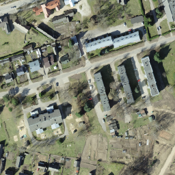
オルソフォトは、エストニアをカバーする航空写真データセットです。オルソフォトは、地形の起伏、露出時の地面に対するカメラの傾き、カメラの中心投影によって生じる歪みが除去された、処理済みの航空写真です。デジタル オルソフォトには、特定の … エストニア 低空飛行 オルソフォト RGB -
エストニア RGB オルソフォト

オルソフォトは、エストニアをカバーする航空写真データセットです。オルソフォトは、地形の起伏、露出時の地面に対するカメラの傾き、カメラの中心投影によって生じる歪みが除去された、処理済みの航空写真です。デジタル オルソフォトには、特定の … エストニア オルソフォト RGB -
エストニア モノクロ低空飛行オルソフォト
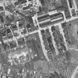
オルソフォトは、エストニアをカバーする航空写真データセットです。オルソフォトは、地形の起伏、露出時の地面に対するカメラの傾き、カメラの中心投影によって生じる歪みが除去された、処理済みの航空写真です。デジタル オルソフォトには、特定の … エストニア 低空飛行 オルソフォト -
エストニア モノクロ オルソフォト
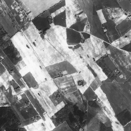
オルソフォトは、エストニアをカバーする航空写真データセットです。オルソフォトは、地形の起伏、露出時の地面に対するカメラの傾き、カメラの中心投影によって生じる歪みが除去された、処理済みの航空写真です。デジタル オルソフォトには、特定の … エストニア オルソフォト
Datasets tagged estonia in Earth Engine
[null,null,[],[],["The content describes aerial photo datasets, known as orthophotos, covering Estonia. These processed photos correct distortions from terrain, camera tilt, and central projection. There are mono and RGB orthophoto datasets, with some designated as low-flying. The datasets are tagged with \"estonia,\" \"orthophoto,\" and either \"rgb\" or \"low-flying\", depending on the specific characteristics of each set.\n"]]