-
エストニアの RGB 低空飛行オルソフォト
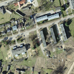
オルソ写真は、エストニアをカバーする航空写真データセットです。オルソフォトとは、地形の起伏、露出時の地面に対するカメラの傾き、カメラの中心投影によって生じた歪みが除去された、処理済みの航空写真です。デジタルオルソ画像には、… estonia low-flying orthophotos rgb -
エストニアのモノクロ低空飛行オルソフォト
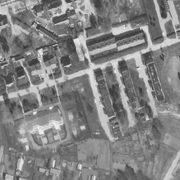
オルソ写真は、エストニアをカバーする航空写真データセットです。オルソフォトとは、地形の起伏、露出時の地面に対するカメラの傾き、カメラの中心投影によって生じた歪みが除去された、処理済みの航空写真です。デジタルオルソ画像には、… estonia low-flying orthophotos
Datasets tagged low-flying in Earth Engine
[null,null,[],[],["Estonia has aerial photo datasets called orthophotos. These are processed photos where distortions from terrain, camera tilt, and projection are removed. The datasets cover Estonia and are available in both monochrome and RGB formats. The photos were taken at low-flying altitudes. The datasets are referred to as Estonia mono low flying orthophotos and Estonia RGB low flying orthophotos.\n"]]