-
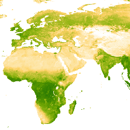
EVI:Malaria Atlas Project 填充了缺失数据的增强型植被指数(每 8 天 1 千米)

此增强型植被指数 (EVI) 产品的基础数据集是 MODIS BRDF 校正后的影像 (MCD43B4),该影像已使用 Weiss 等人 (2014) 概述的方法进行了缺口填充,以消除因云覆盖等因素而导致的数据缺失。在填充缺失数据后,数据被剪裁到 … evi malariaatlasproject map publisher-dataset vegetation vegetation-indices -
EVI:Malaria Atlas Project 填充了缺失数据的增强型植被指数(每年 1 千米)

此增强型植被指数 (EVI) 产品的基础数据集是 MODIS BRDF 校正后的影像 (MCD43B4),该影像已使用 Weiss 等人 (2014) 概述的方法进行了缺口填充,以消除因云覆盖等因素而导致的数据缺失。在填充缺失数据后,数据被剪裁到 … evi malariaatlasproject map publisher-dataset vegetation vegetation-indices -
EVI:Malaria Atlas Project 填充了缺失数据的增强型植被指数(每月 1 千米)

此增强型植被指数 (EVI) 产品的基础数据集是 MODIS BRDF 校正后的影像 (MCD43B4),该影像已使用 Weiss 等人 (2014) 概述的方法进行了缺口填充,以消除因云覆盖等因素而导致的数据缺失。在填充缺失数据后,数据被剪裁到 … evi malariaatlasproject map publisher-dataset vegetation vegetation-indices -
Landsat Collection 2 Tier 1 Level 2 8 天 EVI 复合数据

这些 Landsat Collection 2 Tier 1 Level 2 合成影像由 Tier 1 Level 2 正射校正后的场景构成。增强型植被指数 (EVI) 是根据每个场景的近红外波段、红波段和蓝波段生成的,值范围为 -1.0 到 1.0。参见 Huete … evi 陆地卫星 陆地卫星合成 usgs 植被 植被指数 -
Landsat Collection 2 Tier 1 Level 2 年度 EVI 合成影像

这些 Landsat Collection 2 Tier 1 Level 2 合成影像由 Tier 1 Level 2 正射校正后的场景构成。增强型植被指数 (EVI) 是根据每个场景的近红外波段、红波段和蓝波段生成的,值范围为 -1.0 到 1.0。参见 Huete … evi 陆地卫星 陆地卫星合成 usgs 植被 植被指数 -
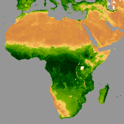
MCD12Q2.006 土地覆盖动态年度全球 500 米

Terra 和 Aqua 组合的中等分辨率成像光谱辐射计 (MODIS) 土地覆盖动态 (MCD12Q2) 版本 6.1 数据产品以年为间隔提供全球陆地表面物候指标。MCD12Q2 版本 6.1 数据产品源自双波段增强型植被指数 (EVI2) 的时间序列… EVI 全球 土地利用和土地覆盖 MODIS 绿度开始 物候 -
MOD13A1.061 Terra 植被指数 16 天全球 500 米

MOD13A1 V6.1 产品以像素为基础提供植被指数 (VI) 值。主要有两层植被。第一个是归一化差值植被指数 (NDVI),它被称为现有美国国家海洋和大气管理局 (NOAA) … 16 天 evi global modis nasa ndvi -
MOD13A2.061 Terra 植被指数 16 天全球 1 公里

MOD13A2 V6.1 产品提供两种植被指数 (VI):归一化差值植被指数 (NDVI) 和增强型植被指数 (EVI)。NDVI 被称为连续性指数,可与现有的美国国家海洋和大气管理局-高级甚高分辨率辐射计 (NOAA-AVHRR) 派生的 NDVI 进行比较。… 16 天 evi global modis nasa ndvi -
MOD13A3.061 植被指数月度 L3 全球 1 公里 SIN 网格

MOD13A3 V6.1 产品数据以 1 公里 (km) 的空间分辨率按月提供。在生成此月度产品时,该算法会提取与相应月份重叠的所有 MOD13A2 产品,并采用加权时间平均值。植被指数用于在全球范围内监测植被… evi global modis monthly nasa ndvi -
MOD13Q1.061 Terra 植被指数 16 天全球 250 米

MOD13Q1 V6.1 产品以像素为单位提供植被指数 (VI) 值。主要有两层植被。第一个是归一化差值植被指数 (NDVI),它被称为现有美国国家海洋和大气管理局 (NOAA) … 16 天 evi global modis nasa ndvi -
MYD13A1.061 Aqua 植被指数 16 天全球 500 米

MYD13A1 V6.1 产品以每个像素为基础提供植被指数 (VI) 值。主要有两层植被。第一个是归一化差值植被指数 (NDVI),它被称为现有美国国家海洋和大气管理局 (NOAA) … 16 天 aqua evi global modis nasa -
MYD13A2.061 Aqua 植被指数 16 天全球 1 公里

MYD13A2 V6.1 产品提供两种植被指数 (VI):归一化差值植被指数 (NDVI) 和增强型植被指数 (EVI)。NDVI 被称为连续性指数,可与现有的美国国家海洋和大气管理局-高级甚高分辨率辐射计 (NOAA-AVHRR) 派生的 NDVI 进行比较。… 16 天 aqua evi global modis nasa -
MYD13A3.061 Aqua 植被指数月度 L3 全球 1 公里 SIN 网格

Aqua 中分辨率成像光谱辐射计 (MODIS) 植被指数 (MYD13A3) 版本 6.1 数据以网格化 3 级产品的形式按月提供,空间分辨率为 1 公里 (km),采用正弦投影。在生成此月度产品时,该算法会提取所有 MYD13A2 产品,这些产品… aqua evi global modis monthly nasa -
MYD13Q1.061 Aqua 植被指数 16 天全球 250 米

MYD13Q1 V6.1 产品以像素为单位提供植被指数 (VI) 值。主要有两层植被。第一个是归一化差值植被指数 (NDVI),它被称为现有美国国家海洋和大气管理局 (NOAA) … 16 天 aqua evi global modis nasa -
VNP13A1.002:VIIRS 植被指数 16 天 500 米

苏奥米国家极地轨道合作伙伴计划 (S-NPP) NASA 可见光红外成像辐射仪套件 (VIIRS) 植被指数 (VNP13A1) 数据产品通过在 16 天的采集期内以 500 米的分辨率选择最佳可用像素来提供植被指数。VNP13 数据产品旨在… 16 天 evi nasa ndvi noaa npp
Datasets tagged evi in Earth Engine
[null,null,[],[],[]]