-
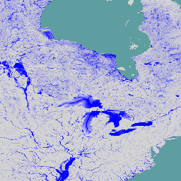
GFPLAIN250m:全球 250 米洪泛平原数据集

GFPLAIN250m 包含地球洪泛平原的光栅数据,这些数据是使用 Nardi 等人(2006 年、2018 年)提出的地貌方法识别的。250 米洪泛平原数据集是通过处理从 http://srtm.csi.cgiar.org/ 收集的 NASA SRTM 数字高程模型(尤其是 250 米 SRTM 版本 4.1)得出的… flood monitoring surface-ground-water -
全球洪灾数据库 v1(2000 年至 2018 年)

全球洪涝数据库包含 2000 年至 2018 年间发生的 913 次洪涝事件的范围和时间分布地图。如需了解详情,请参阅相关期刊文章。洪水事件数据是从达特茅斯洪水观测站收集的,用于收集 MODIS 影像。所选 913 … 洪水 地表水 地表地下水 水 -
JRC 全球河流洪灾危险地图版本 2.1

全球河流洪水灾害地图是一个网格化数据集,表示河流网络沿线的淹没情况,涵盖七个不同的洪水重现期(从 10 年一遇到 500 年一遇)。新地图的输入河流流量数据是通过开源水文模型生成的… flood monitoring surface-ground-water wri -
WRI Aqueduct 基准年度版本 4.0

Aqueduct 4.0 是 WRI 水风险框架的最新迭代版本,旨在将复杂的水文数据转化为直观的用水相关风险指标。该数据集将 13 个与水量、水质和声誉问题相关的水风险指标纳入一个综合框架中。对于 5 个… aqueduct flood monitoring surface-ground-water table wri -
WRI Aqueduct 基准月度版本 4.0

Aqueduct 4.0 是 WRI 水风险框架的最新迭代版本,旨在将复杂的水文数据转化为直观的用水相关风险指标。该数据集将 13 个与水量、水质和声誉问题相关的水风险指标纳入一个综合框架中。对于 5 个… aqueduct flood monitoring surface-ground-water table wri -
WRI Aqueduct 洪灾风险地图版本 2

Aqueduct Floods 数据可衡量在当前基准条件和 2030 年、2050 年和 2080 年的未来预测情景下,河流和沿海地区的洪涝风险。除了提供洪水风险地图和评估风险之外,Aqueduct Floods 还有助于进行全面的成本效益分析,以评估堤坝的价值… flood monitoring surface-ground-water wri -
WRI Aqueduct 未来年度版本 4.0

Aqueduct 4.0 是 WRI 水风险框架的最新迭代版本,旨在将复杂的水文数据转化为直观的用水相关风险指标。该数据集将 13 个与水量、水质和声誉问题相关的水风险指标纳入一个综合框架中。对于 5 个… aqueduct flood monitoring surface-ground-water table wri
Datasets tagged flood in Earth Engine
[null,null,[],[],["The datasets provide information on global flood events and water risk. The Global Flood Database maps 913 flood events from 2000-2018 using MODIS imagery. The JRC Global River Flood Hazard Maps offer gridded data on river inundation for various flood return periods. WRI Aqueduct Floods data assess riverine and coastal flood risks, including future projections. Aqueduct 4.0 datasets contain 13 water risk indicators related to quantity, quality, and reputational concerns.\n"]]