-
FORMA 提醒阈值

WRI 的注意事项:WRI 决定停止更新 FORMA 提醒。目标是简化 Global Forest Watch 用户体验并减少冗余。我们发现,Terra-i 和 GLAD 的使用频率更高。此外,使用 GLAD 作为标准,发现 Terra-i 的性能优于 FORMA… 每日 森林砍伐 火灾 森林 FORMA gfw -
FORMA 提醒

WRI 的注意事项:WRI 决定停止更新 FORMA 提醒。目标是简化 Global Forest Watch 用户体验并减少冗余。我们发现,Terra-i 和 GLAD 的使用频率更高。此外,使用 GLAD 作为标准,发现 Terra-i 的性能优于 FORMA… 每日 森林砍伐 火灾 森林 FORMA gfw -
FORMA 原始输出 FIRMS

WRI 的注意事项:WRI 决定停止更新 FORMA 提醒。目标是简化 Global Forest Watch 用户体验并减少冗余。我们发现,Terra-i 和 GLAD 的使用频率更高。此外,使用 GLAD 作为标准,发现 Terra-i 的性能优于 FORMA… 每日 森林砍伐 火灾 森林 FORMA gfw -
FORMA 原始输出 NDVI

WRI 的注意事项:WRI 决定停止更新 FORMA 提醒。目标是简化 Global Forest Watch 用户体验并减少冗余。我们发现,Terra-i 和 GLAD 的使用频率更高。此外,使用 GLAD 作为标准,发现 Terra-i 的性能优于 FORMA… 每日 森林砍伐 森林 森林生物质 FORMA gfw -
FORMA 植被 T 统计信息

WRI 的注意事项:WRI 决定停止更新 FORMA 提醒。目标是简化 Global Forest Watch 用户体验并减少冗余。我们发现,Terra-i 和 GLAD 的使用频率更高。此外,使用 GLAD 作为标准,发现 Terra-i 的性能优于 FORMA… 每日 森林砍伐 森林 森林生物质 FORMA gfw -
全球发电厂数据库

Global Power Plant Database 是一个全面的开源数据库,其中收录了世界各地的发电厂。它集中了发电厂数据,以便用户更轻松地浏览、比较和获取数据洞见。每个发电厂都有地理位置信息,条目包含有关发电厂容量、发电量等信息。 infrastructure-boundaries 表格 wri -
JRC 全球河流洪灾危险地图版本 2.1

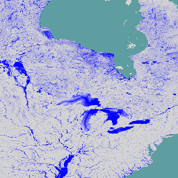
全球河流洪水灾害地图是一个网格化数据集,表示河流网络沿线的淹没情况,涵盖七个不同的洪水重现期(从 10 年一遇到 500 年一遇)。新地图的输入河流流量数据是通过开源水文模型生成的… flood monitoring surface-ground-water wri -
SBTN Natural Lands Map v1

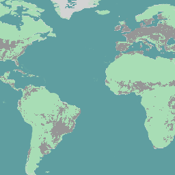
SBTN 自然土地地图 v1 是一张 2020 年的自然和非自然土地覆盖基准地图,旨在供制定基于科学的自然目标的公司使用,特别是 SBTN 土地目标 1:不转换自然生态系统。“自然”和“非自然”的定义改编自… 生态系统 landcover landuse-landcover wri -
SBTN Natural Lands Map v1.1

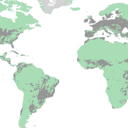
SBTN 自然土地地图 v1.1 是一张 2020 年的自然和非自然土地覆盖基准地图,旨在供企业在制定基于科学的自然目标时使用,特别是 SBTN 土地目标 1:不转换自然生态系统。“自然”和“非自然”的定义改编自… 生态系统 landcover landuse-landcover wri -
WRI Aqueduct 基准年度版本 4.0

Aqueduct 4.0 是 WRI 水风险框架的最新迭代版本,旨在将复杂的水文数据转化为直观的用水相关风险指标。该数据集将 13 个与水量、水质和声誉问题相关的水风险指标纳入一个综合框架中。对于 5 个… aqueduct flood monitoring surface-ground-water table wri -
WRI Aqueduct 基准月度版本 4.0

Aqueduct 4.0 是 WRI 水风险框架的最新迭代版本,旨在将复杂的水文数据转化为直观的用水相关风险指标。该数据集将 13 个与水量、水质和声誉问题相关的水风险指标纳入一个综合框架中。对于 5 个… aqueduct flood monitoring surface-ground-water table wri -
WRI Aqueduct 洪灾风险地图版本 2

Aqueduct Floods 数据可衡量在当前基准条件下以及 2030 年、2050 年和 2080 年的未来预测情景下,河流和沿海地区的洪涝风险。除了提供灾害地图和评估风险之外,Aqueduct Floods 还可以帮助进行全面的成本效益分析,以评估堤坝的价值… flood monitoring surface-ground-water wri -
WRI Aqueduct 未来年度版本 4.0

Aqueduct 4.0 是 WRI 水风险框架的最新迭代版本,旨在将复杂的水文数据转化为直观的用水相关风险指标。该数据集将 13 个与水量、水质和声誉问题相关的水风险指标纳入一个综合框架中。对于 5 个… aqueduct flood monitoring surface-ground-water table wri -
WRI/Google DeepMind 全球森林损失驱动因素 2001-2022 年 v1.0

此数据集以 1 公里分辨率在全球范围内绘制了 2001 年至 2022 年间树木覆盖损失的主要驱动因素。该数据由世界资源研究所 (WRI) 和 Google DeepMind 共同制作,是使用在全球范围内收集的一组样本训练的全球神经网络模型 (ResNet) 开发而成… 农业 森林砍伐 森林 森林生物质 Google landandcarbon -
WRI/Google DeepMind 全球森林损失驱动因素 2001-2023 年 v1.1

此数据集以 1 公里分辨率在全球范围内绘制了 2001 年至 2023 年间树木覆盖率下降的主要驱动因素。该数据由世界资源研究所 (WRI) 和 Google DeepMind 共同制作,是使用在全球范围内收集的一组样本训练的全球神经网络模型 (ResNet) 开发而成… 农业 森林砍伐 森林 森林生物质 Google landandcarbon -
WRI/Google DeepMind,“2001-2024 年全球森林损失驱动因素”v1.2

此数据集以 1 公里分辨率在全球范围内绘制了 2001 年至 2024 年间森林覆盖损失的主要驱动因素。该数据由世界资源研究所 (WRI) 和 Google DeepMind 共同制作,是使用在全球范围内收集的一组样本训练的全球神经网络模型 (ResNet) 开发而成… 农业 森林砍伐 森林 森林生物质 Google landandcarbon
Datasets tagged wri in Earth Engine
[null,null,[],[],["The provided content describes datasets related to flood risks, water risk assessment, deforestation alerts, power plants, and land cover. Flood hazard maps present inundation data for different return periods and future projections. Aqueduct data offers water risk indicators for quantity, quality, and reputation. FORMA alerts, which monitor deforestation, are no longer updated. A Global Power Plant Database centralizes plant information. The SBTN Natural Lands Maps provide natural and non-natural land cover classifications.\n"]]