-
FIRMS:资源管理系统火灾信息

资源管理系统火灾信息 (FIRMS) 数据集的 Earth Engine 版本包含光栅化的 LANCE 火灾检测产品。LANCE 使用标准 MODIS MOD14/MYD14 火点和热异常产品处理近乎实时 (NRT) 的火点位置。每… eosdis 火灾 firms 地球物理 热点 lance -
FORMA 提醒阈值

WRI 的注意事项:WRI 决定停止更新 FORMA 提醒。目标是简化 Global Forest Watch 用户体验并减少冗余。我们发现,Terra-i 和 GLAD 的使用频率更高。此外,使用 GLAD 作为标准,发现 Terra-i 的性能优于 FORMA… 每日 森林砍伐 火灾 森林 FORMA gfw -
FORMA 提醒

WRI 的注意事项:WRI 决定停止更新 FORMA 提醒。目标是简化 Global Forest Watch 用户体验并减少冗余。我们发现,Terra-i 和 GLAD 的使用频率更高。此外,使用 GLAD 作为标准,发现 Terra-i 的性能优于 FORMA… 每日 森林砍伐 火灾 森林 FORMA gfw -
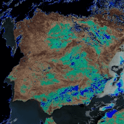
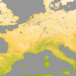
FORMA 原始输出 FIRMS

WRI 的注意事项:WRI 决定停止更新 FORMA 提醒。目标是简化 Global Forest Watch 用户体验并减少冗余。我们发现,Terra-i 和 GLAD 的使用频率更高。此外,使用 GLAD 作为标准,发现 Terra-i 的性能优于 FORMA… 每日 森林砍伐 火灾 森林 FORMA gfw -
FORMA 原始输出 NDVI

WRI 的注意事项:WRI 决定停止更新 FORMA 提醒。目标是简化 Global Forest Watch 用户体验并减少冗余。我们发现,Terra-i 和 GLAD 的使用频率更高。此外,使用 GLAD 作为标准,发现 Terra-i 的性能优于 FORMA… 每日 森林砍伐 森林 森林生物质 FORMA gfw -
FORMA 植被 T 统计信息

WRI 的注意事项:WRI 决定停止更新 FORMA 提醒。目标是简化 Global Forest Watch 用户体验并减少冗余。我们发现,Terra-i 和 GLAD 的使用频率更高。此外,使用 GLAD 作为标准,发现 Terra-i 的性能优于 FORMA… 每日 森林砍伐 森林 森林生物质 FORMA gfw -
FireCCI51:MODIS Fire_cci 烧毁面积像素产品,版本 5.1

MODIS Fire_cci 烧毁面积像素产品版本 5.1 (FireCCI51) 是一个每月更新的全球数据集,空间分辨率约为 250 米,其中包含烧毁面积信息以及辅助数据。该指数基于 MODIS 仪器在近红外 (NIR) 波段的地表反射率计算得出,… burn cci climate-change copernicus esa fire -
MCD12C1.061 MODIS 土地覆盖类型年度全球 0.05 度 CMG

Terra 和 Aqua 组合的中等分辨率成像光谱辐射计 (MODIS) 土地覆盖气候模型网格 (CMG) (MCD12C1) 版本 6.1 数据产品提供了平铺 MCD12Q1 版本 6.1 数据产品的空间聚合和重新投影版本。国际地圈-生物圈计划 (IGBP) 地图,… 大学 landcover landuse-landcover modis nasa usgs yearly -
MCD12Q1.061 MODIS 土地覆被类型年度全球 500 米
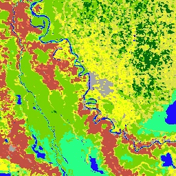
Terra 和 Aqua 组合的中等分辨率成像光谱辐射计 (MODIS) 土地覆盖类型 (MCD12Q1) 版本 6.1 数据产品以年为间隔提供全球土地覆盖类型。MCD12Q1 版本 6.1 数据产品是使用 MODIS Terra 和 Aqua 反射率数据的监督分类得出的。土地… landcover landuse-landcover modis nasa usgs yearly -
MCD12Q2.006 土地覆盖动态年度全球 500 米

Terra 和 Aqua 卫星组合的中等分辨率成像光谱辐射计 (MODIS) 土地覆盖动态 (MCD12Q2) 版本 6.1 数据产品以年为间隔提供全球地表物候指标。MCD12Q2 版本 6.1 数据产品源自双波段增强型植被指数 (EVI2) 的时间序列… EVI 全球 土地利用和土地覆盖 MODIS 绿度起始 物候 -
MCD15A3H.061 MODIS 叶面积指数/FPAR 4 天全球 500 米

MCD15A3H 版本 6.1 中等分辨率成像光谱辐射计 (MODIS) 4 级产品,即组合的光合有效辐射吸收比 (FPAR) 和叶面积指数 (LAI) 产品,是一个 4 天合成数据集,像素大小为 500 米。该算法会从所有…中选择最佳像素 fpar global lai modis nasa plant-productivity -
MCD19A1.061:陆地表面 BRF 每日 L2G 全球 500 米和 1 公里

MCD19A1 版本 6.1 数据产品是中等分辨率成像光谱辐射计 (MODIS) Terra 和 Aqua 组合地表双向反射率因子 (BRF) 格网化 2 级产品,以 500 米和 1 千米分辨率每日生成。如需了解详情,请参阅 MAIAC 用户指南。 气溶胶 aod aqua 每日 全球 maiac -
MCD19A2.061:Terra 和 Aqua MAIAC 陆地气溶胶光学深度(每日 1 公里)

MCD19A2 V6.1 数据产品是 MODIS Terra 和 Aqua 组合的多角度大气校正 (MAIAC) 陆地气溶胶光学厚度 (AOD) 格网 2 级产品,以 1 公里分辨率每日生成。如需了解详情,请参阅 MAIAC 用户指南。注意:此产品具有… 气溶胶 aod aqua 大气 每日 全球 -
MCD43A1.061 MODIS BRDF-Albedo 模型参数 每日 500 米

MCD43A1 V6.1 双向反射率分布函数和反照率 (BRDF/Albedo) 模型形参数据集是一种 500 米分辨率的每日 16 天产品。儒略日表示 16 天反演周期的第 9 天,因此观测结果会加权,以估计当天的 BRDF/反照率。… 反照率 brdf 每日 全球 modis nasa -
MCD43A2.061 MODIS BRDF-Albedo 质量每日 500 米

MCD43A2 V6.1 双向反射率分布函数和反照率 (BRDF/Albedo) 质量数据集是一种 500 米分辨率的每日 16 天产品。它包含相应 16 天 MCD43A3 反照率和 MCD43A4 天顶 BRDF (NBAR) 产品的所有质量信息。MCD43A2 包含各个波段的质量和观测数据… 反照率 brdf 每日 全球 modis nasa -
MCD43A3.061 MODIS 反照率每日 500 米

MCD43A3 V6.1 反照率模型数据集是一种每日 16 天的产品。它为每个 MODIS 地表反射率波段(波段 1 至波段 7)以及 3 个宽光谱波段提供方向半球反射率(黑空反照率)和双半球反射率(白空反照率)… albedo black-sky daily global modis nasa -
MCD43A4.061 MODIS 天底 BRDF 调整后的反射率每日 500 米

MCD43A4 V6.1 天底双向反射率分布函数调整后的反射率 (NBAR) 产品提供 MODIS“陆地”波段 1-7 的 500 米反射率数据。这些值会使用双向反射率分布函数进行调整,以模拟从天底视角收集的值。… 反照率 brdf 每日 全球 modis nasa -
MCD43C3.061 BRDF/反照率每日 L3 0.05 度 CMG

MCD43C3 版本 6.1 双向反射率分布函数和反照率 (BRDF/Albedo) 反照率数据集采用 Terra 和 Aqua 卫星 MODIS 16 天观测数据,基于 0.05 度(赤道处约 5,600 米)气候模拟网格 (CMG) 每日生成。数据在时间维度上加权至反演周期的第 9 天… 反照率 晴空 双向反射率分布函数 (BRDF) 每日 全球 MODIS -
MCD64A1.061 MODIS 烧毁区域月度全球 500 米

Terra 和 Aqua 组合的 MCD64A1 版本 6.1 烧毁面积数据产品是一种每月更新的全球网格化 500 米产品,包含每个像素的烧毁面积和质量信息。MCD64A1 烧毁区域测绘方法采用 500 米 MODIS 地表反射率影像,并结合 1 公里 MODIS 火点观测数据。该算法… burn change-detection fire geophysical global mcd64a1 -
MOD08_M3.061 Terra 大气月度全球产品

MOD08_M3 V6.1 是一种大气全球产品,包含大气参数的月度 1x1 度网格平均值。这些参数与大气气溶胶粒子属性、总臭氧负荷、大气水汽、云光学和物理属性以及大气稳定性指数有关。… 大气 气候 地球物理 全球 modis 月度 -
MOD09A1.061 Terra 地表反射率 8 天全球 500 米
MOD09A1 V6.1 产品提供 Terra MODIS 波段 1-7 在 500 米分辨率下的地表光谱反射率估计值,并针对气体、气溶胶和瑞利散射等大气条件进行了校正。除了七个反射率波段外,还有质量层和四个观测… 8 天 全球 modis nasa satellite-imagery sr -
MOD09GA.061 Terra 地表反射率每日全球 1 公里和 500 米

MODIS 地表反射率产品可提供地表光谱反射率的估计值,该值是在没有大气散射或吸收的情况下于地面测得的。低级别数据已针对大气气体和气溶胶进行校正。MOD09GA 版本 6.1 以 … 格式提供波段 1-7。 daily global modis nasa satellite-imagery sr -
MOD09GQ.061 Terra 地表反射率每日全球 250 米
MODIS 地表反射率产品可提供地表光谱反射率的估计值,该值是在没有大气散射或吸收的情况下于地面测得的。低级别数据已针对大气气体和气溶胶进行校正。MOD09GQ 版本 6.1 提供波段 1 和 … daily global modis nasa satellite-imagery sr -
MOD09Q1.061 Terra 地表反射率 8 天全球 250 米
MOD09Q1 产品提供 250 米分辨率下波段 1 和 2 的地表光谱反射率估计值,并针对气体、气溶胶和瑞利散射等大气条件进行了校正。除了这两个反射率波段,还包括一个质量层。对于每个… 8 天 全球 mod09q1 modis nasa 卫星图像 -
MOD10A1.061 Terra Snow Cover Daily Global 500m

MOD10A1 V6.1 积雪每日全球 500 米产品包含积雪、积雪反照率、部分积雪和质量评估 (QA) 数据。积雪覆盖率数据基于一种积雪测绘算法,该算法采用归一化差异积雪指数 (NDSI) 和其他标准测试。常规… albedo cryosphere daily geophysical global modis -
MOD10A2.061 Terra 雪盖 8 天 L3 全球 500 米

MOD10A2 是 Terra 卫星上 MODIS 提供的积雪覆盖率数据集。该数据集报告了 8 天内最大积雪范围,分辨率为 500 米。之所以选择 8 天的合成周期,是因为这是精确的地面轨道重复周期… 冰冻圈 每日 地球物理 全球 modis nasa -
MOD11A1.061 Terra 地表温度与发射率每日全球 1 公里

MOD11A1 V6.1 产品以 1200 x 1200 公里网格提供每日地表温度 (LST) 和发射率值。温度值源自 MOD11_L2 观测带产品。在 30 度纬度以上,部分像素可能有多项观测结果,其中晴空条件… climate daily emissivity global lst modis -
MOD11A2.061 Terra 地表温度与发射率 8 天全球 1 公里

MOD11A2 V6.1 产品以 1200 x 1200 公里网格提供平均 8 天地表温度 (LST)。MOD11A2 中的每个像素值都是相应 8 天时间段内收集的所有相应 MOD11A1 LST 像素的简单平均值。MOD11A2 会执行… 8 天 气候 发射率 全球 lst mod11a2 -
MOD13A1.061 Terra Vegetation Indices 16-Day Global 500m

MOD13A1 V6.1 产品以像素为基础提供植被指数 (VI) 值。主要有两层植被。第一个是归一化差值植生指数 (NDVI),它被称为现有美国国家海洋和大气管理局 (NOAA) … 16-day evi global modis nasa ndvi -
MOD13A2.061 Terra Vegetation Indices 16-Day Global 1km

MOD13A2 V6.1 产品提供两种植被指数 (VI):归一化差值植被指数 (NDVI) 和增强型植被指数 (EVI)。NDVI 被称为连续性指数,可与现有的美国国家海洋和大气管理局-高级甚高分辨率辐射计 (NOAA-AVHRR) 派生的 NDVI 进行比较。… 16-day evi global modis nasa ndvi -
MOD13A3.061 Vegetation Indices Monthly L3 Global 1 km SIN Grid

MOD13A3 V6.1 产品数据以 1 公里 (km) 的空间分辨率按月提供。在生成此月度产品时,算法会纳入与相应月份重叠的所有 MOD13A2 产品,并采用加权时间平均值。植被指数用于在全球范围内监测植被… evi global modis monthly nasa ndvi -
MOD13Q1.061 Terra Vegetation Indices 16-Day Global 250m

MOD13Q1 V6.1 产品以像素为单位提供植被指数 (VI) 值。主要有两层植被。第一个是归一化差值植生指数 (NDVI),它被称为现有美国国家海洋和大气管理局 (NOAA) … 16-day evi global modis nasa ndvi -
MOD14A1.061:Terra 热异常和火灾每日全球 1 公里

MOD14A1 V6.1 数据集提供每日 1 公里分辨率的火灾掩膜合成数据,这些数据源自 MODIS 4 微米和 11 微米辐射亮度。火灾检测策略基于对火灾的绝对检测(当火势足以检测到时)以及相对于…的检测。 daily fire global modis nasa terra -
MOD14A2.061:Terra 热异常与火灾 8 天全球 1 公里

MOD14A2 V6.1 数据集以 1 公里分辨率提供 8 天的火灾掩膜合成数据。它包含合成期内各个像素类的最大值。除了火点掩模之外,系统还会提供相关联的质量信息层。文档:用户指南 - 算法理论基础… 8 天 火灾 全球 modis nasa terra -
MOD15A2H.061:Terra 叶面积指数/FPAR 8 天全球 500 米

MOD15A2H V6.1 MODIS 组合叶面积指数 (LAI) 和光合有效辐射吸收比 (FPAR) 产品是一个 8 天合成数据集,分辨率为 500 米。该算法会从 Terra 传感器在 8 天内采集的所有图像中选择“最佳”像素。… 8 天 fpar 全球 lai modis nasa -
MOD16A2.061:Terra 净蒸发蒸腾量 8 天全球 500 米

MOD16A2 第 6.1 版蒸散量/潜热通量产品是一种 8 天合成产品,以 500 米像素分辨率生成。MOD16 数据产品集合所用的算法基于 Penman-Monteith 方程的逻辑,其中包括每日气象再分析数据输入… 8 天 蒸发蒸腾 全球 mod16a2 modis nasa -
MOD16A2:MODIS 全球陆地蒸散量 8 天全球 1 公里

MOD16A2 V105 产品提供有关 8 天全球陆地蒸散的信息,像素分辨率为 1 公里。蒸发蒸腾 (ET) 是指从地球表面到大气层的蒸发量和植物蒸腾量之和。借助长期 ET 数据,可以评估气候、土地利用和… 8 天 蒸发蒸腾 全球 mod16a2 modis 水汽 -
MOD16A2GF.061:Terra 净蒸发蒸腾量(已填补缺口)8 天全球 500 米

Terra 中等分辨率成像光谱辐射计 (MODIS) MOD16A2GF 版本 6.1 蒸发蒸腾/潜热通量 (ET/LE) 产品是一种年终间隙填充的 8 天合成数据集,以 500 米 (m) 像素分辨率生成。用于 MOD16 数据产品集合的算法基于以下逻辑… 8 天 蒸发蒸腾 全球 modis nasa 水汽 -
MOD17A2H.061:Terra 总初级生产力 8 天全球 500 米

MOD17A2H V6.1 总初级生产力 (GPP) 产品是累积的 8 天合成产品,像素大小为 500 米。该产品基于辐射利用效率概念,可作为数据模型的输入,用于计算陆地能量、碳、水循环过程等。 8 天 全球 gpp modis nasa 光合作用 -
MOD17A2HGF.061:Terra 总初级生产力 8 天全球 500 米

MOD17A2HGF 版本 6.1 总初级生产力 (GPP) 产品是基于辐射利用效率概念的累积 8 天合成值,像素大小为 500 米 (m),可潜在用作数据模型的输入来计算陆地能量、碳、水… 8 天 全球 gpp modis nasa 光合作用 -
MOD44B.061 Terra 植被连续场年度全球 250 米

Terra MODIS 植被连续场 (VCF) 产品是全球地表植被覆盖估计值的亚像素级表示。该模型旨在以基本植被特征的比例来连续表示地球陆地表面,它提供了三种地表覆盖成分的梯度:树木覆盖率百分比、… 年度 地球物理 全球 土地利用和土地覆盖 MODIS NASA -
MOD44W.005 基于 MODIS 和 SRTM 派生的陆地水体掩码

全球水体掩膜使用 SWBD(SRTM 水体数据)与 MODIS 250 米数据相结合,创建了一张完整的全球地表水地图,空间分辨率为 250 米,时间约为 2000-2002 年。此数据集旨在用于处理栅格数据,并用于… 地球物理 mod44w modis srtm 地表地下水 水掩膜 -
MOD44W.006 Terra Land Water Mask Derived From MODIS and SRTM Yearly Global 250m

MOD44W V6 陆地/水体掩码 250 米产品是使用经过 MODIS 数据训练并经过 MOD44W V5 产品验证的决策树分类器得出的。应用了一系列掩码来解决地形阴影、烧伤痕迹、多云或冰盖等造成的已知问题… 地球物理 mod44w modis nasa srtm 地表-地下水 -
美国本土 MODIS 初级生产总值

MODIS 美国本土初级生产力 (GPP) CONUS 数据集使用美国本土 MODIS 地表反射率来估计 GPP。GPP 是指生态系统中植物捕获的碳量,是净初级生产力 (NPP) 计算中的一个重要组成部分。GPP 的计算方式为… 8 天 美国本土 gpp gridmet 派生 mod09q1 mod17 -
美国本土 MODIS 地表净初级生产力

MODIS 美国本土净初级生产力 (NPP) 数据集使用美国本土的 MODIS 地表反射率来估计 NPP。NPP 是指生态系统中植物捕获的碳量,其中已考虑呼吸作用造成的损失。NPP 是使用 MOD17 算法计算的(请参阅 MOD17 用户… conus gridmet-derived mod09q1 mod17 modis nlcd-derived -
MODOCGA.006 Terra 海洋反射率每日全球 1 公里
MODOCGA V6 海洋反射率产品包含来自 Terra MODIS 波段 8-16 的 1 公里反射率数据。该产品被称为海洋反射率,因为波段 8-16 主要用于生成海洋产品,但由于图块…,因此该产品并非海洋产品 daily global modis nasa oceans reflectance -
MYD08_M3.061 Aqua 大气月度全球产品

MYD08_M3 V6.1 是一种大气全球产品,包含大气形参的月度 1x1 度网格平均值。这些参数与大气气溶胶粒子属性、总臭氧负荷、大气水汽、云光学和物理属性以及大气稳定性指数有关。… aqua 大气 气候 地球物理 全球 modis -
MYD09A1.061 Aqua 地表反射率 8 天全球 500 米

MYD09A1 V6.1 产品提供 Aqua MODIS 波段 1-7 在 500 米分辨率下的地表光谱反射率估计值,并针对气体、气溶胶和瑞利散射等大气条件进行了校正。除了七个反射率波段外,还有质量层和四个观测… 8 天 aqua 全球 modis nasa 卫星图像 -
MYD09GA.061 Aqua 地表反射率每日全球 1 公里和 500 米
MODIS 地表反射率产品可提供地表光谱反射率的估计值,该值是在没有大气散射或吸收的情况下于地面测得的。低级别数据已针对大气气体和气溶胶进行校正。MYD09GA 版本 6.1 以 … 格式提供波段 1-7。 aqua daily global modis nasa satellite-imagery -
MYD09GQ.061 Aqua 地表反射率每日全球 250 米

MODIS 地表反射率产品可提供地表光谱反射率的估计值,该值是在没有大气散射或吸收的情况下于地面测得的。低级别数据已针对大气气体和气溶胶进行校正。MYD09GQ 版本 6.1 提供波段 1 和 … aqua daily global modis nasa satellite-imagery -
MYD09Q1.061 Aqua 地表反射率 8 天全球 250 米

MYD09Q1 产品提供 250 米分辨率下波段 1 和 2 的地表光谱反射率估计值,并针对气体、气溶胶和瑞利散射等大气条件进行了校正。除了这两个反射率波段,还包括一个质量层。对于每个… 8 天 aqua 全球 modis nasa 卫星图像 -
MYD10A1.061 Aqua 积雪每日全球 500 米

MYD10A1 V6 积雪每日全球 500 米产品包含积雪、积雪反照率、积雪覆盖率和质量评估 (QA) 数据。积雪覆盖率数据基于一种积雪测绘算法,该算法采用归一化差异积雪指数 (NDSI) 和其他标准测试。常规… albedo aqua cryosphere daily geophysical global -
MYD11A1.061 Aqua 地表温度与发射率每日全球 1 公里

MYD11A1 V6.1 产品以 1200 x 1200 公里网格提供每日地表温度 (LST) 和发射率值。温度值源自 MYD11_L2 扫描带产品。在 30 度纬度以上,部分像素可能有多项观测结果,其中晴空条件… aqua climate daily emissivity global lst -
MYD11A2.061 Aqua 地表温度与发射率 8 天全球 1 公里
MYD11A2 V6.1 产品以 1200 x 1200 公里网格提供平均 8 天地表温度 (LST)。MYD11A2 中的每个像素值都是相应 MYD11A1 LST 像素在相应 8 天内收集的所有值的简单平均值。MYD11A2 可执行… 8 天 aqua climate emissivity global lst -
MYD13A1.061 Aqua Vegetation Indices 16-Day Global 500m

MYD13A1 V6.1 产品以每个像素为基础提供植被指数 (VI) 值。主要有两层植被。第一个是归一化差值植生指数 (NDVI),它被称为现有美国国家海洋和大气管理局 (NOAA) … 16-day aqua evi global modis nasa -
MYD13A2.061 Aqua Vegetation Indices 16-Day Global 1km

MYD13A2 V6.1 产品提供两种植被指数 (VI):归一化差值植被指数 (NDVI) 和增强型植被指数 (EVI)。NDVI 被称为连续性指数,可与现有的美国国家海洋和大气管理局-高级甚高分辨率辐射计 (NOAA-AVHRR) 派生的 NDVI 进行比较。… 16-day aqua evi global modis nasa -
MYD13A3.061 Aqua Vegetation Indices Monthly L3 Global 1 km SIN Grid
Aqua 中等分辨率成像光谱辐射计 (MODIS) 植被指数 (MYD13A3) 版本 6.1 数据以正弦投影网格化 3 级产品的形式按月提供,空间分辨率为 1 公里 (km)。在生成此月度产品时,该算法会提取所有 MYD13A2 产品,这些产品… aqua evi global modis monthly nasa -
MYD13Q1.061 Aqua Vegetation Indices 16-Day Global 250m

MYD13Q1 V6.1 产品以每个像素为基础提供植被指数 (VI) 值。主要有两层植被。第一个是归一化差值植生指数 (NDVI),它被称为现有美国国家海洋和大气管理局 (NOAA) … 16-day aqua evi global modis nasa -
MYD14A1.061:Aqua 热异常和火灾每日全球 1 公里

MYD14A1 V6.1 数据集提供每日火灾掩膜合成数据,分辨率为 1 公里,基于 MODIS 4 微米和 11 微米辐射率得出。火灾检测策略基于对火灾的绝对检测(当火势足以检测到时)以及相对于…的检测。 aqua daily fire global modis nasa -
MYD14A2.061:Aqua 热异常与火灾 8 天全球 1 公里

MYD14A2 V6.1 数据集以 1 公里分辨率提供 8 天的火灾掩码合成数据。它包含合成期内各个像素类的最大值。除了火点掩模之外,系统还会提供相关联的质量信息层。文档:用户指南 - 算法理论基础… 8 天 aqua fire global modis nasa -
MYD15A2H.061:Aqua 叶面积指数/FPAR 8 天全球 500 米

MYD15A2H V6.1 MODIS 组合叶面积指数 (LAI) 和光合有效辐射吸收比 (FPAR) 产品是一个 8 天合成数据集,分辨率为 500 米。该算法会从 Aqua 传感器在 8 天内采集的所有像素中选择“最佳”像素。… 8 天 aqua fpar global lai modis -
MYD16A2.061:Aqua 净蒸发量 8 天 L4 全球 500 米 SIN 网格 V061
MYD16A2 版本 6.1 蒸散/潜热通量产品是一种 8 天合成产品,像素分辨率为 500 米。用于 MOD16 数据产品集合的算法基于 Penman-Monteith 方程的逻辑,其中包括每日气象再分析数据输入以及… 8 天 蒸发蒸腾 全球 modis nasa 水汽 -
MYD17A2H.061:Aqua 总初级生产力 8 天全球 500 米

MYD17A2H V6.1 总初级生产力 (GPP) 产品是累积的 8 天合成产品,分辨率为 500 米。该产品基于辐射利用效率概念,可潜在用作数据模型的输入,以计算陆地能量、碳、水循环过程,以及… 8 天 aqua global gpp modis nasa -
MYDOCGA.006 Aqua 海洋反射率每日全球 1 公里

MYDOCGA V6 海洋反射率产品包含来自 Aqua MODIS 波段 8-16 的 1 公里反射率数据。该产品被称为海洋反射率,因为波段 8-16 主要用于生成海洋产品,但由于图块…,因此该产品并非海洋产品 aqua daily global modis nasa oceans -
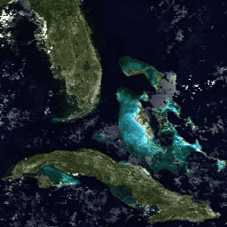
海洋颜色 SMI:标准映射图像 MODIS Aqua 数据

此 3 级产品包括在 EOSDIS 下生成或收集的海洋颜色和卫星海洋生物学数据。该数据集可用于研究沿海地区的生物学和水文学、沿海海洋生境的多样性和地理分布变化、生物地球化学通量和… 生物学 叶绿素 modis nasa oceandata 海洋 -
海洋颜色 SMI:标准映射图像 MODIS Terra 数据

此 3 级产品包括在 EOSDIS 下生成或收集的海洋颜色和卫星海洋生物学数据。该数据集可用于研究沿海地区的生物学和水文学、沿海海洋生境的多样性和地理分布变化、生物地球化学通量和… 生物学 叶绿素 modis nasa oceandata 海洋 -
OpenLandMap 长期地表温度月度白天中位数

地表温度昼间月度平均值(2000 年至 2017 年)。基于 R 语言的 data.table 包和分位数函数推导。如需详细了解 MODIS LST 产品,请参阅此页面。不包括南极洲。如需在 Earth Engine 之外访问和直观呈现地图,请使用此页面。… climate envirometrix lst mod11a2 modis monthly -
OpenLandMap 长期地表温度月度白天标准差

基于 2000-2017 年时间序列的 1 公里分辨率 MODIS 地表温度长期昼夜温差标准差。基于 R 语言的 data.table 包和分位数函数推导。如需详细了解 MODIS LST 产品,请参阅此页面。不包括南极洲。如需访问… climate envirometrix lst mod11a2 modis monthly -
OpenLandMap 长期地表温度月度昼夜差

基于 2000-2017 年时间序列的 1 公里分辨率 MODIS 地表温度长期昼夜差。基于 R 语言的 data.table 包和分位函数推导。如需详细了解 MODIS LST 产品,请参阅此页面。不包括南极洲。如需访问和直观呈现… climate day envirometrix lst mod11a2 modis -
VJ114IMGTDL_NRT 每日栅格:VIIRS (NOAA-20) 375 米波段活动火点

NOAA-20 (JPSS-1) 可见光红外成像辐射计套件 (VIIRS) 主动火点探测产品基于该仪器的 375 米标称分辨率数据。与其他粗分辨率(≥ 1 公里)卫星火灾探测产品相比,改进后的 375 米数据在探测相对较小的火灾方面具有更高的响应能力… eosdis 火灾 firms 地球物理 热点 lance -
VNP14IMGTDL_NRT 每日栅格:VIIRS (S-NPP) 375 米波段活动火点

Suomi NPP 可见光红外成像辐射计套件 (VIIRS) 主动火点探测产品基于该仪器的 375 米标称分辨率数据。与其他粗分辨率(≥ 1 公里)卫星火灾探测产品相比,改进后的 375 米数据在探测相对较小的火灾方面具有更高的响应能力… eosdis 火灾 firms 地球物理 热点 lance
Datasets tagged modis in Earth Engine
[null,null,[],[],[]]