-
GFPLAIN250m: Küresel 250 Metre Taşkın Ovası Veri Kümesi

GFPLAIN250m, Nardi ve diğerleri (2006, 2018) tarafından sunulan jeomorfolojik bir yaklaşımla tanımlanan, Dünya'nın taşkın ovalarına ait raster verilerini içerir. 250 m'lik taşkın alanı veri kümesi, http://srtm.csi.cgiar.org/ adresinden toplanan NASA SRTM Dijital Yükseklik modelinin ve özellikle 250 m'lik SRTM sürüm 4.1'in işlenmesiyle elde edilir. flood monitoring surface-ground-water -
Global Sel Veritabanı v1 (2000-2018)

Global Flood Database (Küresel Sel Veritabanı), 2000-2018 yılları arasında meydana gelen 913 sel olayının kapsamı ve zamansal dağılımıyla ilgili haritalar içerir. Daha fazla bilgi için ilgili dergi makalesine bakın. Sel olayları Dartmouth Flood Observatory'den toplanmış ve MODIS görüntülerini toplamak için kullanılmıştır. Seçilen 913 … flood surface surface-ground-water water -
JRC Global River Flood Hazard Maps Version 2.1
Küresel nehir taşkını tehlike haritaları, nehir ağı boyunca su baskınlarını temsil eden bir ızgara veri kümesidir. Bu veri kümesi, yedi farklı taşkın tekrarı dönemi (10 yılda 1 ile 500 yılda 1 arasında) için oluşturulmuştur. Yeni haritalar için giriş nehir akışı verileri, açık kaynaklı hidrolojik model … kullanılarak üretilir. flood monitoring surface-ground-water wri -
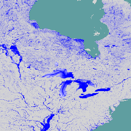
WRI Aqueduct Baseline Annual Version 4.0

Aqueduct 4.0, WRI'ın karmaşık hidrolojik verileri suyla ilgili risklerin sezgisel göstergelerine dönüştürmek için tasarladığı su riski çerçevesinin en son sürümüdür. Bu veri kümesi, miktar, kalite ve itibar endişeleriyle ilgili 13 su riski göstergesini kapsamlı bir çerçeve içinde bir araya getirir. 5 adet … için aqueduct flood monitoring surface-ground-water table wri -
WRI Aqueduct Baseline Monthly Version 4.0

Aqueduct 4.0, WRI'ın karmaşık hidrolojik verileri suyla ilgili risklerin sezgisel göstergelerine dönüştürmek için tasarladığı su riski çerçevesinin en son sürümüdür. Bu veri kümesi, miktar, kalite ve itibar endişeleriyle ilgili 13 su riski göstergesini kapsamlı bir çerçeve içinde bir araya getirir. 5 adet … için aqueduct flood monitoring surface-ground-water table wri -
WRI Aqueduct Floods Hazard Maps Version 2

Aqueduct Floods verileri, hem mevcut temel koşullar hem de 2030, 2050 ve 2080'deki gelecekteki tahminler kapsamında nehir ve kıyı taşkını risklerini ölçer. Tehlike haritaları sunmanın ve riskleri değerlendirmenin yanı sıra Aqueduct Floods, setlerin değerini değerlendirmek için kapsamlı bir maliyet-fayda analizi yapmaya yardımcı olur. flood monitoring surface-ground-water wri -
WRI Aqueduct Future Annual Version 4.0

Aqueduct 4.0, WRI'ın karmaşık hidrolojik verileri suyla ilgili risklerin sezgisel göstergelerine dönüştürmek için tasarladığı su riski çerçevesinin en son sürümüdür. Bu veri kümesi, miktar, kalite ve itibar endişeleriyle ilgili 13 su riski göstergesini kapsamlı bir çerçeve içinde bir araya getirir. 5 adet … için aqueduct flood monitoring surface-ground-water table wri
Datasets tagged flood in Earth Engine
[null,null,[],[],["The datasets provide information on global flood events and water risk. The Global Flood Database maps 913 flood events from 2000-2018 using MODIS imagery. The JRC Global River Flood Hazard Maps offer gridded data on river inundation for various flood return periods. WRI Aqueduct Floods data assess riverine and coastal flood risks, including future projections. Aqueduct 4.0 datasets contain 13 water risk indicators related to quantity, quality, and reputational concerns.\n"]]