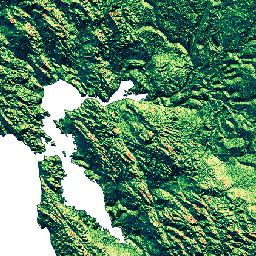
-
WWF HydroSHEDS の流出方向、15 秒
HydroSHEDS は、地域および世界規模のアプリケーション向けに水域情報を一貫した形式で提供するマッピング プロダクトです。河川ネットワーク、流域境界、流出方向、流量の集積など、さまざまなスケールの地理参照データセット(ベクターとラスター)が提供されています。HydroSHEDS は次に基づいています。 方向 排水 流量 地理物理学 水路測量 水文学 -
WWF HydroSHEDS の流出方向、3 秒
HydroSHEDS は、地域および世界規模のアプリケーション向けに水域情報を一貫した形式で提供するマッピング プロダクトです。河川ネットワーク、流域境界、流出方向、流量の集積など、さまざまなスケールの地理参照データセット(ベクターとラスター)が提供されています。HydroSHEDS は次に基づいています。 方向 排水 流量 地理物理学 水路測量 水文学 -
WWF HydroSHEDS の流出方向、30 秒弧
HydroSHEDS は、地域および世界規模のアプリケーション向けに水域情報を一貫した形式で提供するマッピング プロダクトです。河川ネットワーク、流域境界、流出方向、流量の集積など、さまざまなスケールの地理参照データセット(ベクターとラスター)が提供されています。HydroSHEDS は次に基づいています。 方向 排水 流量 地理物理学 水路測量 水文学 -
WWF HydroSHEDS 流量蓄積、15 弧秒
HydroSHEDS は、地域および世界規模のアプリケーション向けに水域情報を一貫した形式で提供するマッピング プロダクトです。河川ネットワーク、流域境界、流出方向、流量の集積など、さまざまなスケールの地理参照データセット(ベクターとラスター)が提供されています。HydroSHEDS は次に基づいています。 蓄積 排水 流量 地理物理学 水路測量 水文学 -
WWF HydroSHEDS 流量の累積、30 アーク秒
HydroSHEDS は、地域および世界規模のアプリケーション向けに水域情報を一貫した形式で提供するマッピング プロダクトです。河川ネットワーク、流域境界、流出方向、流量の集積など、さまざまなスケールの地理参照データセット(ベクターとラスター)が提供されています。HydroSHEDS は次に基づいています。 蓄積 排水 流量 地理物理学 水路測量 水文学
Datasets tagged flow in Earth Engine
[null,null,[],[[["\u003cp\u003eHydroSHEDS provides hydrographic information like river networks, watershed boundaries, drainage directions, and flow accumulations for regional and global-scale applications.\u003c/p\u003e\n"],["\u003cp\u003eThe datasets are available in both vector and raster formats at various scales (3, 15, and 30 arc-seconds).\u003c/p\u003e\n"],["\u003cp\u003eHydroSHEDS offers a consistent format for analyzing drainage patterns, flow accumulation, and direction.\u003c/p\u003e\n"],["\u003cp\u003eThe data is derived from elevation data and is suitable for hydrological modeling and water resource management.\u003c/p\u003e\n"]]],[],null,["# Datasets tagged flow in Earth Engine\n\n-\n\n |-------------------------------------------------------------------------------------------------------------------------------------------------------------------------------------------------------------------------------------------------------------------------------------------------------------------------------------------------------|\n | [### WWF HydroSHEDS Drainage Direction, 15 Arc-Seconds](/earth-engine/datasets/catalog/WWF_HydroSHEDS_15DIR) |\n | HydroSHEDS is a mapping product that provides hydrographic information for regional and global-scale applications in a consistent format. It offers a suite of geo-referenced datasets (vector and raster) at various scales, including river networks, watershed boundaries, drainage directions, and flow accumulations. HydroSHEDS is based on ... |\n | [direction](/earth-engine/datasets/tags/direction) [drainage](/earth-engine/datasets/tags/drainage) [flow](/earth-engine/datasets/tags/flow) [geophysical](/earth-engine/datasets/tags/geophysical) [hydrography](/earth-engine/datasets/tags/hydrography) [hydrology](/earth-engine/datasets/tags/hydrology) |\n\n-\n\n |-------------------------------------------------------------------------------------------------------------------------------------------------------------------------------------------------------------------------------------------------------------------------------------------------------------------------------------------------------|\n | [### WWF HydroSHEDS Drainage Direction, 3 Arc-Seconds](/earth-engine/datasets/catalog/WWF_HydroSHEDS_03DIR) |\n | HydroSHEDS is a mapping product that provides hydrographic information for regional and global-scale applications in a consistent format. It offers a suite of geo-referenced datasets (vector and raster) at various scales, including river networks, watershed boundaries, drainage directions, and flow accumulations. HydroSHEDS is based on ... |\n | [direction](/earth-engine/datasets/tags/direction) [drainage](/earth-engine/datasets/tags/drainage) [flow](/earth-engine/datasets/tags/flow) [geophysical](/earth-engine/datasets/tags/geophysical) [hydrography](/earth-engine/datasets/tags/hydrography) [hydrology](/earth-engine/datasets/tags/hydrology) |\n\n-\n\n |-------------------------------------------------------------------------------------------------------------------------------------------------------------------------------------------------------------------------------------------------------------------------------------------------------------------------------------------------------|\n | [### WWF HydroSHEDS Drainage Direction, 30 Arc-Seconds](/earth-engine/datasets/catalog/WWF_HydroSHEDS_30DIR) |\n | HydroSHEDS is a mapping product that provides hydrographic information for regional and global-scale applications in a consistent format. It offers a suite of geo-referenced datasets (vector and raster) at various scales, including river networks, watershed boundaries, drainage directions, and flow accumulations. HydroSHEDS is based on ... |\n | [direction](/earth-engine/datasets/tags/direction) [drainage](/earth-engine/datasets/tags/drainage) [flow](/earth-engine/datasets/tags/flow) [geophysical](/earth-engine/datasets/tags/geophysical) [hydrography](/earth-engine/datasets/tags/hydrography) [hydrology](/earth-engine/datasets/tags/hydrology) |\n\n-\n\n |-------------------------------------------------------------------------------------------------------------------------------------------------------------------------------------------------------------------------------------------------------------------------------------------------------------------------------------------------------|\n | [### WWF HydroSHEDS Flow Accumulation, 15 Arc-Seconds](/earth-engine/datasets/catalog/WWF_HydroSHEDS_15ACC) |\n | HydroSHEDS is a mapping product that provides hydrographic information for regional and global-scale applications in a consistent format. It offers a suite of geo-referenced datasets (vector and raster) at various scales, including river networks, watershed boundaries, drainage directions, and flow accumulations. HydroSHEDS is based on ... |\n | [accumulation](/earth-engine/datasets/tags/accumulation) [drainage](/earth-engine/datasets/tags/drainage) [flow](/earth-engine/datasets/tags/flow) [geophysical](/earth-engine/datasets/tags/geophysical) [hydrography](/earth-engine/datasets/tags/hydrography) [hydrology](/earth-engine/datasets/tags/hydrology) |\n\n-\n\n |-------------------------------------------------------------------------------------------------------------------------------------------------------------------------------------------------------------------------------------------------------------------------------------------------------------------------------------------------------|\n | [### WWF HydroSHEDS Flow Accumulation, 30 Arc-Seconds](/earth-engine/datasets/catalog/WWF_HydroSHEDS_30ACC) |\n | HydroSHEDS is a mapping product that provides hydrographic information for regional and global-scale applications in a consistent format. It offers a suite of geo-referenced datasets (vector and raster) at various scales, including river networks, watershed boundaries, drainage directions, and flow accumulations. HydroSHEDS is based on ... |\n | [accumulation](/earth-engine/datasets/tags/accumulation) [drainage](/earth-engine/datasets/tags/drainage) [flow](/earth-engine/datasets/tags/flow) [geophysical](/earth-engine/datasets/tags/geophysical) [hydrography](/earth-engine/datasets/tags/hydrography) [hydrology](/earth-engine/datasets/tags/hydrology) |"]]