-
MERIT Hydro: 世界の水路学データセット

MERIT Hydro は、MERIT DEM 標高データと水域データセット(G1WBM、GSWO、OpenStreetMap)のバージョン 1.0.3 から導出された、解像度 3 秒角(赤道で約 90 m)の新しいグローバルな流れの方向マップです。MERIT Hydro には、新しい … の出力が含まれています。 dem elevation flow-direction hand hydrography hydrosheds -
MERIT Hydro: 補足的な可視化レイヤ
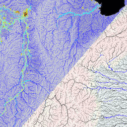
MERIT Hydro の補足的な可視化レイヤ dem elevation flow-direction hand hydrography hydrosheds
Datasets tagged hand in Earth Engine
[null,null,[],[],[]]