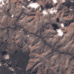
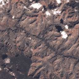
USGS Landsat 2 MSS সংগ্রহ 2 টিয়ার 1 কাঁচা দৃশ্য ল্যান্ডস্যাট 2 এমএসএস সংগ্রহ 2 টিয়ার 1 ডিএন মান, স্কেল করা, ক্যালিব্রেটেড অ্যাট-সেন্সর উজ্জ্বলতা উপস্থাপন করে। সর্বোচ্চ উপলব্ধ ডেটা মানের সাথে ল্যান্ডস্যাট দৃশ্যগুলিকে টিয়ার 1 এ স্থাপন করা হয় এবং সময়-সিরিজ প্রক্রিয়াকরণ বিশ্লেষণের জন্য উপযুক্ত বলে বিবেচিত হয়। টিয়ার 1-এ লেভেল-1 প্রিসিশন টেরেইন (L1TP) প্রসেসড ডেটা রয়েছে যা… c2 গ্লোবাল l2 ল্যান্ডস্যাট lm2 mss USGS Landsat 2 MSS সংগ্রহ 2 টিয়ার 2 কাঁচা দৃশ্য ল্যান্ডস্যাট 2 এমএসএস সংগ্রহ 2 টিয়ার 2 ডিএন মান, স্কেল করা, ক্যালিব্রেটেড অ্যাট-সেন্সর উজ্জ্বলতা উপস্থাপন করে। প্রসেসিংয়ের সময় যে দৃশ্যগুলি টিয়ার 1 মানদণ্ড পূরণ করে না সেগুলি টিয়ার 2-এ বরাদ্দ করা হয়। এর মধ্যে রয়েছে সিস্টেমেটিক টেরেইন (L1GT) এবং সিস্টেমেটিক (L1GS) প্রসেস করা দৃশ্য, সেইসাথে যেকোন L1TP দৃশ্য যা করে … c2 গ্লোবাল l2 ল্যান্ডস্যাট lm2 mss
Datasets tagged l2 in Earth Engine
[null,null,[],[[["\u003cp\u003eThe USGS Landsat 2 MSS Collection 2 provides Tier 1 and Tier 2 Raw Scene datasets, containing scaled and calibrated at-sensor radiance values.\u003c/p\u003e\n"],["\u003cp\u003eTier 1 data represents the highest quality Landsat scenes suitable for time-series analysis, including Level-1 Precision Terrain (L1TP) processed data.\u003c/p\u003e\n"],["\u003cp\u003eTier 2 data includes scenes not meeting Tier 1 criteria, such as Systematic terrain (L1GT) and Systematic (L1GS) processed scenes, and any L1TP scenes with quality issues.\u003c/p\u003e\n"],["\u003cp\u003eBoth datasets offer global coverage and are tagged with c2, l2, landsat, lm2, and mss for easy identification and filtering within Earth Engine.\u003c/p\u003e\n"]]],["Landsat 2 MSS Collection 2 data is categorized into Tier 1 and Tier 2. Tier 1 scenes contain the highest quality data and are suitable for time-series analysis, and includes Level-1 Precision Terrain processed data. Tier 2 includes scenes that did not meet Tier 1 criteria during processing, this includes Systematic terrain and Systematic processed scenes. Both tiers provide DN values that represent scaled, calibrated at-sensor radiance.\n"],null,["# Datasets tagged l2 in Earth Engine\n\n-\n\n |--------------------------------------------------------------------------------------------------------------------------------------------------------------------------------------------------------------------------------------------------------------------------------------------------------------------------|\n | [### USGS Landsat 2 MSS Collection 2 Tier 1 Raw Scenes](/earth-engine/datasets/catalog/LANDSAT_LM02_C02_T1) |\n | Landsat 2 MSS Collection 2 Tier 1 DN values, representing scaled, calibrated at-sensor radiance. Landsat scenes with the highest available data quality are placed into Tier 1 and are considered suitable for time-series processing analysis. Tier 1 includes Level-1 Precision Terrain (L1TP) processed data that ... |\n | [c2](/earth-engine/datasets/tags/c2) [global](/earth-engine/datasets/tags/global) [l2](/earth-engine/datasets/tags/l2) [landsat](/earth-engine/datasets/tags/landsat) [lm2](/earth-engine/datasets/tags/lm2) [mss](/earth-engine/datasets/tags/mss) |\n\n-\n\n |------------------------------------------------------------------------------------------------------------------------------------------------------------------------------------------------------------------------------------------------------------------------------------------------------|\n | [### USGS Landsat 2 MSS Collection 2 Tier 2 Raw Scenes](/earth-engine/datasets/catalog/LANDSAT_LM02_C02_T2) |\n | Landsat 2 MSS Collection 2 Tier 2 DN values, representing scaled, calibrated at-sensor radiance. Scenes not meeting Tier 1 criteria during processing are assigned to Tier 2. This includes Systematic terrain (L1GT) and Systematic (L1GS) processed scenes, as well as any L1TP scenes that do ... |\n | [c2](/earth-engine/datasets/tags/c2) [global](/earth-engine/datasets/tags/global) [l2](/earth-engine/datasets/tags/l2) [landsat](/earth-engine/datasets/tags/landsat) [lm2](/earth-engine/datasets/tags/lm2) [mss](/earth-engine/datasets/tags/mss) |"]]