-
NEON 冠层高度模型 (CHM)

冠层顶部相对于裸地的海拔高度(冠层高度模型;CHM)。CHM 源自 NEON LiDAR 点云,通过在 LiDAR 调查的整个空间域内创建连续的冠层高度估计值表面来生成。… 机载 冠层 森林 森林生物质 激光雷达 NEON -
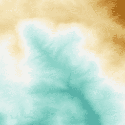
NEON 数字高程模型 (DEM)

根据 NEON LiDAR 数据得出的地表数字模型 (DSM) 和地形数字模型 (DTM)。DSM:地表特征(包含植被和人造结构的地形信息)。DTM:裸地海拔(已移除植被和人造结构的地形信息)。图片以米为单位显示了平均海平面以上的… 机载 数字高程模型 海拔地形 森林 激光雷达 NEON -
NEON RGB 相机图像

高分辨率红-绿-蓝 (RGB) 正射校正相机图像,使用最近邻重采样进行镶嵌并输出到固定的均匀空间网格;空间分辨率为 0.1 米。数码相机是 NEON 机载观测平台 (AOP) 上的一套仪器的一部分,该平台还包括… airborne forest highres neon neon-prod-earthengine orthophoto -
NEON 表面双向反射率

NEON AOP 地表双向反射率是一种高光谱 VSWIR(可见光到短波红外)数据产品,包含 426 个波段,波长范围约为 380 nm 到 2510 nm。反射率按 10000 的系数进行缩放。将 1340-1445 nm 和 1790-1955 nm 之间的波长设置为… 机载 森林 高光谱 neon neon-prod-earthengine publisher-dataset -
NEON 地表方向性反射率

NEON AOP 地表定向反射率是一种高光谱 VSWIR(可见光到短波红外)数据产品,包含 426 个波段,波长范围约为 380 nm 到 2510 nm。反射率按 10000 的系数进行缩放。将 1340-1445 nm 和 1790-1955 nm 之间的波长设置为… 机载 森林 高光谱 neon neon-prod-earthengine publisher-dataset
Datasets tagged neon in Earth Engine
[null,null,[],[],["NEON data includes the Canopy Height Model (CHM), which estimates canopy height from LiDAR. Digital Elevation Models (DEM) provide surface and terrain information from LiDAR. Directional and Bidirectional Surface Reflectance data offer hyperspectral information across 426 bands, excluding water vapor absorption bands. RGB Camera Imagery provides high-resolution, orthorectified images at 0.1m resolution, collected using an airborne platform. All the data includes information about the forest.\n"]]