-
NEON 캐노피 높이 모델 (CHM)
맨땅 위의 캐노피 상단 높이 (캐노피 높이 모델, CHM)입니다. CHM은 NEON LiDAR 포인트 클라우드에서 파생되며 LiDAR 조사의 전체 공간 도메인에 걸쳐 나뭇잎 천장 높이 추정치의 연속적인 표면을 만들어 생성됩니다. … airborne canopy forest forest-biomass lidar neon -
NEON 디지털 고도 모델 (DEM)
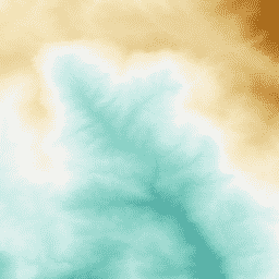
NEON LiDAR 데이터에서 파생된 지형지물 (DSM) 및 지형 (DTM)의 디지털 모델입니다. DSM: 지형지물 (식생 및 인공 구조물이 있는 지형 정보) DTM: 노출 지형지물 고도 (식생 및 인공 구조물이 삭제된 지형 정보) 이미지는 평균 해수면 위의 미터(m)로 표시됩니다. airborne dem elevation-topography forest lidar neon -
NEON RGB 카메라 이미지
고해상도 적색-녹색-파란색 (RGB) 직교 보정 카메라 이미지가 모자이크 처리되고 가장 가까운 이웃 재샘플링을 사용하여 고정된 균일한 공간 그리드에 출력됩니다. 공간 해상도는 0.1m입니다. 디지털 카메라는 NEON 항공 관측 플랫폼 (AOP)의 계측기 모음의 일부이며 여기에는 … airborne forest highres neon neon-prod-earthengine orthophoto -
NEON 표면 양방향 반사도
NEON AOP 표면 양방향 반사율은 약 380nm~2510nm의 파장에 걸쳐 426개 밴드를 포함하는 하이퍼스펙트럴 VSWIR (가시광선~단파 적외선) 데이터 제품입니다. 반사율은 10,000배로 조정됩니다. 1340~1445nm 및 1790~1955nm 사이의 파장은 …으로 설정됩니다. 항공 숲 하이퍼스펙트럴 neon neon-prod-earthengine publisher-dataset -
NEON 표면 방향 반사도
NEON AOP 표면 방향 반사율은 가시적~적외선 (VSWIR) 하이퍼스펙트럼 데이터 제품으로, 파장이 약 380nm~2,510nm에 걸쳐 있는 426개 밴드를 포함합니다. 반사율은 10,000배로 조정됩니다. 1340~1445nm 및 1790~1955nm 사이의 파장은 …으로 설정됩니다. 항공 숲 하이퍼스펙트럴 neon neon-prod-earthengine publisher-dataset
Datasets tagged neon in Earth Engine
[null,null,[],[[["\u003cp\u003eThe NEON datasets provide various remote sensing data, including Canopy Height Models (CHM), Digital Elevation Models (DEM), and surface reflectance data, collected using LiDAR and hyperspectral imaging.\u003c/p\u003e\n"],["\u003cp\u003eThe CHM represents canopy height above bare earth, while the DEM offers surface and terrain models derived from LiDAR data, including vegetation and man-made structures.\u003c/p\u003e\n"],["\u003cp\u003eNEON offers both directional and bidirectional surface reflectance data, covering visible to shortwave infrared wavelengths, ideal for vegetation analysis.\u003c/p\u003e\n"],["\u003cp\u003eHigh-resolution RGB camera imagery is also available, providing orthorectified images with a spatial resolution of 0.1 meters, captured by the NEON Airborne Observation Platform.\u003c/p\u003e\n"],["\u003cp\u003eThese datasets are valuable for ecological research, forest monitoring, and land cover analysis, offering detailed insights into ecosystem structure and function.\u003c/p\u003e\n"]]],["NEON data includes the Canopy Height Model (CHM), which estimates canopy height from LiDAR. Digital Elevation Models (DEM) provide surface and terrain information from LiDAR. Directional and Bidirectional Surface Reflectance data offer hyperspectral information across 426 bands, excluding water vapor absorption bands. RGB Camera Imagery provides high-resolution, orthorectified images at 0.1m resolution, collected using an airborne platform. All the data includes information about the forest.\n"],null,["# Datasets tagged neon in Earth Engine\n\n-\n\n |---------------------------------------------------------------------------------------------------------------------------------------------------------------------------------------------------------------------------------------------------------------------------------------------|\n | [### NEON Canopy Height Model (CHM)](/earth-engine/datasets/catalog/projects_neon-prod-earthengine_assets_CHM_001) |\n | Height of the top of canopy above bare earth (Canopy Height Model; CHM). The CHM is derived from the NEON LiDAR point cloud and is generated by creating a continuous surface of canopy height estimates across the entire spatial domain of the LiDAR survey. The ... |\n | [airborne](/earth-engine/datasets/tags/airborne) [canopy](/earth-engine/datasets/tags/canopy) [forest](/earth-engine/datasets/tags/forest) [forest-biomass](/earth-engine/datasets/tags/forest-biomass) [lidar](/earth-engine/datasets/tags/lidar) [neon](/earth-engine/datasets/tags/neon) |\n\n-\n\n |-----------------------------------------------------------------------------------------------------------------------------------------------------------------------------------------------------------------------------------------------------------------------------------------------------------------------------------------|\n | [### NEON Digital Elevation Model (DEM)](/earth-engine/datasets/catalog/projects_neon-prod-earthengine_assets_DEM_001) |\n | Digital models of the surface (DSM) and terrain (DTM) derived from NEON LiDAR data. DSM: Surface features (topographic information with vegetation and man-made structures present). DTM: Bare earth elevation (topographic information with vegetation and man-made structures removed). Images are given in meters above mean sea ... |\n | [airborne](/earth-engine/datasets/tags/airborne) [dem](/earth-engine/datasets/tags/dem) [elevation-topography](/earth-engine/datasets/tags/elevation-topography) [forest](/earth-engine/datasets/tags/forest) [lidar](/earth-engine/datasets/tags/lidar) [neon](/earth-engine/datasets/tags/neon) |\n\n-\n\n |-------------------------------------------------------------------------------------------------------------------------------------------------------------------------------------------------------------------------------------------------------------------------------------------------------------------------|\n | [### NEON RGB Camera Imagery](/earth-engine/datasets/catalog/projects_neon-prod-earthengine_assets_RGB_001) |\n | High resolution Red-Green-Blue (RGB) orthorectified camera images mosaicked and output onto a fixed, uniform spatial grid using nearest-neighbor resampling; spatial resolution is 0.1 m. The digital camera is part of a suite of instruments on the NEON Airborne Observation Platform (AOP) that also includes a ... |\n | [airborne](/earth-engine/datasets/tags/airborne) [forest](/earth-engine/datasets/tags/forest) [highres](/earth-engine/datasets/tags/highres) [neon](/earth-engine/datasets/tags/neon) [neon-prod-earthengine](/earth-engine/datasets/tags/neon-prod-earthengine) [orthophoto](/earth-engine/datasets/tags/orthophoto) |\n\n-\n\n |-------------------------------------------------------------------------------------------------------------------------------------------------------------------------------------------------------------------------------------------------------------------------------------------------------------------------------------------------|\n | [### NEON Surface Bidirectional Reflectance](/earth-engine/datasets/catalog/projects_neon-prod-earthengine_assets_HSI_REFL_002) |\n | The NEON AOP Surface Bidirectional Reflectance is a hyperspectral VSWIR (visible to shortwave infrared) data product, containing 426 bands spanning wavelengths from \\~380 nm to 2510 nm. Reflectance is scaled by a factor of 10000. Wavelengths between 1340-1445 nm and 1790-1955 nm are set to ... |\n | [airborne](/earth-engine/datasets/tags/airborne) [forest](/earth-engine/datasets/tags/forest) [hyperspectral](/earth-engine/datasets/tags/hyperspectral) [neon](/earth-engine/datasets/tags/neon) [neon-prod-earthengine](/earth-engine/datasets/tags/neon-prod-earthengine) [publisher-dataset](/earth-engine/datasets/tags/publisher-dataset) |\n\n-\n\n |-------------------------------------------------------------------------------------------------------------------------------------------------------------------------------------------------------------------------------------------------------------------------------------------------------------------------------------------------|\n | [### NEON Surface Directional Reflectance](/earth-engine/datasets/catalog/projects_neon-prod-earthengine_assets_HSI_REFL_001) |\n | The NEON AOP Surface Directional Reflectance is a hyperspectral VSWIR (visible to shortwave infrared) data product, containing 426 bands spanning wavelengths from \\~380 nm to 2510 nm. Reflectance is scaled by a factor of 10000. Wavelengths between 1340-1445 nm and 1790-1955 nm are set to ... |\n | [airborne](/earth-engine/datasets/tags/airborne) [forest](/earth-engine/datasets/tags/forest) [hyperspectral](/earth-engine/datasets/tags/hyperspectral) [neon](/earth-engine/datasets/tags/neon) [neon-prod-earthengine](/earth-engine/datasets/tags/neon-prod-earthengine) [publisher-dataset](/earth-engine/datasets/tags/publisher-dataset) |"]]