-
NEON Canopy Height Model (CHM)
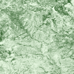
Wysokość wierzchołka pokrywy roślinnej nad gołą ziemią (model wysokości pokrywy roślinnej, CHM). CHM jest tworzony na podstawie chmury punktów LiDAR NEON. Powstaje przez utworzenie ciągłej powierzchni szacowanych wysokości pokrywy roślinnej w całym obszarze przestrzennym badania LiDAR. The … airborne canopy forest forest-biomass lidar neon -
NEON Digital Elevation Model (DEM)
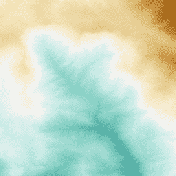
Modele cyfrowe powierzchni (DSM) i terenu (DTM) uzyskane z danych LiDAR NEON. DSM: cechy powierzchni (informacje topograficzne z uwzględnieniem roślinności i struktur stworzonych przez człowieka). DTM: wysokość terenu (informacje topograficzne bez roślinności i struktur stworzonych przez człowieka). Wartości podane są w metrach nad średnim poziomem morza… airborne dem elevation-topography forest lidar neon -
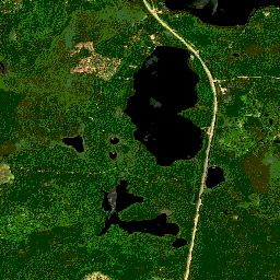
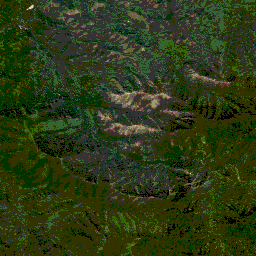
Obrazy z kamery NEON RGB
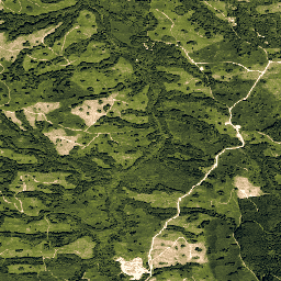
Obrazy z kamery w wysokiej rozdzielczości w kolorach czerwonym, zielonym i niebieskim (RGB) po ortorektyfikacji, zmozaikowane i wygenerowane na stałej, jednolitej siatce przestrzennej z użyciem metody ponownego próbkowania najbliższego sąsiada; rozdzielczość przestrzenna wynosi 0,1 m. Aparat cyfrowy jest częścią zestawu instrumentów na pokładzie platformy obserwacyjnej NEON Airborne Observation Platform (AOP), który obejmuje również… airborne forest highres neon neon-prod-earthengine orthophoto -
NEON Surface Bidirectional Reflectance
Dwukierunkowe odbicie powierzchniowe NEON AOP to hiperspektralny produkt danych VSWIR (widzialny do krótkofalowego podczerwonego), zawierający 426 pasm o długościach fal od ok. 380 nm do 2510 nm. Współczynnik odbicia jest skalowany przez współczynnik 10 000. Długości fal w zakresach 1340–1445 nm i 1790–1955 nm są ustawione na… airborne forest hyperspectral neon neon-prod-earthengine publisher-dataset -
NEON Surface Directional Reflectance
NEON AOP Surface Directional Reflectance to hiperspektralny produkt danych VSWIR (widzialny do krótkofalowego podczerwonego), zawierający 426 pasm o długościach fal od ok. 380 nm do 2510 nm. Współczynnik odbicia jest skalowany przez współczynnik 10 000. Długości fal w zakresach 1340–1445 nm i 1790–1955 nm są ustawione na… airborne forest hyperspectral neon neon-prod-earthengine publisher-dataset
Datasets tagged neon-prod-earthengine in Earth Engine
[null,null,[],[],[]]