-
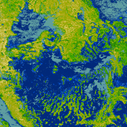
Pokrycie terenu w Ameryce Północnej w rozdzielczości 30 metrów, 2020 r.
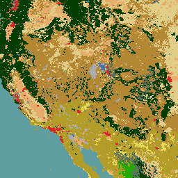
Zbiór danych o pokryciu terenu Ameryki Północnej z 2020 r. o rozdzielczości 30 metrów został opracowany w ramach północnoamerykańskiego systemu monitorowania zmian pokrycia terenu (NALCMS), trójstronnej inicjatywy Natural Resources Canada, United States Geological Survey i 3 meksykańskich organizacji, w tym Narodowego Instytutu Statystyki i Geografii… landcover landsat landuse-landcover nlcd reflectance -
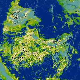
NLCD 2019: USGS National Land Cover Database, 2019 release
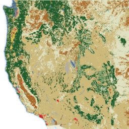
NLCD (National Land Cover Database) to baza danych pokrycia terenu oparta na danych z satelity Landsat o rozdzielczości 30 m, obejmująca 8 okresów (2001, 2004, 2006, 2008, 2011, 2013, 2016 i 2019 r.). Dostępna jest tu też dziewiąta epoka na 2021 r. Obrazy wykorzystują warstwę danych o nieprzepuszczalności w przypadku obszarów miejskich… blm landcover landuse-landcover mrlc nlcd usgs -
NLCD 2021: USGS National Land Cover Database, 2021 r.
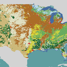
Amerykańska służba geologiczna (USGS) we współpracy z kilkoma agencjami federalnymi opracowała i udostępniła 7 produktów National Land Cover Database (NLCD): NLCD 1992, 2001, 2006, 2011, 2016, 2019 i 2021. Od 2016 r. produkty dotyczące pokrycia terenu są tworzone w interwałach 2–3-letnich… blm landcover landuse-landcover mrlc nlcd usgs -
RCMAP Rangeland Component Timeseries (1985-2023), v06
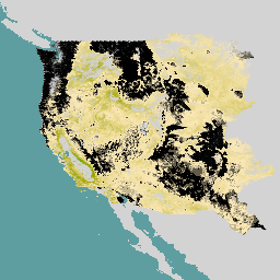
„Zbiór danych RCMAP (Rangeland Condition Monitoring Assessment and Projection) określa procent pokrycia komponentów pastwisk w zachodniej części Ameryki Północnej na podstawie zdjęć Landsat z lat 1985–2023. Pakiet produktów RCMAP składa się z 10 komponentów ułamkowych: roczne rośliny zielne, nieporośnięty teren, rośliny zielne, ściółka, krzewy inne niż bylica, wieloletnie rośliny zielne, bylica … climate-change disturbance landsat-derived landuse-landcover nlcd rangeland -
RCMAP Rangeland Trends Year for Component Timeseries (1985-2023), v06
Kolekcja obejmuje roczne produkty RCMAP z lat 1985–2023. Zbiór danych RCMAP (Rangeland Condition Monitoring Assessment and Projection) określa procent pokrycia komponentów pastwisk w zachodniej części Ameryki Północnej na podstawie zdjęć Landsat z lat 1985–2023. Pakiet produktów RCMAP składa się z 10 komponentów ułamkowych: roczny… climate-change disturbance landsat-derived landuse-landcover nlcd rangeland -
RCMAP Rangeland Trends for Component Timeseries (1985-2023), v06
Zbiór danych RCMAP (Rangeland Condition Monitoring Assessment and Projection) określa procent pokrycia komponentów pastwisk w zachodniej części Ameryki Północnej na podstawie zdjęć Landsat z lat 1985–2023. Pakiet produktów RCMAP składa się z 10 komponentów ułamkowych: roczne rośliny zielne, nieporośnięty teren, rośliny zielne, ściółka, krzewy inne niż bylica, wieloletnie rośliny zielne, bylica … climate-change disturbance landsat-derived landuse-landcover nlcd rangeland
Datasets tagged nlcd in Earth Engine
[null,null,[],[],[]]