-
팜유 농장 글로벌 지도
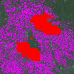
이 데이터 세트는 2019년의 10m 글로벌 산업 및 소규모 농가의 팜유 지도입니다. 이 지역에는 팜유 농장이 감지된 지역이 포함됩니다. 분류된 이미지는 Sentinel-1 및 Sentinel-2 반기 합성물을 기반으로 하는 컨볼루션 신경망의 출력입니다. 자세한 내용은 도움말을 참고하세요. 생물다양성 보존 작물 전 세계 토지 사용 팜유 -
팜유 농장 가능성 v20240312

이 이미지 모음은 기본 영역이 팜유 농경지일 확률을 픽셀당 제공합니다. 이러한 확률 추정치는 10m 해상도로 제공되며 머신러닝 모델에 의해 생성되었습니다. 커뮤니티 참여자가 제공한 라벨이 지정된 팜유 농장의 예시 생물다양성 보존 작물 산림파괴 eudr 토지이용
Datasets tagged oilpalm in Earth Engine
[null,null,[],[],["Two datasets provide information on global oil palm plantations. The first is a 10m map of industrial and smallholder oil palm areas for 2019, derived from a convolutional neural network using Sentinel-1 and Sentinel-2 data. The second dataset offers per-pixel probability estimates of oil palm cultivation at 10m resolution. This is generated via a machine learning model trained with community-contributed examples, offering detailed insight into oil palm cultivation distribution. Both maps can help with biodiversity and conservation.\n"]]