نقشه جهانی مزارع روغن پالم 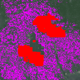
این مجموعه داده، نقشهای از ۱۰ میلیون نخل روغنی صنعتی و خردهمالکی جهان برای سال ۲۰۱۹ است. این نقشه مناطقی را پوشش میدهد که در آنها مزارع نخل روغنی شناسایی شدهاند. تصاویر طبقهبندیشده، خروجی یک شبکه عصبی کانولوشنی مبتنی بر ترکیبهای نیمسال Sentinel-1 و Sentinel-2 هستند. برای اطلاعات بیشتر به مقاله مراجعه کنید... کشاورزی، تنوع زیستی، حفاظت، محصول، کاربری جهانی زمین مدل احتمال کف دست ۲۰۲۵a 
این مجموعه تصویر، احتمال تقریبی اشغال شدن منطقه زیرین توسط کالا را بر حسب پیکسل ارائه میدهد. تخمینهای احتمال با وضوح 10 متر ارائه شده و توسط یک مدل یادگیری ماشینی تولید شدهاند. برای جزئیات بیشتر، به مستندات فنی مربوط به Forest Data Partnership مراجعه کنید... کشاورزی، تنوع زیستی، حفاظت از محصول، eudr، دادههای جنگل، مشارکت مدل احتمال کف دست ۲۰۲۵b 
این مجموعه تصویر، احتمال تقریبی اشغال شدن منطقه زیرین توسط کالا را بر حسب پیکسل ارائه میدهد. تخمینهای احتمال با وضوح 10 متر ارائه شده و توسط یک مدل یادگیری ماشینی تولید شدهاند. برای جزئیات بیشتر، به مستندات فنی مربوط به Forest Data Partnership مراجعه کنید... کشاورزی، آلفا-ارث، حفاظت از تنوع زیستی ، eudr محصول
Datasets tagged palm in Earth Engine
[null,null,[],[],[]]