-
NICFI 衛星データ プログラムの熱帯林モニタリング用ベースマップ - アフリカ
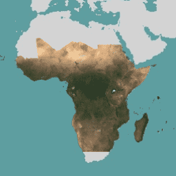
この画像コレクションは、熱帯林の減少を抑制して逆転させることを主な目的として、熱帯地域の高解像度衛星モニタリングへのアクセスを提供します。これにより、気候変動への対策、生物多様性の保全、森林の再生、復元、強化、持続可能な開発の促進に貢献します。 basemaps forest nicfi planet planet-nicfi publisher-dataset -
NICFI 衛星データ プログラムの熱帯林モニタリング用ベースマップ - アメリカ

この画像コレクションは、熱帯林の減少を抑制して逆転させることを主な目的として、熱帯地域の高解像度衛星モニタリングへのアクセスを提供します。これにより、気候変動への対策、生物多様性の保全、森林の再生、復元、強化、持続可能な開発の促進に貢献します。 basemaps forest nicfi planet planet-nicfi publisher-dataset -
NICFI 衛星データ プログラムの熱帯林モニタリング用ベースマップ - アジア

この画像コレクションは、熱帯林の減少を抑制して逆転させることを主な目的として、熱帯地域の高解像度衛星モニタリングへのアクセスを提供します。これにより、気候変動への対策、生物多様性の保全、森林の再生、復元、強化、持続可能な開発の促進に貢献します。 basemaps forest nicfi planet planet-nicfi publisher-dataset -
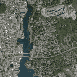
Planet SkySat 公開オルソ画像、マルチスペクトル

Planet Labs Inc. の SkySat 衛星からのこのデータは、2015 年に試験運用された「Skybox for Good Beta」プログラム、さまざまな危機対応イベント、その他のいくつかのプロジェクトのために収集されました。データは、5 バンドのマルチスペクトル/パン コレクションと、… highres multispectral pansharpened planet satellite-imagery skysat -
Planet SkySat 公開オルソ画像、RGB
Planet Labs Inc. の SkySat 衛星からのこのデータは、2015 年に試験運用された「Skybox for Good Beta」プログラム、さまざまな危機対応イベント、その他のいくつかのプロジェクトのために収集されました。データは、5 バンドのマルチスペクトル/パン コレクションと、… highres pansharpened planet rgb satellite-imagery skysat
Datasets tagged planet in Earth Engine
[null,null,[],[],[]]