-
NICFI Satellite Data Program Basemaps for Tropical Forest Monitoring - Africa

Ta kolekcja obrazów zapewnia dostęp do monitorowania satelitarnego tropików w wysokiej rozdzielczości. Jej głównym celem jest ograniczenie i odwrócenie utraty lasów tropikalnych, co przyczynia się do walki ze zmianami klimatu, ochrony bioróżnorodności, wspomagania odrastania, odtwarzania i wzmacniania lasów oraz ułatwiania zrównoważonego rozwoju. basemaps forest nicfi planet planet-nicfi publisher-dataset -
Mapy bazowe programu NICFI Satellite Data Program do monitorowania lasów tropikalnych – Ameryka
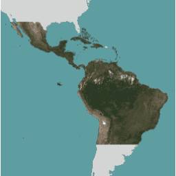
Ta kolekcja obrazów zapewnia dostęp do monitorowania satelitarnego tropików w wysokiej rozdzielczości. Jej głównym celem jest ograniczenie i odwrócenie utraty lasów tropikalnych, co przyczynia się do walki ze zmianami klimatu, ochrony bioróżnorodności, wspomagania odrastania, odtwarzania i wzmacniania lasów oraz ułatwiania zrównoważonego rozwoju. basemaps forest nicfi planet planet-nicfi publisher-dataset -
Mapy bazowe programu NICFI Satellite Data Program do monitorowania lasów tropikalnych – Azja
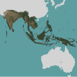
Ta kolekcja obrazów zapewnia dostęp do monitorowania satelitarnego tropików w wysokiej rozdzielczości. Jej głównym celem jest ograniczenie i odwrócenie utraty lasów tropikalnych, co przyczynia się do walki ze zmianami klimatu, ochrony bioróżnorodności, wspomagania odrastania, odtwarzania i wzmacniania lasów oraz ułatwiania zrównoważonego rozwoju. basemaps forest nicfi planet planet-nicfi publisher-dataset -
Planet SkySat Public Ortho Imagery, Multispectral
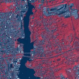
Te dane z satelitów SkySat firmy Planet Labs Inc. zostały zebrane w 2015 r. w ramach eksperymentalnego programu „Skybox for Good Beta”, a także w związku z różnymi sytuacjami kryzysowymi i kilkoma innymi projektami. Dane są dostępne w zbiorze wielospektralnym/panchromatycznym w 5 pasmach oraz w … highres multispectral pansharpened planet satellite-imagery skysat -
Planet SkySat Public Ortho Imagery, RGB
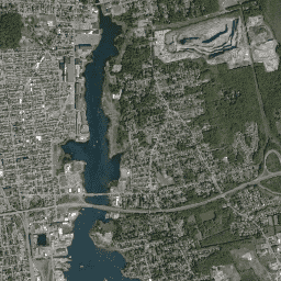
Te dane z satelitów SkySat firmy Planet Labs Inc. zostały zebrane w 2015 r. w ramach eksperymentalnego programu „Skybox for Good Beta”, a także w związku z różnymi sytuacjami kryzysowymi i kilkoma innymi projektami. Dane są dostępne w zbiorze wielospektralnym/panchromatycznym w 5 pasmach oraz w … highres pansharpened planet rgb satellite-imagery skysat
Datasets tagged planet in Earth Engine
[null,null,[],[],[]]