-
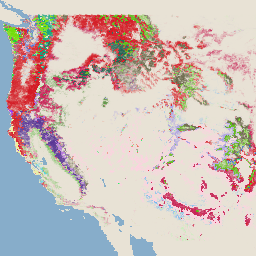
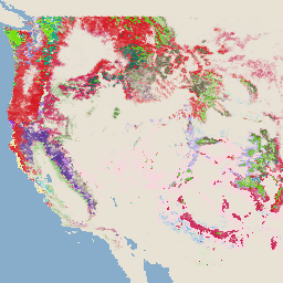
Images de gravité des brûlures d'écran pour la surveillance des tendances de gravité des brûlures d'écran (MTBS)
Les mosaïques de sévérité des feux de forêt sont constituées d'images matricielles thématiques des classes de sévérité des feux de forêt de l'IMT pour tous les feux de forêt de l'IMT actuellement terminés pour les États-Unis continentaux, l'Alaska, Hawaï et Porto Rico. Les images de la sévérité des feux de forêt sont compilées chaque année par État américain et par … eros fire forest gtac landcover landsat-derived -
USFS Landscape Change Monitoring System v2024.10 (CONUS et OCONUS)
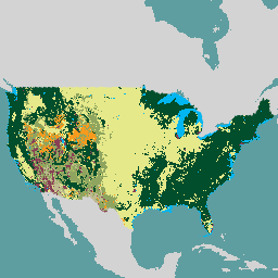
Ce produit fait partie de la suite de données du système de surveillance des changements paysagers (LCMS). Il présente les changements, la couverture et/ou les classes d'utilisation des sols modélisés par le LCMS pour chaque année. Il couvre les États-Unis continentaux (CONUS) ainsi que les zones situées en dehors de ceux-ci (OCONUS), y compris l'Alaska (AK), Porto Rico (PR), les îles Vierges des États-Unis (USVI) et les îles … change-detection forest gtac landcover landuse landuse-landcover -
Couverture arborée de l'USFS, version 2023-5 (CONUS et OCONUS)
Ce produit fait partie de la suite de données sur la couverture arborée. Il comprend la couverture végétale modélisée, l'erreur standard (ES) et les données de la base de données nationale sur la couverture des sols (NLCD) pour chaque année. Les données sur les CC produites par le Service des forêts (USFS) du département de l'Agriculture des États-Unis sont… forest gtac landuse-landcover redcastle-resources usda usfs -
USFS TreeMap v2016 (États-Unis contigus)
Ce produit fait partie de la suite de données TreeMap. Il fournit des informations spatiales détaillées sur les caractéristiques des forêts, y compris le nombre d'arbres vivants et morts, la biomasse et le carbone sur l'ensemble de la superficie forestière des États-Unis continentaux en 2016. TreeMap v2016 contient une image, un … biomasse carbone changement climatique conus forêt biomasse forestière
Datasets tagged redcastle-resources in Earth Engine
[null,null,[],[[["\u003cp\u003eThe MTBS dataset provides annual burn severity mosaics for fires across the US, including Alaska, Hawaii, and Puerto Rico.\u003c/p\u003e\n"],["\u003cp\u003eThe USFS TreeMap v2016 dataset offers detailed forest characteristic information for the continental United States, including tree counts, biomass, and carbon estimates.\u003c/p\u003e\n"],["\u003cp\u003eThe USFS Tree Canopy Cover v2021-4 dataset includes modeled and NLCD tree canopy cover data, along with standard error, for the continental US and other US territories.\u003c/p\u003e\n"]]],[],null,["# Datasets tagged redcastle-resources in Earth Engine\n\n-\n\n |------------------------------------------------------------------------------------------------------------------------------------------------------------------------------------------------------------------------------------------------------------------------------------------------|\n | [### Monitoring Trends in Burn Severity (MTBS) Burn Severity Images](/earth-engine/datasets/catalog/USFS_GTAC_MTBS_annual_burn_severity_mosaics_v1) |\n | The burn severity mosaics consist of thematic raster images of MTBS burn severity classes for all currently completed MTBS fires for the continental United States, Alaska, Hawaii and Puerto Rico. Mosaicked burn severity images are compiled annually for each year by US State and the ... |\n | [eros](/earth-engine/datasets/tags/eros) [fire](/earth-engine/datasets/tags/fire) [forest](/earth-engine/datasets/tags/forest) [gtac](/earth-engine/datasets/tags/gtac) [landcover](/earth-engine/datasets/tags/landcover) [landsat-derived](/earth-engine/datasets/tags/landsat-derived) |\n\n-\n\n |-----------------------------------------------------------------------------------------------------------------------------------------------------------------------------------------------------------------------------------------------------------------------------------------------------------------------------|\n | [### USFS Landscape Change Monitoring System v2024.10 (CONUS and OCONUS)](/earth-engine/datasets/catalog/USFS_GTAC_LCMS_v2024-10) |\n | This product is part of the Landscape Change Monitoring System (LCMS) data suite. It shows LCMS-modeled change, land cover, and/or land use classes for each year and covers the Conterminous United States (CONUS) as well as areas outside the CONUS (OCONUS) including Alaska (AK), Puerto ... |\n | [change-detection](/earth-engine/datasets/tags/change-detection) [forest](/earth-engine/datasets/tags/forest) [gtac](/earth-engine/datasets/tags/gtac) [landcover](/earth-engine/datasets/tags/landcover) [landuse](/earth-engine/datasets/tags/landuse) [landuse-landcover](/earth-engine/datasets/tags/landuse-landcover) |\n\n-\n\n |-------------------------------------------------------------------------------------------------------------------------------------------------------------------------------------------------------------------------------------------------------------------------------------------------------------------|\n | [### USFS Tree Canopy Cover v2023-5 (CONUS and OCONUS)](/earth-engine/datasets/catalog/USGS_NLCD_RELEASES_2023_REL_TCC_v2023-5) |\n | This product is part of the Tree Canopy Cover (TCC) data suite. It includes modeled TCC, standard error (SE), and National Land Cover Database's (NLCD) TCC data for each year. TCC data produced by the the United States Department of Agriculture, Forest Service (USFS) are ... |\n | [forest](/earth-engine/datasets/tags/forest) [gtac](/earth-engine/datasets/tags/gtac) [landuse-landcover](/earth-engine/datasets/tags/landuse-landcover) [redcastle-resources](/earth-engine/datasets/tags/redcastle-resources) [usda](/earth-engine/datasets/tags/usda) [usfs](/earth-engine/datasets/tags/usfs) |\n\n-\n\n |---------------------------------------------------------------------------------------------------------------------------------------------------------------------------------------------------------------------------------------------------------------------------------------------------------------|\n | [### USFS TreeMap v2016 (Conterminous United States)](/earth-engine/datasets/catalog/USFS_GTAC_TreeMap_v2016) |\n | This product is part of the TreeMap data suite. It provides detailed spatial information on forest characteristics including number of live and dead trees, biomass, and carbon across the entire forested extent of the continental United States in 2016. TreeMap v2016 contains one image, a ... |\n | [biomass](/earth-engine/datasets/tags/biomass) [carbon](/earth-engine/datasets/tags/carbon) [climate-change](/earth-engine/datasets/tags/climate-change) [conus](/earth-engine/datasets/tags/conus) [forest](/earth-engine/datasets/tags/forest) [forest-biomass](/earth-engine/datasets/tags/forest-biomass) |\n\n-\n\n |---------------------------------------------------------------------------------------------------------------------------------------------------------------------------------------------------------------------------------------------------------------------------------------------------------|\n | [### USFS TreeMap v2020](/earth-engine/datasets/catalog/USFS_GTAC_TreeMap_v2020) |\n | This product is part of the TreeMap data suite. It provides detailed spatial information on forest characteristics including number of live and dead trees, biomass, and carbon across the entire forested extent of the United States in 2020. TreeMap v2020 contains 22-band 30 x 30m ... |\n | [aboveground](/earth-engine/datasets/tags/aboveground) [biomass](/earth-engine/datasets/tags/biomass) [carbon](/earth-engine/datasets/tags/carbon) [climate-change](/earth-engine/datasets/tags/climate-change) [conus](/earth-engine/datasets/tags/conus) [forest](/earth-engine/datasets/tags/forest) |\n\n-\n\n |---------------------------------------------------------------------------------------------------------------------------------------------------------------------------------------------------------------------------------------------------------------------------------------------------------|\n | [### USFS TreeMap v2022](/earth-engine/datasets/catalog/USFS_GTAC_TreeMap_v2022) |\n | This product is part of the TreeMap data suite. It provides detailed spatial information on forest characteristics including number of live and dead trees, biomass, and carbon across the entire forested extent of the United States in 2022. TreeMap v2022 contains 22-band 30 x 30m ... |\n | [aboveground](/earth-engine/datasets/tags/aboveground) [biomass](/earth-engine/datasets/tags/biomass) [carbon](/earth-engine/datasets/tags/carbon) [climate-change](/earth-engine/datasets/tags/climate-change) [conus](/earth-engine/datasets/tags/conus) [forest](/earth-engine/datasets/tags/forest) |"]]