Page Summary
-
The ASTER Global Emissivity Dataset provides mean emissivity and standard deviation data.
-
The ASTER L1T Radiance dataset is a multispectral imager with a data gap between November 28, 2024 and January 16, 2025.
-
The FIRMS dataset contains near real-time active fire locations processed by LANCE.
-
VIIRS Active Fire detection products from NOAA-20 and Suomi NPP offer improved detection over smaller fires compared to coarser resolution data.
-
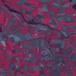
AG100: ASTER Global Emissivity Dataset 100-meter V003
The Advanced Spaceborne Thermal Emission and Reflection Radiometer Global Emissivity Database (ASTER-GED) was developed by the National Aeronautics and Space Administration's (NASA) Jet Propulsion Laboratory (JPL), California Institute of Technology. This product includes the mean emissivity and standard deviation for all 5 ASTER Thermal Infrared … aster elevation emissivity geophysical infrared jpl -
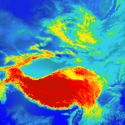
ASTER L1T Radiance
Note: There is a gap in data collection between November 28, 2024 and January 16, 2025 due to technical issues with the ASTER instrument. See the USGS announcement for more information. The Advanced Spaceborne Thermal Emission and Reflection Radiometer (ASTER) is a multispectral imager that … aster imagery nasa nir radiance satellite-imagery -
FIRMS: Fire Information for Resource Management System
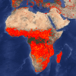
The Earth Engine version of the Fire Information for Resource Management System (FIRMS) dataset contains the LANCE fire detection product in rasterized form. The near real-time (NRT) active fire locations are processed by LANCE using the standard MODIS MOD14/MYD14 Fire and Thermal Anomalies product. Each … eosdis fire firms geophysical hotspot lance -
VJ114IMGTDL_NRT Daily Raster: VIIRS (NOAA-20) Band 375m Active Fire
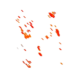
NOAA-20 (JPSS-1) Visible Infrared Imaging Radiometer Suite (VIIRS) Active Fire detection product is based on the instrument's 375m nominal resolution data. Compared to other coarser resolution (≥ 1km) satellite fire detection products, the improved 375 m data provide greater response over fires of relatively small … eosdis fire firms geophysical hotspot lance -
VNP14IMGTDL_NRT Daily Raster: VIIRS (S-NPP) Band 375m Active Fire

Suomi NPP Visible Infrared Imaging Radiometer Suite (VIIRS) Active Fire detection product is based on the instrument's 375m nominal resolution data. Compared to other coarser resolution (≥ 1km) satellite fire detection products, the improved 375 m data provide greater response over fires of relatively small … eosdis fire firms geophysical hotspot lance