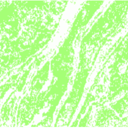
DESS চীন টেরেস মানচিত্র v1 এই ডেটাসেটটি 2018 সালে 30 মিটার রেজোলিউশনে একটি চায়না টেরেস ম্যাপ। এটি Google আর্থ ইঞ্জিন প্ল্যাটফর্মের উপর ভিত্তি করে মাল্টিসোর্স এবং মাল্টি-টেম্পোরাল ডেটা ব্যবহার করে তত্ত্বাবধানে পিক্সেল-ভিত্তিক শ্রেণীবিভাগের মাধ্যমে তৈরি করা হয়েছে। সামগ্রিক নির্ভুলতা এবং কাপ্পা সহগ যথাক্রমে 94% এবং 0.72 অর্জন করেছে। এই প্রথম… কৃষি ল্যান্ডকভার ল্যান্ড ইউজ ল্যান্ডউজ-ল্যান্ডকভার সিংহুয়া Tsinghua FROM-GLC বছরের অভেদ্য সারফেসে পরিবর্তনের বছর এই ডেটাসেটে 30m রেজোলিউশনে 1985 থেকে 2018 সাল পর্যন্ত বিশ্বব্যাপী অভেদ্য পৃষ্ঠের এলাকার বার্ষিক পরিবর্তনের তথ্য রয়েছে। তত্ত্বাবধানে শ্রেণীবিভাগ এবং সাময়িক সামঞ্জস্য যাচাইয়ের একটি সম্মিলিত পদ্ধতির ব্যবহার করে অস্পষ্ট থেকে অভেদ্য পরিবর্তন নির্ধারণ করা হয়েছিল। অভেদ্য পিক্সেল 50% অভেদ্য হিসাবে সংজ্ঞায়িত করা হয়। … নির্মিত জনসংখ্যা Tsinghua শহুরে
Datasets tagged tsinghua in Earth Engine
[null,null,[],[[["\u003cp\u003eThe DESS China Terrace Map provides a 30m resolution view of terrace farming across China in 2018, achieving high accuracy through supervised classification using multi-source data.\u003c/p\u003e\n"],["\u003cp\u003eThe Tsinghua FROM-GLC dataset offers insights into annual changes in global impervious surfaces from 1985 to 2018 at 30m resolution, identifying areas where pervious land has become impervious.\u003c/p\u003e\n"]]],["Two datasets are described: a 2018 China terrace map at 30m resolution, created via supervised pixel-based classification using multisource and multi-temporal data. The method had an overall accuracy of 94% and a kappa coefficient of 0.72. The second dataset provides annual changes in global impervious surface area, from 1985 to 2018 at 30m resolution. This was done by a combination of supervised classification and temporal consistency checking. Impervious pixels are above 50% impervious.\n"],null,["# Datasets tagged tsinghua in Earth Engine\n\n-\n\n |--------------------------------------------------------------------------------------------------------------------------------------------------------------------------------------------------------------------------------------------------------------------------------------------------------------------|\n | [### DESS China Terrace Map v1](/earth-engine/datasets/catalog/Tsinghua_DESS_ChinaTerraceMap_v1) |\n | This dataset is a China terrace map at 30 m resolution in 2018. It was developed through supervised pixel-based classification using multisource and multi-temporal data based on the Google Earth Engine platform. The overall accuracy and kappa coefficient achieved 94% and 0.72, respectively. This first ... |\n | [agriculture](/earth-engine/datasets/tags/agriculture) [landcover](/earth-engine/datasets/tags/landcover) [landuse](/earth-engine/datasets/tags/landuse) [landuse-landcover](/earth-engine/datasets/tags/landuse-landcover) [tsinghua](/earth-engine/datasets/tags/tsinghua) |\n\n-\n\n |---------------------------------------------------------------------------------------------------------------------------------------------------------------------------------------------------------------------------------------------------------------------------------------------------------------------------------|\n | [### Tsinghua FROM-GLC Year of Change to Impervious Surface](/earth-engine/datasets/catalog/Tsinghua_FROM-GLC_GAIA_v10) |\n | This dataset contains annual change information of global impervious surface area from 1985 to 2018 at a 30m resolution. Change from pervious to impervious was determined using a combined approach of supervised classification and temporal consistency checking. Impervious pixels are defined as above 50% impervious. ... |\n | [built](/earth-engine/datasets/tags/built) [population](/earth-engine/datasets/tags/population) [tsinghua](/earth-engine/datasets/tags/tsinghua) [urban](/earth-engine/datasets/tags/urban) |"]]