-
ArcticDEM Mozaik V4.1
ArcticDEM, optik stereo görüntüler, yüksek performanslı bilgi işlem ve açık kaynak fotogrametri yazılımı kullanarak Kuzey Kutbu'nun yüksek çözünürlüklü, yüksek kaliteli dijital yüzey modelini (DSM) otomatik olarak üretmek için Ulusal Jeo-uzaysal İstihbarat Ajansı (NGA) ve Ulusal Bilim Vakfı'nın (NSF) kamu-özel girişimidir. Bitki örtüsü, ağaç örtüsü, binalar ve ... arktik dem yükseklik-topografyası jeofiziksel pgc umn -
ArcticDEM Şeritleri
ArcticDEM, optik stereo görüntüler, yüksek performanslı bilgi işlem ve açık kaynak fotogrametri yazılımı kullanarak Kuzey Kutbu'nun yüksek çözünürlüklü, yüksek kaliteli dijital yüzey modelini (DSM) otomatik olarak üretmek için Ulusal Jeo-uzaysal İstihbarat Ajansı (NGA) ve Ulusal Bilim Vakfı'nın (NSF) kamu-özel girişimidir. Bitki örtüsü, ağaç örtüsü, binalar ve ... arktik dem yükseklik-topografyası jeofiziksel pgc umn -
REMA Mozaiği
Antarktika Referans Yükseklik Modeli (REMA), Antarktika'nın 2 metre ile 8 metre uzamsal çözünürlüklerinde yüksek çözünürlüklü, zaman damgalı bir Dijital Yüzey Modeli'dir (DSM). Mosaicked DEM dosyaları, kenar eşleştirme yapılarını azaltmak için birlikte kaydedilen, karıştırılan ve düzleştirilen birden çok şeritten derlenir. dem yükseklik-topografyası jeofiziksel pgc rema umn -
REMA Şeritleri 2 m
Antarktika Referans Yükseklik Modeli (REMA), Antarktika'nın 2 metre ile 8 metre uzamsal çözünürlüklerinde yüksek çözünürlüklü, zaman damgalı bir Dijital Yüzey Modeli'dir (DSM). Banner DEM dosyaları, DigitalGlobe tarafından toplandığı için giriş stereoskopik görüntü çifti şeritlerinin örtüşen alanına karşılık gelir. dem yükseklik-topografyası jeofiziksel pgc rema umn -
REMA Şeritleri 8 m
Antarktika Referans Yükseklik Modeli (REMA), Antarktika'nın 2 metre ile 8 metre uzamsal çözünürlüklerinde yüksek çözünürlüklü, zaman damgalı bir Dijital Yüzey Modeli'dir (DSM). Banner DEM dosyaları, DigitalGlobe tarafından toplandığı için giriş stereoskopik görüntü çifti şeritlerinin örtüşen alanına karşılık gelir. dem yükseklik-topografyası jeofiziksel pgc rema umn
Datasets tagged umn in Earth Engine
[null,null,[],[[["\u003cp\u003eArcticDEM provides high-resolution digital surface models (DSMs) of the Arctic, including vegetation, tree canopy, and buildings, created through a public-private initiative using optical stereo imagery.\u003c/p\u003e\n"],["\u003cp\u003eREMA offers high-resolution, time-stamped DSMs of Antarctica at 2-meter and 8-meter resolutions, available as both individual strips and a mosaic.\u003c/p\u003e\n"],["\u003cp\u003eBoth ArcticDEM and REMA are produced using advanced photogrammetry techniques and high-performance computing.\u003c/p\u003e\n"],["\u003cp\u003eThe datasets are available in strip and mosaic formats, offering flexibility for different research and analysis needs.\u003c/p\u003e\n"]]],[],null,["# Datasets tagged umn in Earth Engine\n\n-\n\n |--------------------------------------------------------------------------------------------------------------------------------------------------------------------------------------------------------------------------------------------------------------------------------------------------------------------------------------------------------------------------------------------|\n | [### ArcticDEM Mosaic V4.1
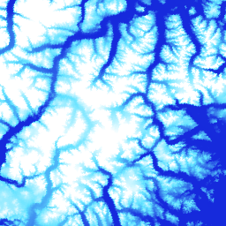
](/earth-engine/datasets/catalog/UMN_PGC_ArcticDEM_V4_2m_mosaic) |\n | ArcticDEM is a National Geospatial-Intelligence Agency (NGA) and National Science Foundation (NSF) public-private initiative to automatically produce a high-resolution, high-quality digital surface model (DSM) of the Arctic using optical stereo imagery, high-performance computing, and open source photogrammetry software. It includes vegetation, tree canopy, buildings, and ... |\n | [arctic](/earth-engine/datasets/tags/arctic) [dem](/earth-engine/datasets/tags/dem) [elevation-topography](/earth-engine/datasets/tags/elevation-topography) [geophysical](/earth-engine/datasets/tags/geophysical) [pgc](/earth-engine/datasets/tags/pgc) [umn](/earth-engine/datasets/tags/umn) |\n\n-\n\n |--------------------------------------------------------------------------------------------------------------------------------------------------------------------------------------------------------------------------------------------------------------------------------------------------------------------------------------------------------------------------------------------|\n | [### ArcticDEM Strips](/earth-engine/datasets/catalog/UMN_PGC_ArcticDEM_V3_2m) |\n | ArcticDEM is a National Geospatial-Intelligence Agency (NGA) and National Science Foundation (NSF) public-private initiative to automatically produce a high-resolution, high-quality digital surface model (DSM) of the Arctic using optical stereo imagery, high-performance computing, and open source photogrammetry software. It includes vegetation, tree canopy, buildings, and ... |\n | [arctic](/earth-engine/datasets/tags/arctic) [dem](/earth-engine/datasets/tags/dem) [elevation-topography](/earth-engine/datasets/tags/elevation-topography) [geophysical](/earth-engine/datasets/tags/geophysical) [pgc](/earth-engine/datasets/tags/pgc) [umn](/earth-engine/datasets/tags/umn) |\n\n-\n\n |---------------------------------------------------------------------------------------------------------------------------------------------------------------------------------------------------------------------------------------------------------------------------------------------------------------------------|\n | [### REMA Mosaic](/earth-engine/datasets/catalog/UMN_PGC_REMA_V1_1_8m) |\n | The Reference Elevation Model of Antarctica (REMA) is a high resolution, time-stamped Digital Surface Model (DSM) of Antarctica at 2-meter and 8-meter spatial resolutions. Mosaicked DEM files are compiled from multiple strips that have been co-registered, blended, and feathered to reduce edge-matching artifacts. |\n | [dem](/earth-engine/datasets/tags/dem) [elevation-topography](/earth-engine/datasets/tags/elevation-topography) [geophysical](/earth-engine/datasets/tags/geophysical) [pgc](/earth-engine/datasets/tags/pgc) [rema](/earth-engine/datasets/tags/rema) [umn](/earth-engine/datasets/tags/umn) |\n\n-\n\n |--------------------------------------------------------------------------------------------------------------------------------------------------------------------------------------------------------------------------------------------------------------------------------------------------------------------------|\n | [### REMA Strips 2m](/earth-engine/datasets/catalog/UMN_PGC_REMA_V1_2m) |\n | The Reference Elevation Model of Antarctica (REMA) is a high resolution, time-stamped Digital Surface Model (DSM) of Antarctica at 2-meter and 8-meter spatial resolutions. Strip DEM files correspond to the overlapping area of the input stereoscopic imagery pair strips as they are collected by DigitalGlobe's ... |\n | [dem](/earth-engine/datasets/tags/dem) [elevation-topography](/earth-engine/datasets/tags/elevation-topography) [geophysical](/earth-engine/datasets/tags/geophysical) [pgc](/earth-engine/datasets/tags/pgc) [rema](/earth-engine/datasets/tags/rema) [umn](/earth-engine/datasets/tags/umn) |\n\n-\n\n |--------------------------------------------------------------------------------------------------------------------------------------------------------------------------------------------------------------------------------------------------------------------------------------------------------------------------|\n | [### REMA Strips 8m](/earth-engine/datasets/catalog/UMN_PGC_REMA_V1_8m) |\n | The Reference Elevation Model of Antarctica (REMA) is a high resolution, time-stamped Digital Surface Model (DSM) of Antarctica at 2-meter and 8-meter spatial resolutions. Strip DEM files correspond to the overlapping area of the input stereoscopic imagery pair strips as they are collected by DigitalGlobe's ... |\n | [dem](/earth-engine/datasets/tags/dem) [elevation-topography](/earth-engine/datasets/tags/elevation-topography) [geophysical](/earth-engine/datasets/tags/geophysical) [pgc](/earth-engine/datasets/tags/pgc) [rema](/earth-engine/datasets/tags/rema) [umn](/earth-engine/datasets/tags/umn) |"]]